Landmark: Thika Dam
City: Thika
Country: Kenya
Continent: Africa
Thika Dam, Thika, Kenya, Africa
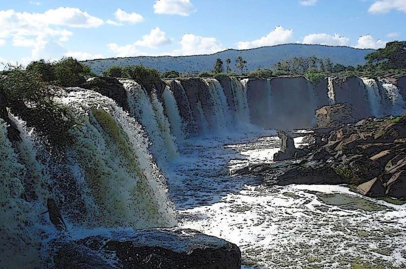
Thika Dam is a concrete gravity dam situated on the Thika River, approximately 10 kilometers northeast of Thika town in Kenya.
Visual Characteristics
The dam structure is composed of concrete and measures approximately 60 meters in height. It impounds a reservoir with a surface area that varies with water levels. The surrounding landscape consists of rolling hills and vegetation.
Location & Access Logistics
Access to Thika Dam is via the A8 Nairobi-Thika Superhighway. Take the exit for Thika town and proceed east on Garissa Road (A3). Turn north onto the unpaved road signposted for the dam, approximately 8 kilometers from Thika town center. The final 2 kilometers are unpaved and can be rough. Parking is available at designated areas near the dam wall, though it is informal. Public transport to Thika town is frequent from Nairobi; from Thika town, local matatus (minibuses) can be hired to reach the dam, but direct scheduled services are not available.
Historical & Ecological Origin
Thika Dam was constructed in 1960 by the Athi Water Services Board. Its primary purpose was to supply water to the surrounding agricultural areas and the town of Thika, as well as for hydroelectric power generation. The dam is built on the Thika River, which flows through a region characterized by savanna grassland and agricultural land.
Key Highlights & Activities
Observation of the dam structure and the reservoir is the primary activity. The area offers opportunities for birdwatching. Limited informal fishing may occur by local residents. Access to the dam crest for viewing is generally permitted during daylight hours.
Infrastructure & Amenities
There are no formal visitor amenities at Thika Dam. Restrooms are not available. Shade is limited to natural vegetation in the immediate vicinity. Cell phone signal (4G/5G) is generally available in the area. No food vendors are present at the dam site; provisions should be made prior to arrival.
Best Time to Visit
The best time of day for photography is generally in the morning or late afternoon when the sun angle is lower, providing more defined shadows on the dam structure. The months of June to September typically offer drier weather. Water levels in the reservoir are highest following the rainy seasons (March-May and October-November).
Facts & Legends
A local anecdote suggests that the reservoir's depth is significant enough to conceal large objects, though this is unsubstantiated. The dam's construction was a key factor in the expansion of agricultural irrigation schemes in the region.
Nearby Landmarks
- Chania Falls (2.5km Southwest)
- Thika Municipal Stadium (9.0km Southwest)
- Ol Donyo Sabuk National Park (25.0km Northeast)
- Fourteen Falls (30.0km East)