City: Nakuru
Country: Kenya
Continent: Africa
Nakuru, Kenya, Africa
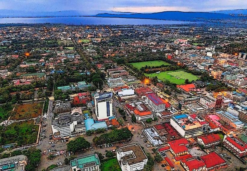
Nakuru is the fourth-largest city in Kenya and the administrative headquarters of Nakuru County. It is situated at an elevation of 1,850 meters in the Great Rift Valley, positioned between the Menengai Crater to the north and Lake Nakuru to the south.
Historical Timeline
Nakuru was established in 1904 as a railway outpost during the construction of the Uganda Railway. The name is derived from the Maasai word Nakurro ("place of dust"). The primary event shaping its current urban form was its 2021 elevation to city status, making it the first Kenyan town to be upgraded to a city since independence in 1963. This status has catalyzed massive infrastructure development, including the expansion of the Nakuru-Mau Summit highway and the modernization of the Lanet Airport.
Demographics & Population
The estimated metropolitan population for 2026 is 760,000. The population is ethnically diverse, with significant Kikuyu and Kalenjin communities, alongside an established Asian merchant population. The median age is approximately 20.3 years.
Urban Layout & Key Districts
The city follows a linear layout along the main A104 highway. Key districts include:
CBD: The commercial core centered on Kenyatta Avenue.
Milimani: An affluent, low-density residential area on the slopes of Menengai Crater.
Lanet: A military and residential hub to the east.
Kenyatta & Langa Langa: Middle-income residential estates.
Njoro: A satellite town to the west, home to Egerton University.
Top City Landmarks
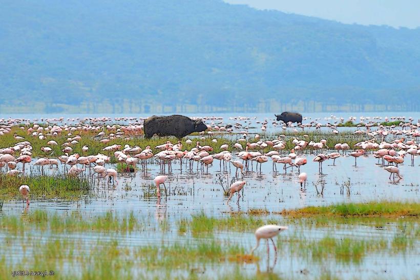
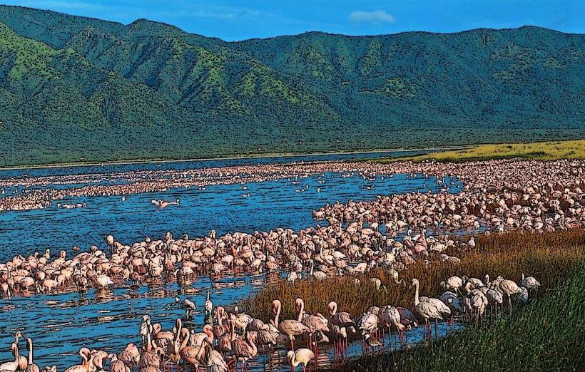
Lake Nakuru National Park: A UNESCO World Heritage site famous for its flamingos, white rhinos, and Rothschild giraffes.
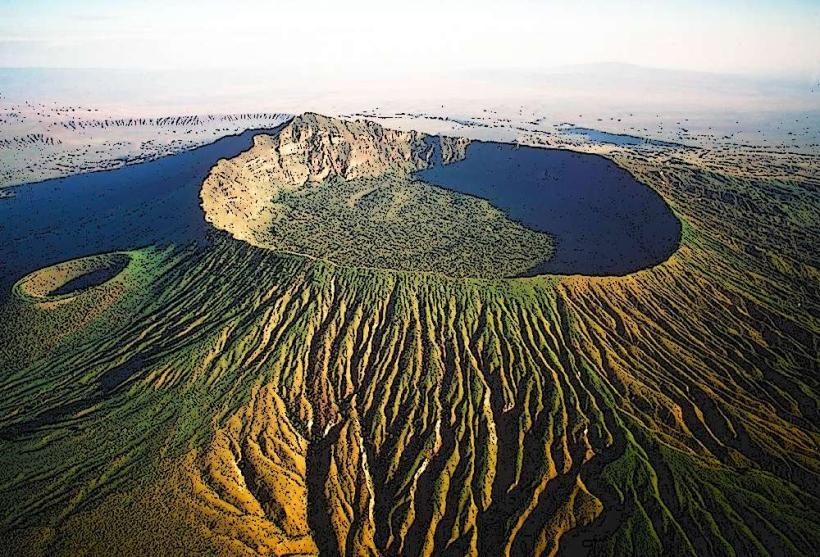
Menengai Crater: One of the largest volcanic calderas in the world.
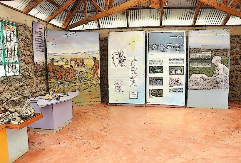
Hyrax Hill Prehistoric Site: A Neolithic and Iron Age archaeological museum.
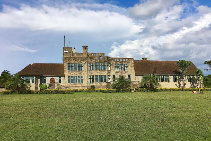
Lord Egerton Castle: A 52-room fortress built between 1938 and 1954.
Lake Elementaita: A nearby soda lake known for pelicans and luxury conservancies.
Transportation Network
Intra-city transit is dominated by Matatus and Boda Bodas. The city is a critical transit point for long-distance transport between Nairobi and Western Kenya/Uganda. The Standard Gauge Railway (SGR) terminates at the Suswa/Mai Mahiu hub, but the Meter Gauge Railway (MGR) provides direct freight and passenger links to Nakuru's central station. Traffic density is high at the main highway intersections.
Safety & "Red Zones"
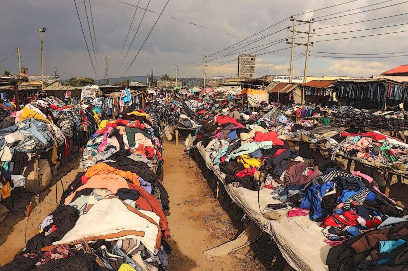
The general safety level is high compared to Nairobi. Petty theft is common in the main bus park and the open-air market. Specific "red zones" include the Bondeni and Ponda Mali informal settlements after dark. Travelers should be cautious of wildlife (specifically baboons) on the highways bordering the National Park.
Digital & Financial Infrastructure
Internet speeds average 30–50 Mbps. Main mobile carriers are Safaricom and Airtel. M-Pesa is the standard for nearly all financial transactions. ATMs are concentrated along Kenyatta Avenue and within Westside Mall and Naivas Supercentre. Credit card acceptance is restricted to large retailers and high-end hotels.
Climate & Air Quality
Temperatures range from 10°C to 27°C. The high altitude provides a temperate climate with cool evenings. Air quality is generally high, though dust levels increase during the dry season (January–March). Significant weather risks include heavy hailstorms and localized flooding during the rainy seasons.
Culture & Social Norms
English and Swahili are used for business; Kikuyu and Kalenjin are the primary local languages. Handshakes are the standard greeting. Nakuru is known as an agricultural hub; social life often revolves around the farming calendar and the city's vibrant nightlife in the CBD. Dress codes are casual-formal.
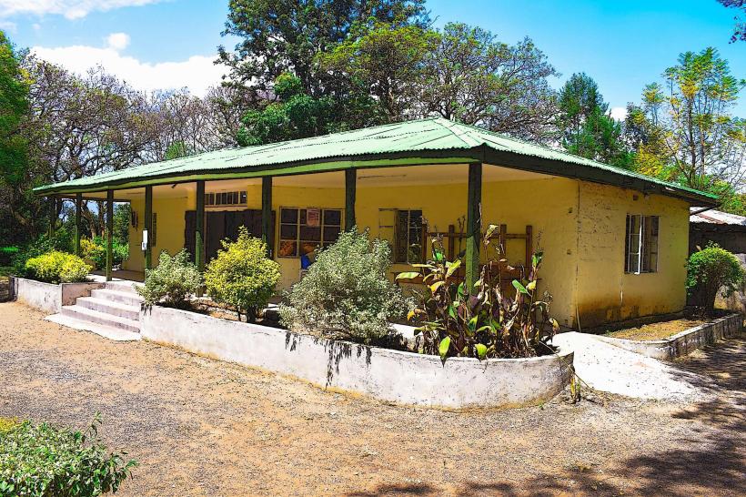
Accommodation Zones
Milimani: Recommended for high-end boutique hotels and quiet surroundings.
Lake Nakuru Perimeter: Recommended for luxury wildlife lodges and proximity to the park gate.
Local Cost Index
1 Espresso: 280 KES ($1.80 USD)
1 Standard Lunch (Nyama Choma/Ugali): 750 KES ($4.80 USD)
1 Short Boda Boda Trip: 100 KES ($0.65 USD)
Nearby Day Trips
Lake Baringo & Lake Bogoria: 100 km (Hot springs and birdwatching).
Nyahururu (Thomson’s Falls): 70 km (74-meter waterfall).
Mau Forest: 40 km (Indigenous forest hiking).
Facts & Legends
Nakuru is often called the "Cleanest City in East Africa," a title stemming from its colonial-era planning. A local legend surrounding Menengai Crater claims it is haunted by the spirits of Maasai warriors who were thrown over the edge during tribal wars, with locals reporting sightings of "ghostly smoke" rising from the caldera. A verified historical oddity is that the city was a favored retreat for Kenya’s first president, Jomo Kenyatta, who conducted much of the nation's business from the Nakuru State House.