Landmark: Menengai Crater
City: Nakuru
Country: Kenya
Continent: Africa
Menengai Crater, Nakuru, Kenya, Africa
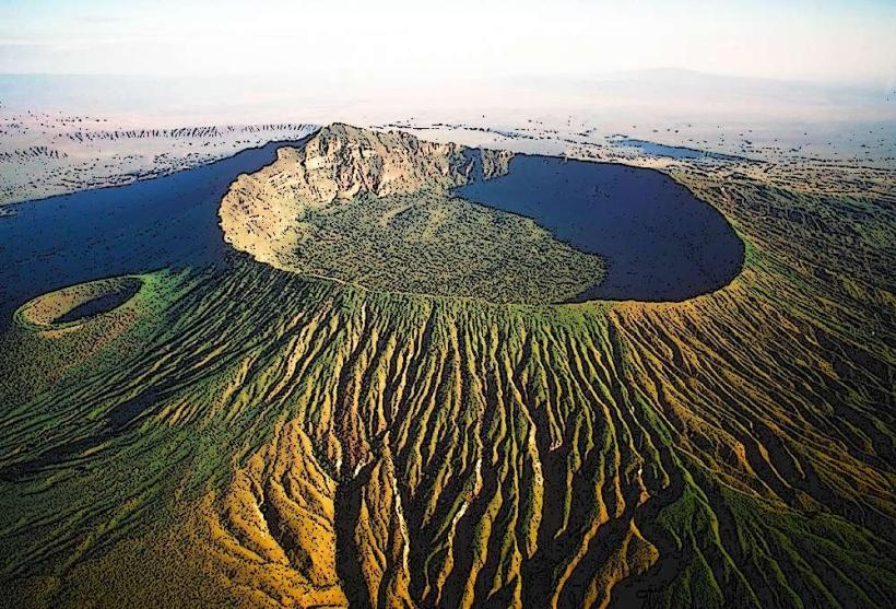
Menengai Crater is a large shield volcano located north of Nakuru, Kenya. It is one of the largest intact calderas in the world.
Visual Characteristics
The crater rim reaches an elevation of 2,250 meters (7,380 feet) above sea level. The caldera floor is approximately 12 kilometers (7.5 miles) in diameter. The inner walls are steep and covered in dense vegetation, primarily acacia trees and shrubs. Steam vents and fumaroles are visible on the caldera floor, indicating geothermal activity.
Location & Access Logistics
Menengai Crater is situated approximately 10 kilometers (6.2 miles) north of Nakuru city center. Access is via the A104 highway, turning off onto local roads leading to the crater rim. The final approach involves a rough track suitable for 4x4 vehicles, though some sections can be navigated by standard vehicles in dry conditions. Limited parking is available at designated viewpoints along the rim. Public transport to the crater is not available; private taxis or hired vehicles are required.
Historical & Ecological Origin
Menengai Crater is a Quaternary shield volcano, formed by effusive eruptions of basaltic lava. Its last major eruption is estimated to have occurred approximately 10,000 years ago. The caldera is a significant geological feature within the East African Rift Valley system.
Key Highlights & Activities
Hiking along the crater rim offers panoramic views of the caldera and surrounding landscape. Descending to the caldera floor is possible via established trails, allowing exploration of geothermal features like steam vents and hot springs. Birdwatching is a common activity due to the diverse avian population. Photography is popular, particularly at sunrise and sunset.
Infrastructure & Amenities
Basic amenities are limited. Designated viewpoints may have rudimentary seating. Restrooms are generally absent. Shade is provided by natural vegetation. Cell phone signal (4G/5G) is intermittent, particularly on the caldera floor. No food vendors are present at the crater itself; provisions should be carried from Nakuru.
Best Time to Visit
The best time of day for photography is early morning or late afternoon when the light is softer and casts longer shadows. The dry season, from June to October, offers clearer skies and more stable weather conditions. The crater floor can be damp and muddy after rainfall.
Facts & Legends
Local folklore associates Menengai Crater with spiritual significance, with some believing it to be a place of healing. A specific point on the rim is known as "God's Window," offering an expansive vista. Geothermal activity is a constant feature, with steam plumes often visible from Nakuru town.
Nearby Landmarks
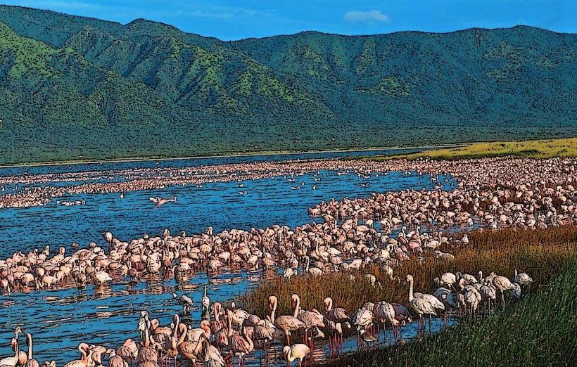
- Lake Nakuru National Park (12km South)
- Hyrax Hill National Museum (8km Southeast)
- Bahati Forest (15km East)
- Solai Dam (25km North)