City: Narok
Country: Kenya
Continent: Africa
Narok, Kenya, Africa
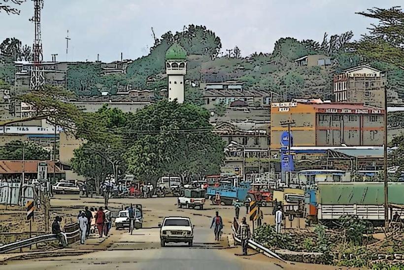
Narok is the administrative capital of Narok County and the primary cultural and commercial hub of the Maasai people. It is situated at an elevation of 1,827 meters in the Great Rift Valley, approximately 140 kilometers west of Nairobi.
Historical Timeline
Narok originated as a traditional Maasai settlement known as Enkare Narok ("Black Water"), named after the river that flows through the town. The primary event shaping its current urban form was its development as a colonial administrative outpost and its subsequent growth into the "Gateway to the Mara." In recent years, the town has transitioned from a rural market center into a bustling urban hub, fueled by the 2021-2022 expansion of the Narok-Bomet highway and the elevation of Maasai Mara University to a full-fledged academic institution.
Demographics & Population
The estimated metropolitan population for 2026 is 145,000. The demographics are predominantly Maasai, but the town is increasingly cosmopolitan due to the influx of students and traders from the Kalenjin and Kikuyu communities. The median age is approximately 19.6 years.
Urban Layout & Key Districts
The town is linear, following the main B3 highway.
The CBD: A dense, high-activity zone focused on the transit of tourists and agricultural trade.
The University District: Located on the outskirts, characterized by student housing and academic facilities.
William Ole Ntimama Stadium Area: The primary sports and public event zone.
Limuru & Total: Key commercial nodes for long-distance transit and local commerce.
Top City Landmarks
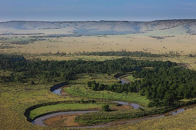
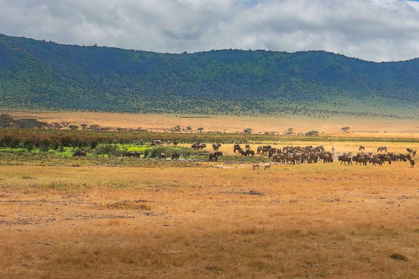
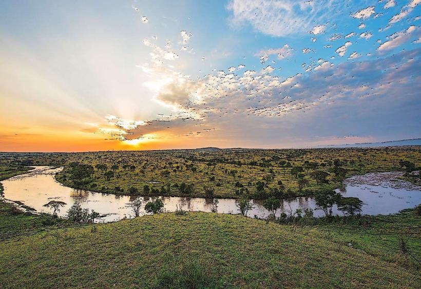
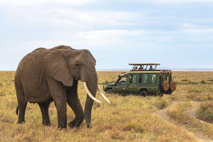
Maasai Mara National Reserve: Located approximately 80 km away, it is the town's primary economic driver and a world-renowned wildlife sanctuary.
William Ole Ntimama Stadium: A 30,000-capacity facility that is a focal point for regional athletics and football.
Maasai Mara University: The leading institution of higher learning in the region.
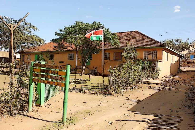
The Narok Museum: A small but significant center preserving Maasai artifacts and cultural history.
Enkare Narok River: The perennial river that provides the town with its namesake and water supply.
Transportation Network
Intra-city transit is dominated by Boda Bodas and Tuk-tuks. Narok is a vital pit stop for all road traffic between Nairobi and the South Rift/Western Kenya regions. There is no rail service; the town relies entirely on the B3 highway. The Narok Airstrip facilitates light aircraft and tourist transfers to the Mara. Traffic is moderate but surges during the "Wildebeest Migration" season (July–September) as tourist shuttles flood the town.
Safety & "Red Zones"
The general safety level is high. Petty theft is common in the main bus park and the crowded livestock markets. There are no specific "red zones," but travelers should avoid poorly lit areas near the riverbanks after dark. Flash flooding is a significant seasonal risk, as the town is situated in a basin that receives rapid runoff from the Mau Escarpment.
Digital & Financial Infrastructure
Internet speeds average 25–40 Mbps. Main carriers are Safaricom and Airtel. M-Pesa is the standard for almost all local commerce. ATMs are ubiquitous along the main highway and within the Narok Mall. Credit card acceptance is limited to high-end lodges, major supermarkets, and fuel stations.
Climate & Air Quality
Temperatures range from 12°C to 28°C. The climate is semi-arid to temperate. Air quality is high, though dust levels are extreme during the dry seasons. Significant weather risks include sudden, intense storms that can lead to rapid-onset flash floods in the town center.
Culture & Social Norms
English and Swahili are used for business; Maa is the dominant local language. The culture is a unique blend of traditional pastoralism and modern commerce; it is common to see Maasai morans (warriors) in traditional attire using mobile phones. Tipping is standard at 5–10% in tourist-centric cafes. Shaking hands is the standard greeting.
Accommodation Zones
Highway Strip / CBD: Recommended for budget travelers and those in transit to the Maasai Mara.
Outskirts / Mau Escarpment: Recommended for scenic lodges and a quieter, cooler atmosphere.
Local Cost Index
1 Espresso: 220 KES ($1.45 USD)
1 Standard Lunch (Nyama Choma/Mursik): 600 KES ($3.90 USD)
1 Short Boda Boda Trip: 100 KES ($0.65 USD)
Nearby Day Trips
Maasai Mara National Reserve: (Wildlife and the Great Migration).
Mau Forest: 40 km (One of Kenya's most important water towers and indigenous forests).
Loita Plains: 30 km (Traditional Maasai heartland and scenic vistas).
Facts & Legends
Narok is the "Wheat Capital of Kenya," producing a significant portion of the country's grain. A local legend claims that the Enkare Narok River is protected by a spiritual guardian that ensures the water never truly runs dry, even during the harshest droughts. A verified historical oddity is that Narok was once a "closed district" during the colonial era, requiring special permits for non-Maasai to enter, which helped preserve the unique cultural identity of the town.