Landmark: Mara River
City: Narok
Country: Kenya
Continent: Africa
Mara River, Narok, Kenya, Africa
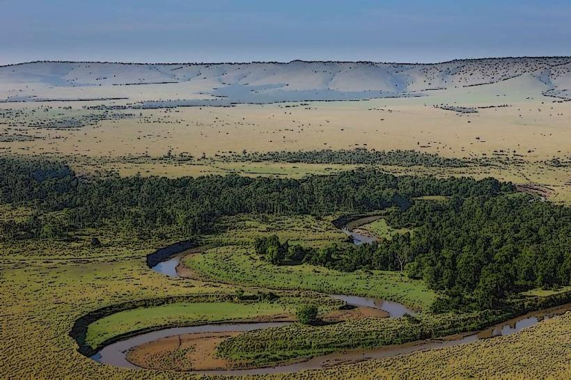
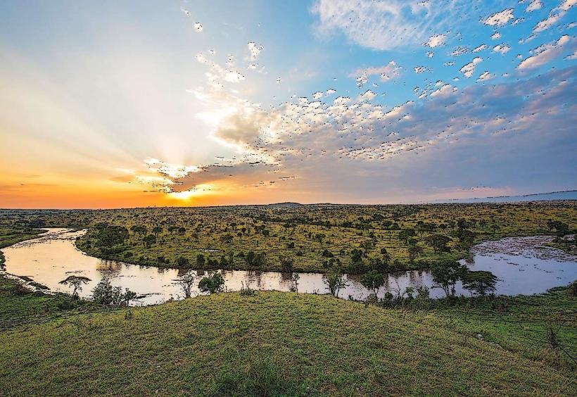
The Mara River is a significant river flowing through the Maasai Mara National Reserve in Narok County, Kenya. It is a crucial water source for the ecosystem and a focal point for wildlife migration.
Visual Characteristics
The river's width varies seasonally, typically ranging from 15 to 50 meters during the dry season and expanding considerably during the rainy periods. Water color is generally brown due to sediment load, especially after rainfall. The riverbanks are characterized by dense acacia woodlands and grasslands, with occasional rocky outcrops.
Location & Access Logistics
The Mara River traverses the Maasai Mara National Reserve. Access to the reserve is primarily via the main gates such as Sekanani Gate or Oloololo Gate. From Narok town, the reserve is approximately 100 kilometers southwest. Road conditions within the reserve are unpaved tracks, requiring a 4x4 vehicle. There are no direct public transport routes to the river itself; access is facilitated by safari operators within the reserve. The nearest airstrip is Mara Serena Airstrip, approximately 10 kilometers from a major crossing point.
Historical & Ecological Origin
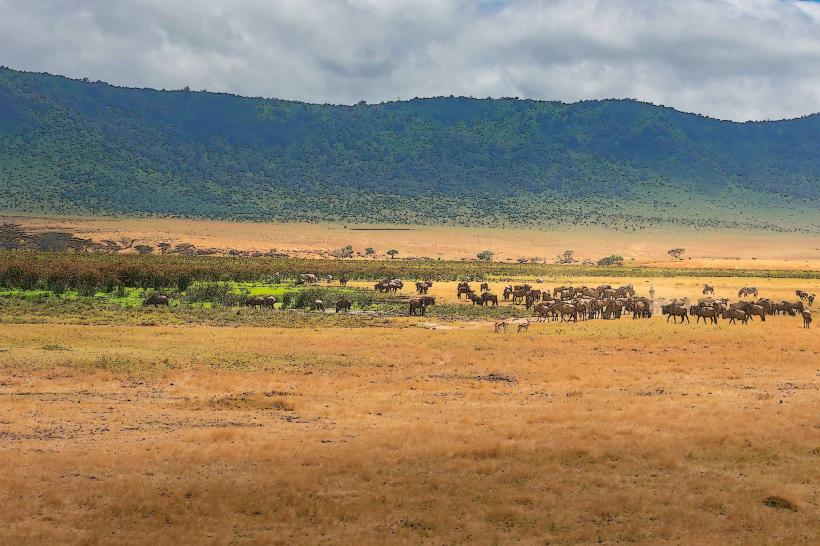
The Mara River is part of the Mara-Serengeti ecosystem, a vast savanna grassland. Its geological formation is typical of rift valley drainage systems. Ecologically, it is classified as a savanna river, supporting a diverse range of flora and fauna adapted to seasonal flooding and drought. The river's annual wildebeest migration, a phenomenon known as the Great Migration, is a key ecological event.
Key Highlights & Activities
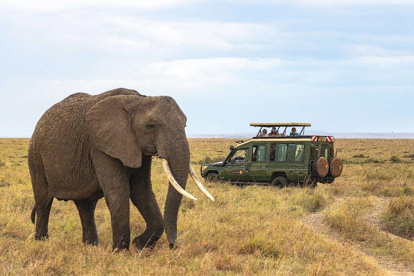
The primary activity associated with the Mara River is wildlife viewing, particularly during the Great Migration (July-October), when large herds cross the river. Boat safaris are not a standard offering due to river conditions and wildlife presence. Walking safaris are permitted in designated areas outside the main reserve boundaries under armed escort. Photography of wildlife and river crossings is a significant draw.
Infrastructure & Amenities
Within the Maasai Mara National Reserve, there are lodges and campsites located near the river. Basic restroom facilities are available at designated picnic sites and lodges. Shade is provided by acacia trees along the riverbanks. Cell phone signal (4G/5G) is intermittent and varies by location within the reserve. Food vendors are not present directly at the river; meals are typically provided by lodges or camps.
Best Time to Visit
For observing river crossings during the Great Migration, the period from late July to October is optimal. The best time of day for photography is generally early morning and late afternoon, due to softer light. The dry season (June to October) offers more predictable wildlife concentrations along the river. High tide is not a relevant factor for river crossings; the timing is dictated by herd movement and predator presence.
Facts & Legends
A notable historical oddity is the sheer volume of wildebeest and zebra that attempt the perilous river crossings, with estimates of over a million animals participating annually. The river's currents can be swift and unpredictable, leading to significant animal mortality during crossings. A visitor tip: observe crossings from a safe distance and be aware of crocodile presence in the water.
Nearby Landmarks
- Maasai Mara National Reserve Main Gates (e.g., Sekanani Gate) - 15km East
- Talek River Confluence - 8km North
- Oloololo Escarpment - 12km West
- Muskoka Plains - 5km South
- Kichwa Tembo Airstrip - 10km North-West