Information
Landmark: Aberdare National ParkCity: Nanyuki
Country: Kenya
Continent: Africa
Aberdare National Park, Nanyuki, Kenya, Africa
Aberdare National Park is a protected area situated in the Aberdare Range of central Kenya. It encompasses a significant portion of the mountain range, extending from the moorlands to the forests.
Visual Characteristics
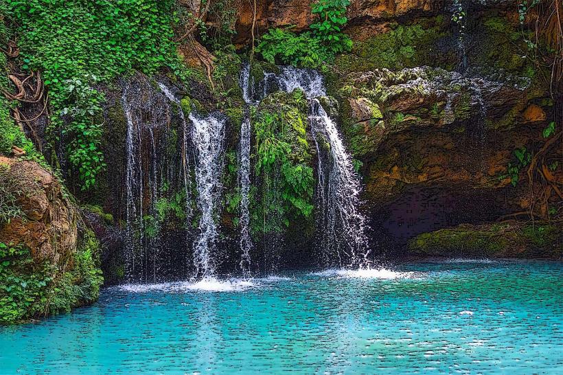
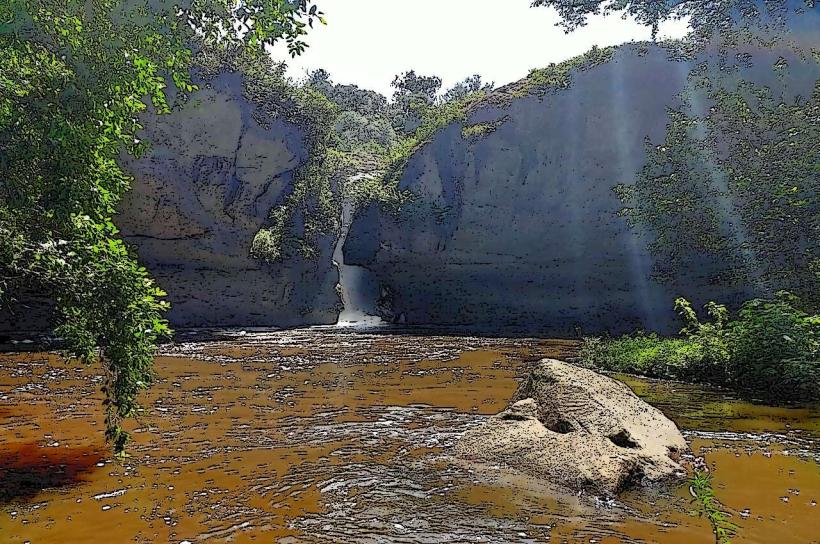
The park features a varied topography, including steep escarpments, deep ravines, and high-altitude moorlands. Vegetation ranges from dense montane forest at lower elevations to open moorland with grasses and giant heathers at higher altitudes. Waterfalls are a common feature, with several significant drops, such as the Karuru Falls. The terrain is characterized by rugged, undulating hills and valleys.
Location & Access Logistics
Aberdare National Park is located approximately 160 kilometers north of Nairobi. Access is primarily via Nanyuki town. The main park gates are the Nanyuki Gate and the Mutubio Gate. Roads within the park are unpaved and can be rough, requiring a 4WD vehicle, especially during the rainy seasons. From Nanyuki town, follow the A2 highway north for approximately 3 kilometers, then turn west onto a signposted road leading to the Nanyuki Gate. Public transport to Nanyuki is available via bus services from Nairobi. There are no direct public transport routes into the park itself.
Historical & Ecological Origin
Aberdare National Park was established in 1950. Its primary purpose is the conservation of the Aberdare Range's unique montane ecosystem and its wildlife. The range itself is geologically part of the Great Rift Valley system, formed by volcanic activity and subsequent erosion. The park protects a critical water catchment area for the Tana River.
Key Highlights & Activities
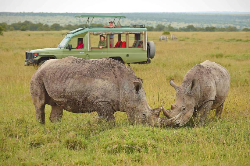
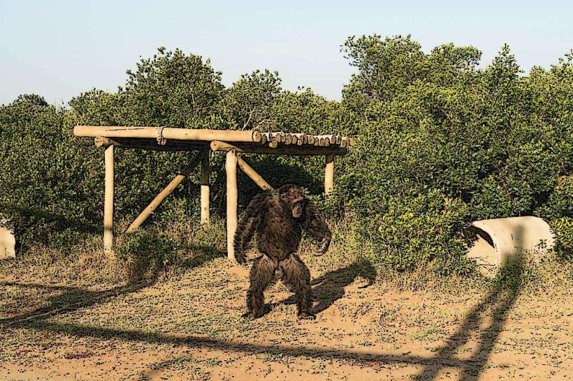
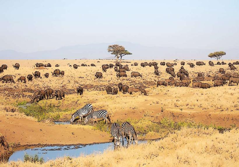
Activities include game drives to observe wildlife such as elephants, lions, leopards, and various antelope species. Hiking is permitted on designated trails, particularly in the moorland areas. Birdwatching is a significant activity due to the high diversity of avian species. Photography of waterfalls and landscapes is also a common pursuit.
Infrastructure & Amenities
Within the park, there are several lodges and campsites. Basic restroom facilities are available at park gates and some designated picnic sites. Cell phone signal is intermittent and generally poor within the park boundaries. There are no food vendors within the park; visitors must carry their own provisions. Shade is provided by the forest canopy in forested areas and by natural rock formations in some open areas.
Best Time to Visit
The best time for game viewing is during the dry seasons, from January to March and from June to October. The park receives heavy rainfall during the long rains (April-May) and short rains (November-December), which can make roads impassable. For photography, early morning and late afternoon offer optimal lighting conditions. There are no specific tide requirements as the park is landlocked.
Facts & Legends
The Aberdare Range is known for its high altitude and frequent cloud cover, which contributes to its unique flora. A notable historical oddity is the presence of the Treetops Hotel, a famous tree hotel built on stilts within the park, which has hosted royalty. Local folklore often speaks of spirits inhabiting the dense forests.
Nearby Landmarks
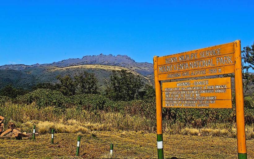
- Mount Kenya National Park (15km East)
- Ol Pejeta Conservancy (20km North-East)
- Solio Ranch (25km South)
- Rumuruti Town (30km North-West)