Landmark: Ankarana Special Reserve
City: Antsiranana
Country: Madagascar
Continent: Africa
Ankarana Special Reserve, Antsiranana, Madagascar, Africa
Visual Characteristics
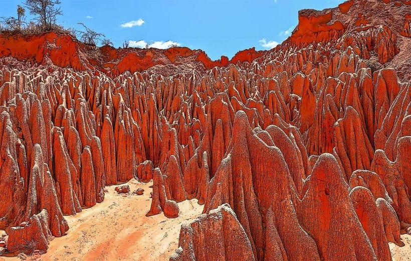
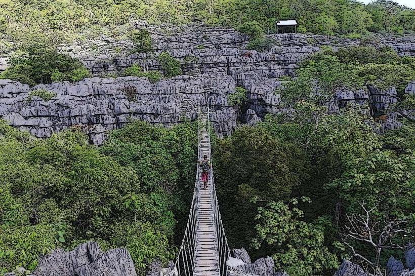
The reserve is characterized by its sharp, eroded limestone karst formations known as tsingy. These formations are grey, reaching heights of up to 30 meters, interspersed with dry deciduous forest and numerous underground rivers and caves. The vegetation density varies from dense forest in canyons to sparse, drought-adapted plants on the tsingy plateaus.
Location & Access Logistics
Access is primarily via National Route 6 (RN 6). The main entrance to the reserve is approximately 100 km south of Antsiranana and 30 km north of Ambilobe. Parking is available at the main entrance and at specific trailheads. Public transport involves bush taxis (taxi-brousse) from Antsiranana or Ambilobe, which can drop visitors at the park entrance or the nearby village of Mahamasina.
Historical & Ecological Origin
Established in 1956, Ankarana Special Reserve was created to protect its unique karst ecosystem and endemic wildlife. Geologically, it is a Jurassic limestone plateau, uplifted and eroded over millions of years by rainfall, forming the distinctive tsingy and an extensive network of caves and subterranean rivers.
Key Highlights & Activities
Activities include guided hikes through the tsingy formations, exploring caves such as the Grotte des Chauves-Souris (Bat Cave) and the Grotte des Crocodiles. Wildlife observation focuses on lemurs, including crowned lemurs and Sanford's brown lemurs, and various bird species. Night walks are possible for spotting nocturnal animals like sportive lemurs and civets. Specific trails lead to viewpoints over the tsingy landscape.
Infrastructure & Amenities
Basic restrooms are available near the main entrance and at designated campsites within the reserve. Shade is provided by the forest canopy along many trails. Cell phone signal (2G/3G) is intermittent and unreliable within the reserve. Food vendors are not present; visitors must bring their own provisions or arrange meals through local guides or lodges outside the park.
Best Time to Visit
The dry season, from May to November, offers the most favorable conditions for hiking and cave exploration due to lower rainfall and less slippery trails. Early morning provides optimal lighting for photography of the tsingy formations and increased wildlife activity. Visiting during the cooler months of June to August is generally more comfortable.
Facts & Legends
Local legend states that the Antakarana people, who inhabit the region, sought refuge in the caves of Ankarana during tribal wars, making the caves sacred sites and burial grounds for their ancestors. A verified oddity is the presence of blind fish and crocodiles in the underground rivers, adapted to the perpetual darkness.
Nearby Landmarks
- Montagne d'Ambre National Park: Approximately 50km North-East
- Analamerana Special Reserve: Approximately 70km East
- Mahamasina Village: Approximately 5km South
- Lac Sacré (Sacred Lake): Approximately 15km North-West