Landmark: Arima Valley
City: Arima
Country: Trinidad and Tobago
Continent: North America
Arima Valley, Arima, Trinidad and Tobago, North America
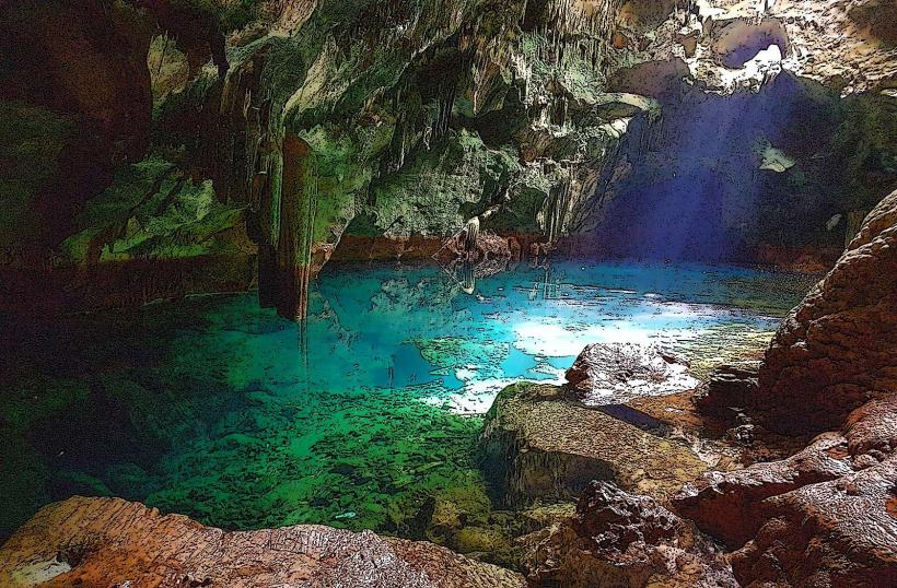
Arima Valley is a geographical region located in the northern part of Trinidad, within the Arima municipality of Trinidad and Tobago. It is characterized by its mountainous terrain and dense tropical rainforest.
Visual Characteristics
The valley is defined by steep, verdant slopes covered in dense tropical rainforest. Dominant tree species include various hardwoods and palms. Watercourses within the valley are typically clear, flowing over rocky beds. Rock formations are primarily sedimentary and metamorphic, with exposed outcrops in steeper sections.
Location & Access Logistics
Arima Valley is situated approximately 5 kilometers north of the Arima town center. Access is primarily via the Blanchisseuse Road (also known as the Arima-Blanchisseuse Road), which traverses the valley. The road is paved but can be narrow and winding. Parking is limited to designated pull-off areas along the roadside. Public transport directly into the valley is infrequent; visitors typically travel to Arima town and arrange private transport or hire taxis.
Historical & Ecological Origin
The valley's geological formation is part of the Northern Range of Trinidad, primarily composed of sedimentary rocks dating back to the Tertiary period. Ecologically, it is classified as a tropical moist forest ecosystem, supporting a high level of biodiversity. Historically, the area was utilized by indigenous populations and later by colonial settlers for logging and agriculture, though much of it has reverted to forest cover.
Key Highlights & Activities
Hiking is a primary activity, with several unofficial trails leading to waterfalls and viewpoints. The most accessible waterfall is approximately a 30-minute walk from the roadside. Birdwatching is also a significant draw due to the diverse avian population. Visitors can observe various species of hummingbirds, tanagers, and parrots.
Infrastructure & Amenities
There are no formal visitor facilities within Arima Valley. Restrooms are not available. Shade is provided by the dense forest canopy. Cell phone signal is intermittent and generally unreliable. Food vendors are not present within the valley; provisions should be made before entering.
Best Time to Visit
The best time of day for photography is generally mid-morning to early afternoon, when sunlight penetrates the canopy, illuminating the forest floor. The dry season, from January to May, offers the most favorable weather conditions with less rainfall. The wet season (June to December) can lead to slippery trails and increased insect activity.
Facts & Legends
A local legend speaks of a hidden waterfall deep within the valley, said to possess healing properties. While unverified, the story contributes to the area's mystique. The valley is also known for its population of the Trinidad piping guan, a bird species endemic to the island.
Nearby Landmarks
- Maracas Bay (10km Southwest)
- El Tucuche (8km Northwest)
- Aripo Caves (15km East)
- Valencia Wildlife Reserve (12km Southeast)