Landmark: Baba Island
City: Western Province
Country: Solomon Islands
Continent: Australia
Baba Island, Western Province, Solomon Islands, Australia
Baba Island is a small landmass situated off the coast of the Western Province in the Solomon Islands.
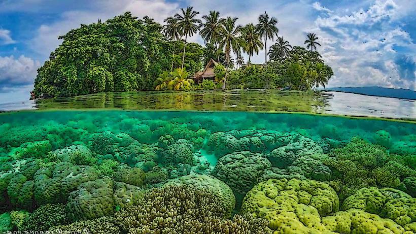
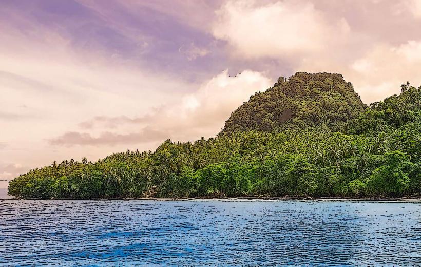
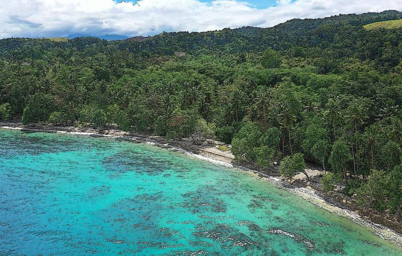
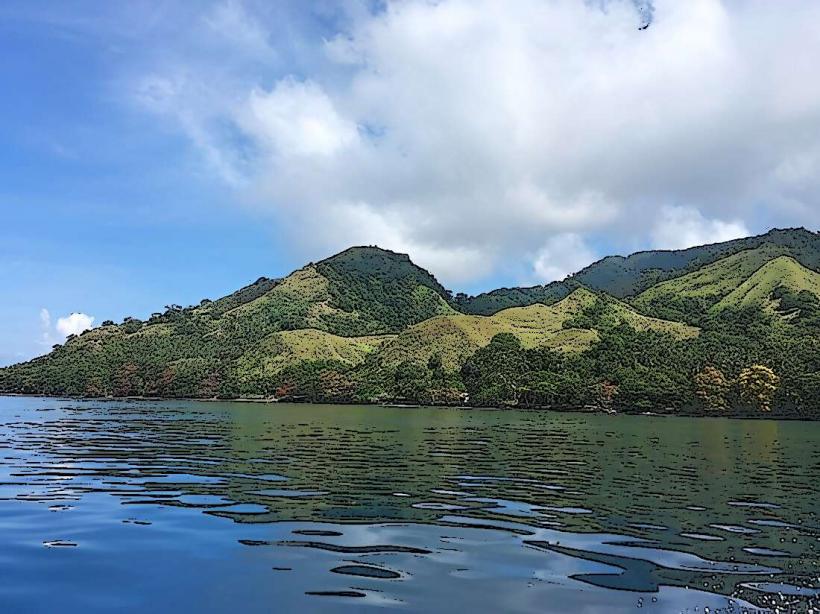
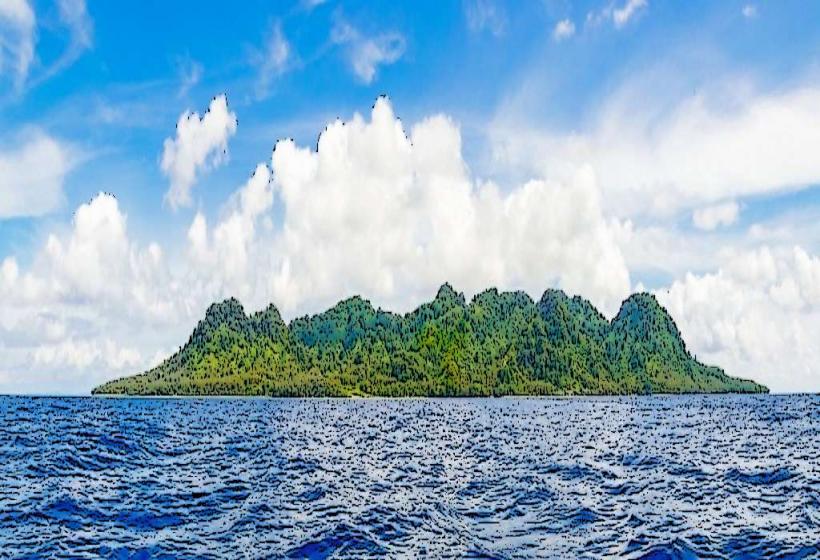
This island is primarily composed of coral limestone and is characterized by low-lying vegetation and sandy shorelines.
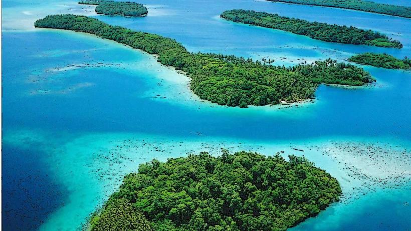
Visual Characteristics
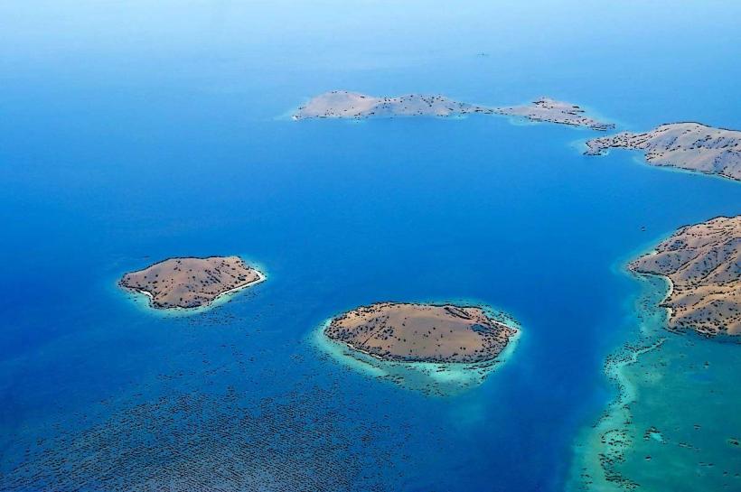
Baba Island presents a low elevation profile, with its highest points not exceeding 10 meters above sea level. The island's perimeter is defined by coral sand beaches. Inland, vegetation consists of dense scrub and scattered palm trees. The surrounding waters are typically clear, with visibility dependent on tidal conditions.
Location & Access Logistics
Baba Island is located approximately 15 kilometers west of Gizo, the provincial capital. Access is exclusively by boat. Private boat hire is available from Gizo town, with journey times averaging 30-45 minutes depending on sea conditions. There is no designated public transport. No formal docking facilities exist; boats anchor offshore and passengers disembark via dinghy or by wading.
Historical & Ecological Origin
The island is a coral atoll, formed by the accumulation of coral skeletons over geological time. Its ecological classification is a small, low-lying coral island. Historically, it has served as a minor fishing and resource point for local communities, with no permanent settlement recorded.
Key Highlights & Activities
Activities include shoreline exploration and observation of marine life in the shallow waters surrounding the island. Snorkeling is possible in calm conditions. Birdwatching is also an option due to the presence of coastal avian species.
Infrastructure & Amenities
There are no permanent structures or amenities on Baba Island. Visitors should bring all necessary supplies, including water and food. Cell phone reception is unreliable and generally absent. No shade structures are present.
Best Time to Visit
The best time for boat access is during the dry season, from May to October, when sea conditions are calmer. Mid-morning offers optimal sunlight for visibility of the water and surrounding reef. Low tide can expose more of the sandy shoreline.
Facts & Legends
Local oral tradition suggests that the island was once a resting place for ancient mariners navigating the Solomon Sea. A specific navigational marker, a distinctively shaped rock formation on the western shore, is said to have been used as a reference point.
Nearby Landmarks
- Gizo Island (15km East)
- Kolombangara Island (25km North)
- Vella Lavella Island (40km West)
- Simbo Island (30km South)