Landmark: Bahía de Taco
City: Baracoa
Country: Cuba
Continent: North America
Bahía de Taco, Baracoa, Cuba, North America
Bahía de Taco is a bay located on the northeastern coast of Cuba, near the city of Baracoa.
This coastal feature is characterized by its mangrove ecosystems and the presence of the Duaba River delta.
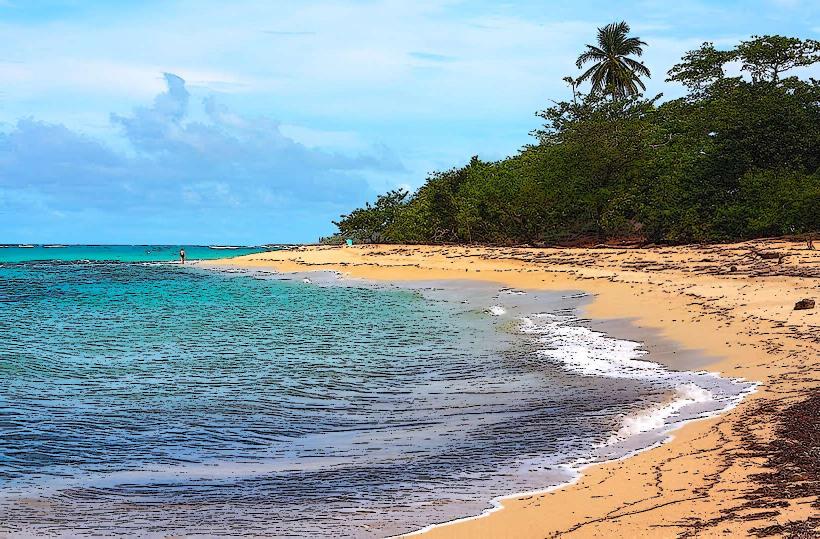
Visual Characteristics
The bay's waters exhibit a range of greens and blues, influenced by sediment load from the Duaba River and the surrounding vegetation. The shoreline is predominantly lined with dense mangrove forests, featuring prop roots and aerial roots characteristic of Rhizophora species. The terrain immediately inland consists of low-lying hills covered in tropical vegetation.
Location & Access Logistics
Bahía de Taco is situated approximately 15 kilometers east of Baracoa. Access is primarily via the Carretera a Maisí (also known as Carretera de la Costa). The final approach involves a dirt track, approximately 2 kilometers in length, which is passable by 4x4 vehicles. Standard vehicles may have difficulty, especially after rainfall. There is no designated public transport directly to the bay; local taxis or private arrangements are required from Baracoa. Parking is informal and available at the end of the dirt track.
Historical & Ecological Origin
Ecologically, Bahía de Taco is a deltaic bay formed by the deposition of sediment from the Duaba River over millennia. The extensive mangrove forests are a result of the brackish water conditions and the nutrient-rich environment. Historically, the area has been utilized by local communities for fishing and as a passage for small boats.
Key Highlights & Activities
Boat tours are available for navigating the mangrove channels. Kayaking is possible within the bay. Birdwatching is a primary activity due to the diverse avian population within the mangroves. Fishing is permitted in designated areas.
Infrastructure & Amenities
Basic amenities are limited. There are no permanent restroom facilities or designated shade structures directly at the bay. Cell phone signal (3G/4G) is intermittent and unreliable. Small, informal food vendors may be present during peak tourist times, offering local seafood and beverages, but this is not guaranteed.
Best Time to Visit
The best time of day for photography is generally in the morning or late afternoon when the light is softer. The dry season, from November to April, offers more predictable weather conditions. High tide is preferable for boat navigation through the mangrove channels.
Facts & Legends
Local folklore suggests that the bay was a favored spot for pirates to anchor and resupply during the colonial era, though concrete historical evidence for this specific location is scarce. A practical tip for visitors is to bring insect repellent, as mosquitoes can be prevalent, particularly at dawn and dusk.
Nearby Landmarks
- Playa Maguana (2.5km West)
- El Yunque de Baracoa (8km Southwest)
- Fuerte Matachín (12km West)
- Baracoa Malecon (15km West)