
Landmark: Playa Maguana
City: Baracoa
Country: Cuba
Continent: North America
Playa Maguana, Baracoa, Cuba, North America
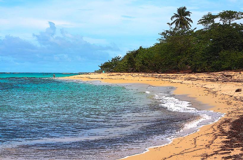
Playa Maguana is a beach located on the northeastern coast of Cuba, near the city of Baracoa.
Visual Characteristics
The beach features fine, light-colored sand. The water is typically clear and exhibits shades of turquoise and blue. Coconut palms line the shore, providing natural shade. The coastline is characterized by a relatively straight stretch of sand bordered by low, vegetated hills.
Location & Access Logistics
Playa Maguana is situated approximately 20 kilometers west of Baracoa. Access is via the Carretera a Maisí (also known as Carretera de la Costa). The road is paved for most of the route. Parking is available directly adjacent to the beach area, often managed by local vendors. Public transport options are limited; shared taxis or private car hire from Baracoa are the most common methods of arrival.
Historical & Ecological Origin
The beach is a natural formation, part of the coastal geology of the eastern Cuban province of Guantánamo. Its formation is attributed to marine erosion and sedimentation processes over geological time. The surrounding vegetation is characteristic of a tropical coastal ecosystem.
Key Highlights & Activities
Swimming is possible in the calm waters. Snorkeling can be done near the rocky outcrops at either end of the main beach area. Local vendors offer fresh seafood and drinks. Relaxing under the palm trees is a primary activity.
Infrastructure & Amenities
Basic palapas (thatched-roof shelters) are present, offering shade. Restrooms are typically available at the small restaurant/bar on site. Cell phone signal (3G) is generally present but can be intermittent. Food and drink vendors operate seasonally.
Best Time to Visit
The best time of day for photography is generally mid-morning or late afternoon when the sun angle is lower, reducing harsh shadows. The dry season, from December to May, offers the most favorable weather conditions with less rainfall. High tide can reduce the visible sand area.
Facts & Legends
Local lore suggests that the name "Maguana" derives from an indigenous Taíno word, though its precise meaning is debated. A specific tip for visitors is to explore the small rocky areas at the western end of the beach, which can reveal small tide pools with marine life during low tide.
Nearby Landmarks
- El Yunque (Mountain) - 8km Northeast
- Baracoa Malecon - 20km East
- Fuerte Matachín - 21km East
- Parque Nacional Alejandro de Humboldt - 35km Southwest


