Landmark: Playa del Toro
City: Baracoa
Country: Cuba
Continent: North America
Playa del Toro, Baracoa, Cuba, North America
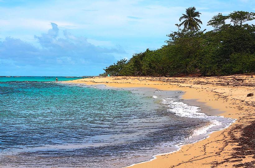
Playa del Toro is a coastal area situated on the northeastern tip of Cuba, near the city of Baracoa.
Visual Characteristics
The beach consists of dark, volcanic sand. The water exhibits a deep blue hue, transitioning to lighter shades closer to the shore. The coastline is characterized by rocky outcrops and a moderate density of coastal vegetation, primarily palm trees and low-lying shrubs.
Location & Access Logistics
Playa del Toro is located approximately 15 kilometers east of Baracoa's city center. Access is via the Carretera a Maisí (also known as Carretera de la Costa). The road surface is paved but can be uneven in sections. Parking is available on unpaved areas adjacent to the beach. Public transport options are limited; local buses may pass the general area, but direct service to the beach is not guaranteed. Taxis from Baracoa are the most reliable transport method.
Historical & Ecological Origin
The dark sand is a result of the region's volcanic geology. The area is part of the eastern Cuban coastal plain, shaped by marine erosion and deposition over millennia.
Key Highlights & Activities
Swimming is possible in the open water. Beachcombing along the shoreline is an available activity. Observation of local birdlife is possible from the beach.
Infrastructure & Amenities
There are no permanent structures or amenities directly on Playa del Toro. Restrooms, food vendors, and shade are not available at the immediate site. Cell phone signal (3G/4G) is generally weak to non-existent.
Best Time to Visit
The best time for photography is during the morning hours (approximately 8:00 AM to 10:00 AM) for direct sunlight on the water. The dry season, from November to April, offers the most stable weather conditions. Tidal variations do not significantly impact access or usability of the beach.
Facts & Legends
Local folklore suggests that the dark color of the sand is due to ancient volcanic activity that infused the earth with mineral-rich particles. A specific tip for visitors is to bring all necessary supplies, including water and food, as no services are present.
Nearby Landmarks
- Baracoa Malecon (2.5km West)
- Fuerte Matachín (3.0km West)
- Parque Natural El Yunque (7.0km Southwest)
- Catedral de Nuestra Señora de la Asunción (14.0km West)