Landmark: Bikini Island Shoreline
City: Bikini Atoll
Country: Marshall Islands
Continent: Australia
Bikini Island Shoreline, Bikini Atoll, Marshall Islands, Australia
The Bikini Island Shoreline is a coastal area located on Bikini Island within the Bikini Atoll, Marshall Islands. This location is primarily known for its historical significance related to nuclear testing and its current status as a UNESCO World Heritage Site.
Visual Characteristics
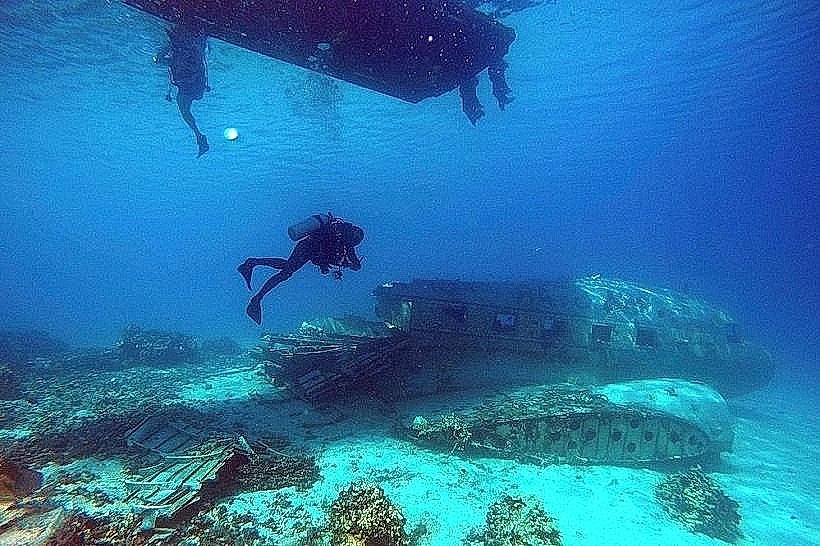
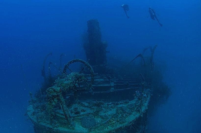
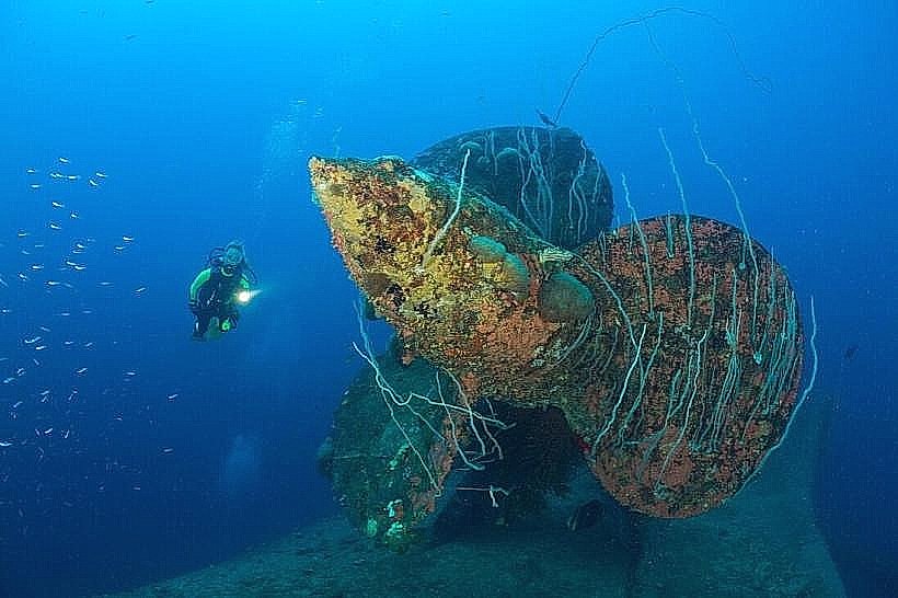
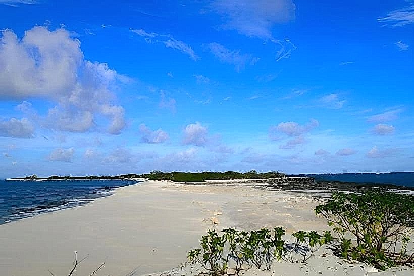
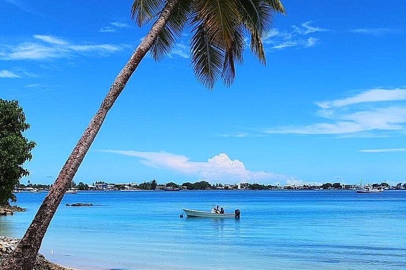
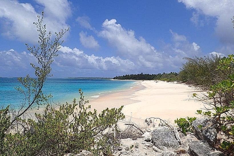
The shoreline consists of coral sand beaches with varying degrees of erosion. The water clarity is generally high, revealing submerged debris from past nuclear tests. Vegetation is sparse, consisting of low-lying coastal plants and scattered coconut palms.
Location & Access Logistics
Bikini Island is accessible via charter flights to the Bikini Atoll's airstrip, followed by a boat transfer to the island. There are no regular public transport services. Parking is not available as the island is largely uninhabited and undeveloped.
Historical & Ecological Origin
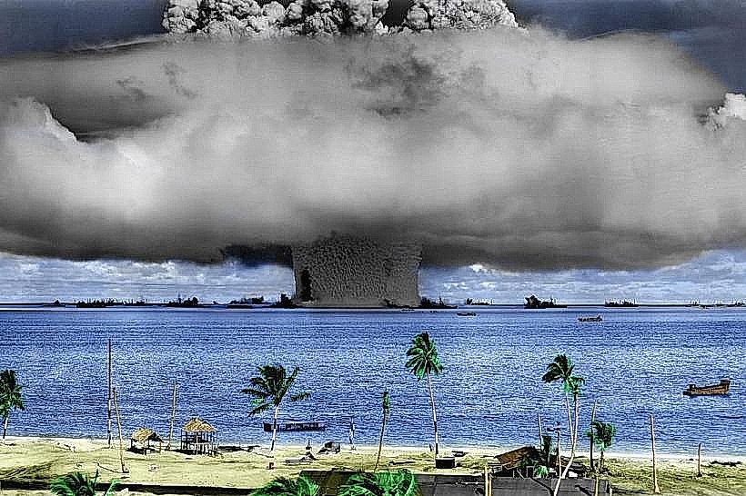
Bikini Atoll is a coral atoll formed by volcanic activity and subsequent coral growth. Bikini Island, specifically, was the site of numerous nuclear weapons tests conducted by the United States between 1946 and 1958, including the Castle Bravo test in 1954. The original purpose of the island's use was for nuclear weapons testing and research.
Key Highlights & Activities
Diving and snorkeling are the primary activities, focusing on the submerged wrecks and marine life that have adapted to the environment. The "Bikini Atoll Nuclear Test Site" is a designated historical area. Limited shore exploration is possible.
Infrastructure & Amenities
There are no permanent infrastructure or amenities on Bikini Island. Visitors must bring all necessary supplies. Cell phone signal is unreliable.
Best Time to Visit
The dry season, from January to April, offers the most favorable weather conditions. Visibility for diving is typically best during daylight hours. Tidal patterns do not significantly impact shoreline access.
Facts & Legends
A notable historical oddity is the presence of numerous shipwrecks from Operation Crossroads, deliberately sunk as targets for nuclear tests, now serving as artificial reefs. A specific tip for visitors is to be aware of residual radiation levels and follow guidance from local authorities.
Nearby Landmarks
- Enyu Island (0.8km Southwest)
- Namor Island (1.5km Northeast)
- Aomon Island (2.2km East)
- Marjuran Island (3.1km Southeast)