Landmark: Blue Holes National Park
City: Andros Island
Country: Bahamas
Continent: North America
Blue Holes National Park, Andros Island, Bahamas, North America
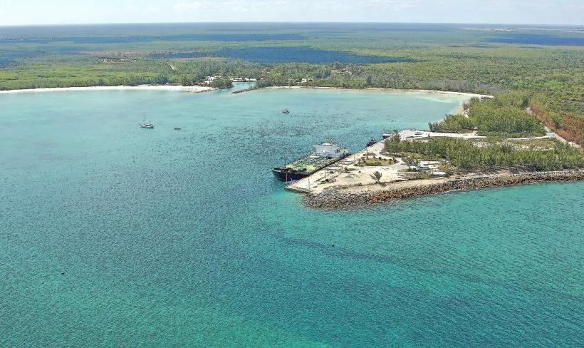
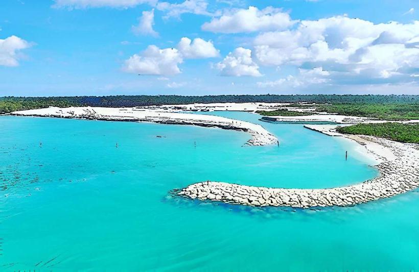
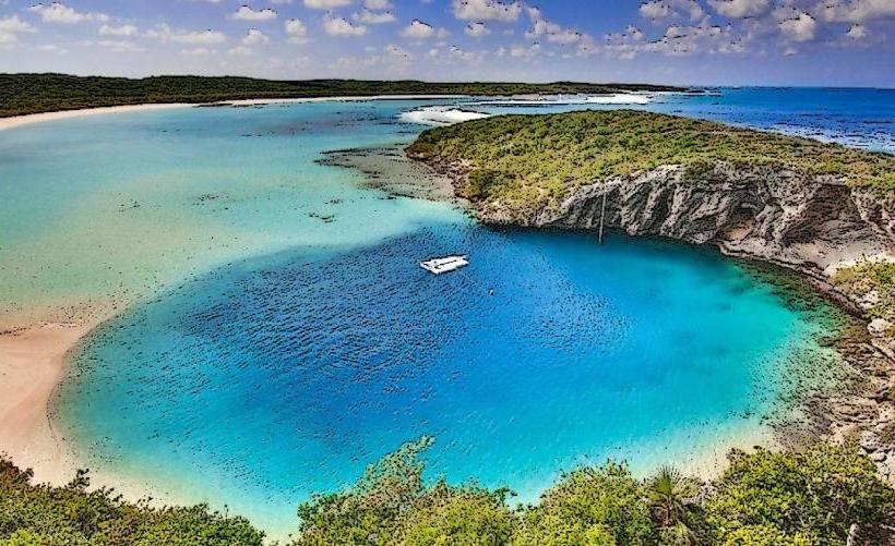
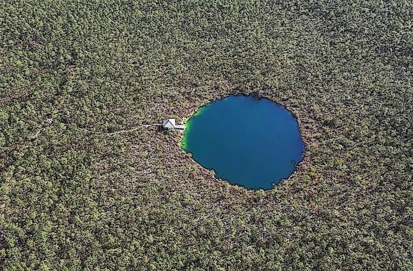
Blue Holes National Park is a protected area located on Andros Island in the Bahamas. It encompasses several significant geological formations, primarily blue holes and surrounding terrestrial and marine ecosystems.
Visual Characteristics
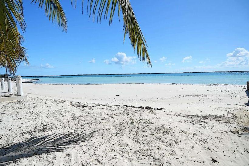
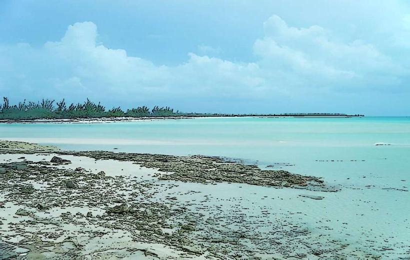
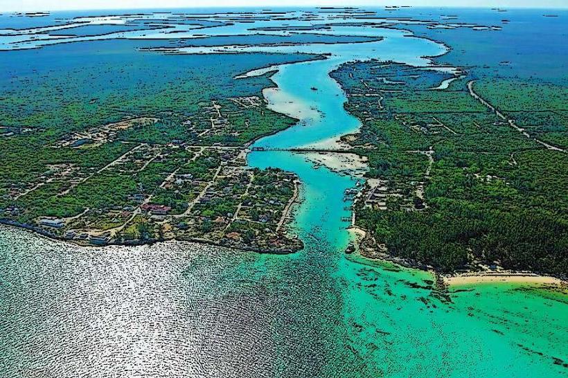
The park features numerous blue holes, which are vertical underwater caves or shafts. These holes are characterized by their deep blue coloration, contrasting with the lighter turquoise of the surrounding shallow waters and mangrove channels. The land areas consist of low-lying limestone terrain with dense mangrove forests and scattered pine forests. The water within the blue holes is typically clear, allowing visibility to significant depths.
Location & Access Logistics
Blue Holes National Park is situated on the eastern side of Andros Island. Access is primarily via the Queen's Highway. From the main settlement of Fresh Creek, travel approximately 15 kilometers south along the Queen's Highway. The park entrance is marked. Parking is available at designated areas near the main blue hole sites. Public transport is limited; a rental car is recommended for independent access. Some tour operators offer guided excursions from resorts.
Historical & Ecological Origin
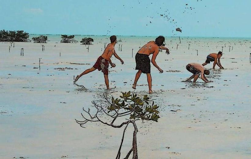
The blue holes are geological features formed by the dissolution of limestone bedrock over millennia, a process common in karst landscapes. During periods of lower sea levels, rainwater would have eroded the limestone, creating underground caverns. As sea levels rose, these caverns became flooded, forming the underwater sinkholes observed today. The park protects these unique geological formations and the associated Bahamian terrestrial and marine habitats, including vital mangrove ecosystems.
Key Highlights & Activities
Activities include observation of the blue holes, such as the famous Blue Hole (also known as the "Great Blue Hole" on Andros, distinct from the Belize site). Snorkeling and diving are permitted in designated areas of certain blue holes, requiring appropriate certification and equipment for deeper dives. Hiking trails provide access to terrestrial viewpoints and smaller blue holes. Birdwatching is also a notable activity due to the diverse avian population.
Infrastructure & Amenities
Basic infrastructure includes marked trails and informational signage at key points. Restrooms are available at the main visitor access points. Shade is provided by natural tree cover in some areas. Cell phone signal (4G/5G) can be intermittent within the park, particularly in denser vegetation. Food vendors are not typically present within the park itself; visitors should plan to bring their own provisions or dine in nearby settlements.
Best Time to Visit
The best time for general visitation is during the dry season, from December to May, when weather conditions are typically calm and sunny. For photography, early morning or late afternoon offers softer lighting. Specific blue holes may have tidal considerations for access or visibility, though most are accessible year-round. Water clarity is generally consistent, but heavy rainfall can temporarily affect visibility.
Facts & Legends
Local folklore suggests that the blue holes are entrances to an underworld or are inhabited by mythical creatures. Scientifically, they are significant for their unique marine life, including endemic species adapted to the low-oxygen, high-salinity environments found at depth. Some blue holes have been explored to depths exceeding 200 meters, revealing complex cave systems.
Nearby Landmarks
- Small Hope Bay Lodge (1.2km Northwest)
- Central Andros (approx. 15km North)
- Nicholls Town (approx. 25km North)
- Congo Town (approx. 30km South)
- Fresh Creek (approx. 15km North)