Landmark: Buyangu Hill
City: Kakamega
Country: Kenya
Continent: Africa
Buyangu Hill, Kakamega, Kenya, Africa
Buyangu Hill is a geological formation located in Kakamega, Kenya.
This elevation offers a vantage point for observing the surrounding landscape.
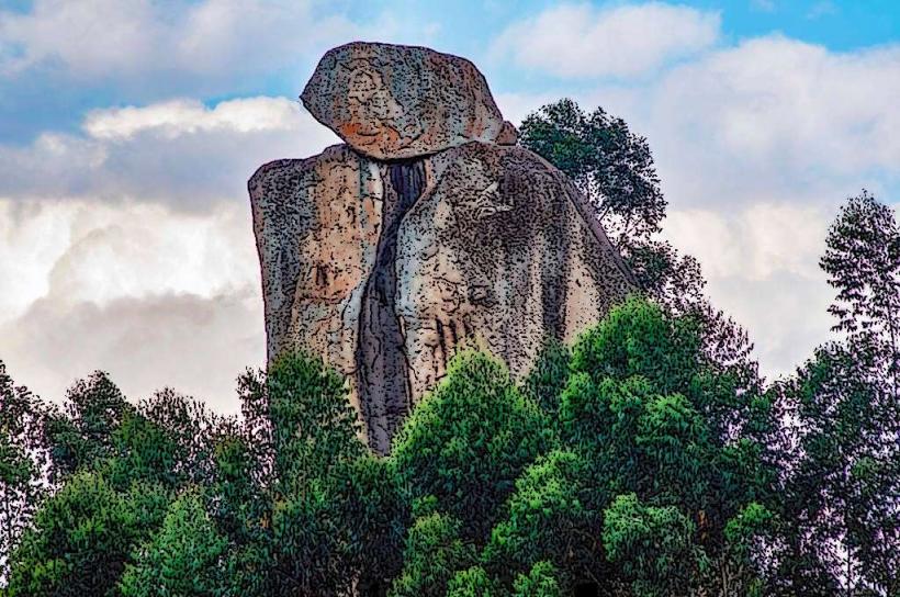
Visual Characteristics
Buyangu Hill is characterized by its exposed rock faces and sparse vegetation. The dominant rock type appears to be weathered granite, exhibiting shades of grey and brown. The summit is relatively flat, with scattered shrubs and grasses. The surrounding terrain consists of rolling hills and agricultural land.
Location & Access Logistics
Buyangu Hill is situated approximately 8 kilometers east of Kakamega town center. Access is via the C40 Kakamega-Webuye road. Turn south onto an unpaved access track approximately 5 kilometers from Kakamega. This track is passable by 2WD vehicles in dry conditions; 4WD is recommended during the rainy season. Parking is available at the base of the hill, with no designated facilities. Public transport to the turn-off point is available via matatus operating on the Kakamega-Webuye route.
Historical & Ecological Origin
Buyangu Hill is a remnant of ancient geological processes, likely formed by the erosion of a larger granitic intrusion. Its ecological classification is that of a savanna woodland, adapted to the local climate with distinct wet and dry seasons.
Key Highlights & Activities
Ascent to the summit is possible via a discernible foot trail. The primary activity is observation of the Kakamega Forest and surrounding agricultural plains. Birdwatching opportunities exist due to the proximity of the forest.
Infrastructure & Amenities
There are no formal infrastructure or amenities at Buyangu Hill. Restrooms, shade, and food vendors are not present. Cell phone signal (4G) is intermittent at the summit and generally reliable at the base.
Best Time to Visit
The best time for clear visibility of the landscape is during the dry season, from June to September. Early morning hours (07:00-09:00) provide optimal lighting for photography due to the angle of the sun. Midday can be hot with reduced visibility due to atmospheric haze.
Facts & Legends
Local folklore suggests that the hill was once a dwelling place for ancient spirits, and that unusual weather patterns observed from its peak are a sign of their presence. A specific tip for visitors is to carry sufficient water, as there are no water sources available on or near the hill.
Nearby Landmarks
- Kakamega Forest National Reserve (3km West)
- Masinde Muliro University of Science and Technology (7km West)
- Kakamega Town Market (8km West)
- Ikolomani Forest (12km South-East)