Landmark: Custer Battlefield Highway Marker
City: Sundance
Country: USA Wyoming
Continent: North America
Custer Battlefield Highway Marker, Sundance, USA Wyoming, North America
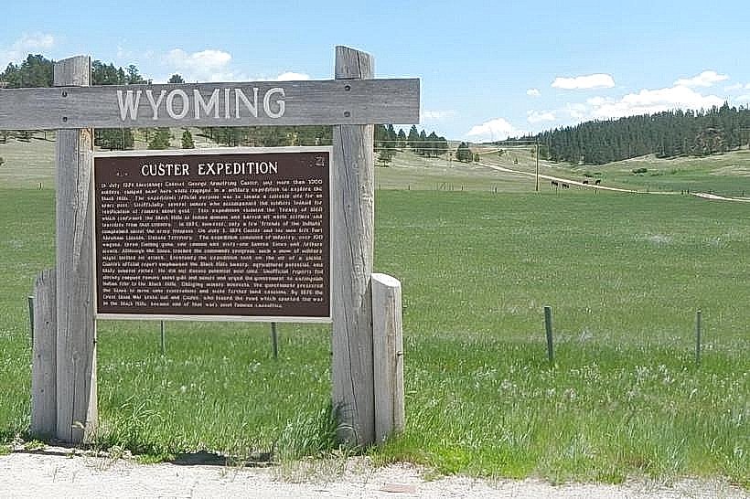
The Custer Battlefield Highway Marker in Sundance, Wyoming, is a historical marker commemorating a significant route in American history. It is situated in the vicinity of Sundance, Wyoming.
Visual Characteristics
The marker is a concrete post with a bronze plaque affixed to its face. The plaque contains embossed text and a map. The surrounding area is characterized by open grassland with scattered sagebrush and occasional juniper trees.
Location & Access Logistics
The marker is located approximately 10 miles east of Sundance, Wyoming, along the former alignment of U.S. Route 14. Access is via a gravel road that branches off U.S. Route 14. Parking is available on the shoulder of this gravel road. No public transport services this location.
Historical & Ecological Origin
The Custer Battlefield Highway was a designated auto trail in the United States that ran from Superior, Wisconsin, to the Custer Battlefield National Monument in Montana. The marker was erected to denote the route's passage through this region. The ecological setting is high plains grassland, part of the North American prairie ecosystem.
Key Highlights & Activities
Visitors can read the historical information presented on the bronze plaque. The site offers an opportunity to reflect on historical transportation routes and the westward expansion of the United States.
Infrastructure & Amenities
No facilities are present at the marker site. There are no restrooms, shade structures, or food vendors. Cell phone signal is intermittent to non-existent.
Best Time to Visit
The best time for photography is during the early morning or late afternoon when the sun angle provides optimal illumination of the plaque and surrounding landscape. Spring and fall offer moderate temperatures for visiting.
Facts & Legends
The Custer Battlefield Highway was one of many auto trails established in the early 20th century to guide motorists across the country. This particular route was named for its destination, the site of the Battle of the Little Bighorn, often referred to as Custer's Last Stand.
Nearby Landmarks
- Sundance Mountain (3km West)
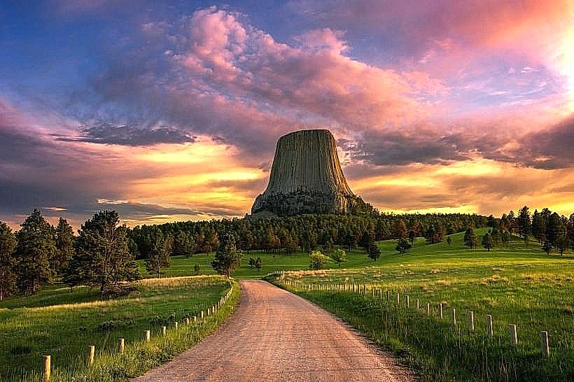
- Devils Tower National Monument (25km Southwest)
- Bear Lodge Mountains (20km Southwest)
- Keyhole State Park (30km Southeast)