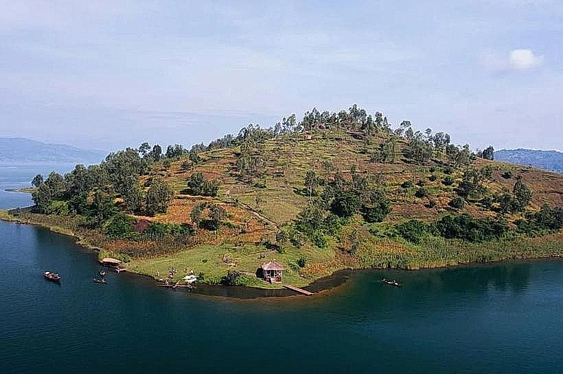
Landmark: Gihaya Island
City: Rusizi
Country: Rwanda
Continent: Africa
Gihaya Island, Rusizi, Rwanda, Africa
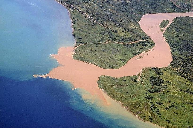
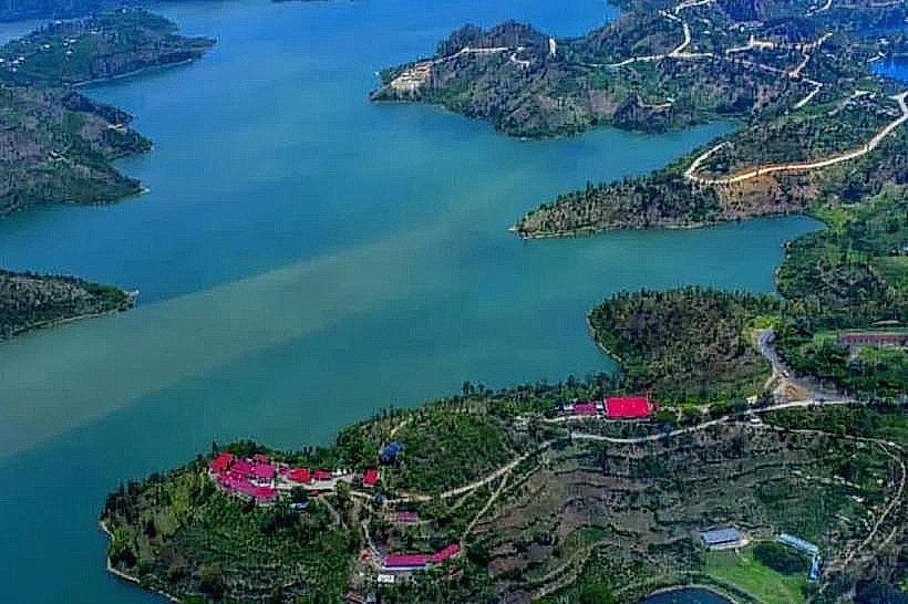
Gihaya Island is the largest inhabited island on the Rwandan side of Lake Kivu, located in the Rusizi District approximately 2km west of the Cyangugu/Kamembe coastline.
Visual Characteristics
The island is characterized by steep, terraced green hills rising sharply from the lake's surface. It features a rugged, irregular shoreline with small sandy coves and dense groves of eucalyptus and fruit trees. The interior is a mosaic of small-scale subsistence farms and traditional mud-brick or plaster dwellings. From the mainland, the island appears as a prominent dark-green landmass set against the backdrop of the DRC’s mountainous coast.
Location & Access Logistics
Access is exclusively by water from the Cyangugu/Kamembe area.
Departure Point: Small motorized wooden boats and traditional dugout canoes depart from the Rusizi I border area or the shores near Kamembe Airport.
Transit Time: A motorized trip takes approximately 15–20 minutes, while a traditional paddle canoe may take 45 minutes depending on water conditions.
Permits: While no formal permit is required for the island itself, visitors should carry identification as the island sits in a sensitive border zone near the DRC.
Historical & Ecological Origin
Geologically, Gihaya is a volcanic remnant within the Albertine Rift. Historically, it has served as a self-sustaining fishing and farming community for generations. The island's isolation preserved traditional agricultural techniques longer than on the mainland. Ecologically, the surrounding waters are a primary breeding ground for Limnothrissa miodon (Sambaza), the small sardine-like fish that is a staple of the Kivu diet.
Key Highlights & Activities
Community Walks: Visitors can hike the island’s narrow footpaths to interact with local farmers and fishermen.
Birdwatching: The island’s quiet interior and reed-lined shores host various water birds, including kingfishers and cormorants.
Night Fishing Observations: At dusk, visitors can watch the "three-boat" catamaran fishing fleets depart from the island with their distinctive gas lamps.
Panoramic Views: The highest points on the island offer unobstructed 360-degree views of Lake Kivu, the Rusizi River delta, and the city of Bukavu in the DRC.
Infrastructure & Amenities
Infrastructure is extremely limited and primarily non-commercial.
Facilities: There are no hotels, paved roads, or public restrooms on the island. Visitors should return to the mainland for these services.
Electricity: Access to the national grid is limited; many residents use small-scale solar installations.
Connectivity: 4G/5G cellular signal remains strong due to the line-of-sight proximity to mainland towers in Kamembe and Bukavu.
Best Time to Visit
The dry seasons (June to August and December to February) are best for calm lake crossings and hiking. Early morning (07:00–10:00) is the optimal time for photography and bird activity. Avoid crossings during the late afternoon in the rainy season, as sudden winds ("Kivu storms") can make the water hazardous for small craft.
Facts & Legends
A verified logistical fact is that the island is home to several hundred families who commute daily to the mainland by canoe for trade and schooling. Local lore often speaks of the "protected" nature of the island during regional conflicts due to its difficult-to-access terrain and the tight-knit nature of its inhabitants.
Nearby Landmarks
Nkombo Island (15km North)
Kamembe Airport (2km East)
Ruzizi I Border Post (2km South)
Bukavu, DRC (3km West across the water)