Landmark: Kalalen Pass
City: Arno Atoll
Country: Marshall Islands
Continent: Australia
Kalalen Pass, Arno Atoll, Marshall Islands, Australia
Kalalen Pass is a marine channel located within Arno Atoll in the Marshall Islands.
This pass connects the open ocean to the atoll's lagoon.
Visual Characteristics
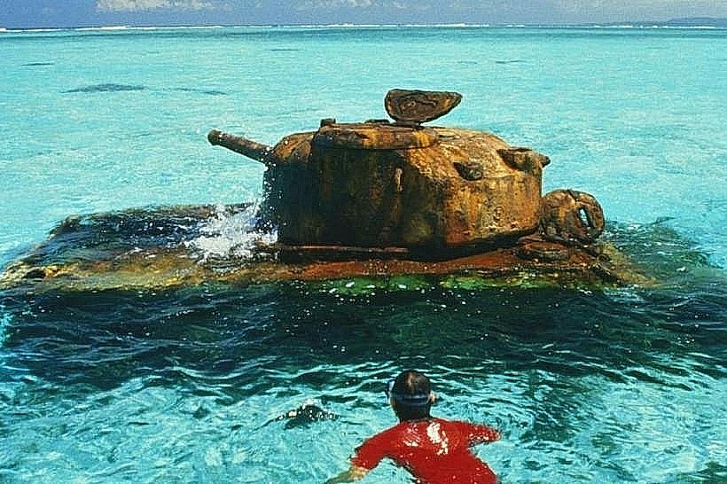
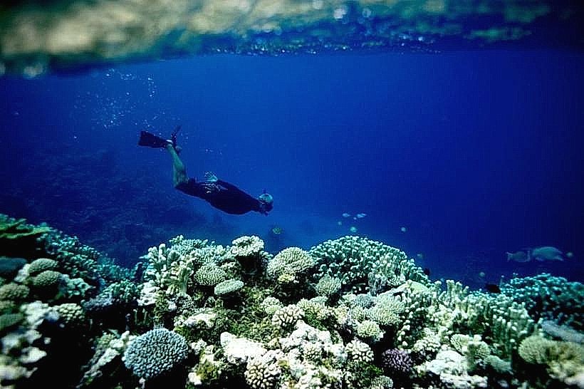
Kalalen Pass is characterized by its clear, turquoise water. The seabed consists of coral formations and sandy patches. The surrounding landmass is composed of low-lying coral islands with sparse vegetation, primarily coconut palms.
Location & Access Logistics
The pass is situated on the eastern side of Arno Atoll. Access is primarily by boat from the main inhabited islands of Arno Atoll, such as Arno Town or Ine Island. There are no direct road connections. Boat transfers can be arranged through local operators. The nearest airport is Arno Atoll Airport (AAA), located on Arno Town, approximately 15 kilometers west of the pass.
Historical & Ecological Origin
Kalalen Pass is a natural geological feature formed by the erosion and subsidence of a coral reef system over millennia. It functions as a crucial conduit for tidal exchange between the Pacific Ocean and the Arno Atoll lagoon, supporting the atoll's marine ecosystem.
Key Highlights & Activities
Snorkeling and diving are the primary activities at Kalalen Pass, particularly during slack tide. The pass is known for its diverse marine life, including various reef fish and occasional larger pelagic species. Kayaking is also possible in the calmer lagoon waters adjacent to the pass.
Infrastructure & Amenities
There are no permanent infrastructure or amenities directly at Kalalen Pass. Basic facilities such as restrooms and food vendors are available on the inhabited islands of Arno Atoll, which require boat travel. Cell phone signal is generally weak to non-existent at the pass itself.
Best Time to Visit
The best time for snorkeling and diving is during daylight hours when visibility is optimal. The months of March through October generally offer calmer seas and less rainfall. Tidal charts should be consulted, as currents can be strong during incoming and outgoing tides.
Facts & Legends
Local lore suggests that the pass was historically used by navigators to gauge the health of the reef system by observing the clarity and abundance of marine life within it.
Nearby Landmarks
- Arno Atoll Airport (AAA) - 15km West
- Arno Town - 15km West
- Ine Island - 12km Southwest
- Maloelap Atoll - 60km North