Landmark: Lonomebong Atoll Views
City: Arno Atoll
Country: Marshall Islands
Continent: Australia
Lonomebong Atoll Views, Arno Atoll, Marshall Islands, Australia
Lonomebong Atoll Views is a section of Arno Atoll located in the Marshall Islands. It offers specific vantage points for observing the atoll's geological and ecological features.
Visual Characteristics
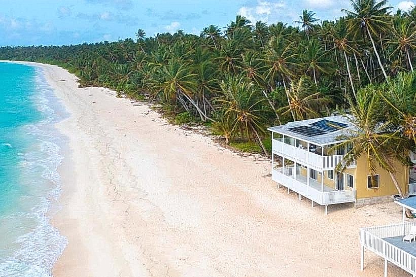
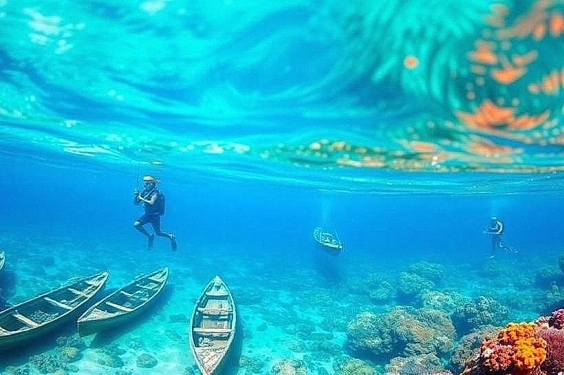
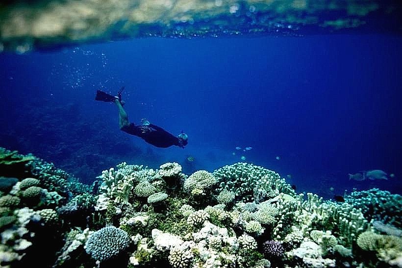
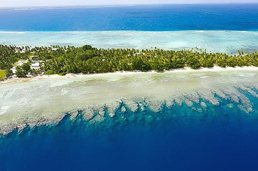
The area is characterized by a shallow lagoon with clear, turquoise water. The lagoon floor consists of coral sand and scattered coral bommies. The landmass is a low-lying coral reef, typically 1-2 meters above sea level, covered with coconut palms and low scrub vegetation. The coastline features narrow sandy beaches.
Location & Access Logistics
Lonomebong Atoll Views is situated on the eastern side of Arno Atoll. Access is primarily via boat from Majuro Atoll, a journey of approximately 1.5 to 2 hours. There are no established road networks connecting to this specific viewpoint from other parts of Arno Atoll. Local boat operators can be hired in Majuro for transport. There is no designated parking area; boats anchor offshore or beach on the sand.
Historical & Ecological Origin
Arno Atoll, including Lonomebong, is a classic example of a coral atoll, formed by the subsidence of a volcanic island and the subsequent growth of coral reefs around its rim. The atoll's current form is the result of Holocene sea-level changes and ongoing coral accretion. Historically, the area has been inhabited by Marshallese people for centuries, utilizing the lagoon and land for subsistence.
Key Highlights & Activities
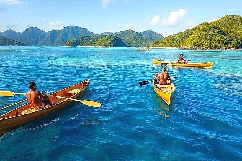
Observation of marine life within the lagoon is a primary activity. Snorkeling is possible in the shallow lagoon waters, particularly around coral formations. Kayaking or paddleboarding offers a way to explore the lagoon. Birdwatching is also feasible, with various seabird species present.
Infrastructure & Amenities
There are no permanent structures or amenities at Lonomebong Atoll Views. Visitors should bring all necessary supplies, including water and food. Cell phone signal is generally unreliable. Shade is limited to natural vegetation, primarily coconut palms.
Best Time to Visit
The best time for clear water visibility is during the dry season, from December to April. Mid-morning to early afternoon provides optimal sunlight for viewing underwater features. High tide is generally preferred for easier boat access and snorkeling conditions.
Facts & Legends
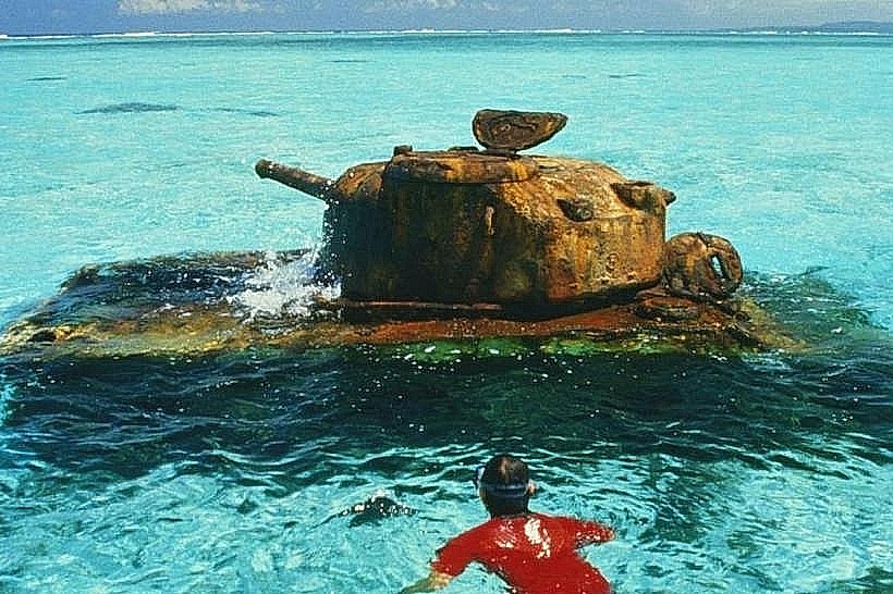
Local lore suggests that certain coral bommies within the lagoon are the resting places of ancient spirits. A specific navigational marker, a pile of coral stones, is said to have been placed by a legendary navigator to guide canoes safely through the reef pass.
Nearby Landmarks
- Arno Atoll Research Station: 3km West
- Ine Atoll: 4.5km Southwest
- Maloelap Atoll: 15km Northeast (requires boat travel)