Landmark: Kintampo Waterfalls
City: Sunyani
Country: Ghana
Continent: Africa
Kintampo Waterfalls, Sunyani, Ghana, Africa
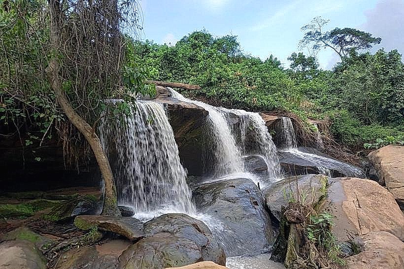
Kintampo Waterfalls is a prominent staircase-shaped cascade located on the Pumpum River in the Bono East Region of Ghana. The site is situated approximately 4 kilometers north of Kintampo township, directly adjacent to the Kintampo-Tamale highway.
Visual Characteristics
The falls consist of three distinct stages, with the highest drop measuring approximately 25 meters. The geological structure is composed of layered sedimentary sandstone and shale, creating a natural staircase effect. Vegetation is high-density tropical rainforest, characterized by mahogany and cedar trees that provide a continuous green canopy over the river gorge.
Location & Access Logistics
The site is positioned at 8.089°N, 1.718°W, accessible via a paved turn-off from the N10 highway. Kintampo is a major transit hub; long-distance buses (V.I.P. or STC) stop in the town center, where local taxis provide the final 4-kilometer transfer. A paved parking lot is situated at the main entrance gate, managed by the Ghana Tourism Authority.
Historical & Ecological Origin
The waterfalls were formerly known as Sanders Falls during the British colonial period and were officially developed for tourism in 1992. Geologically, the site is part of the Voltaian Basin, formed by the erosion of the Pumpum River through varied rock strata over several millennia.
Key Highlights & Activities
Hiking is the primary activity, with 152 concrete steps leading from the top of the falls to the basin of the third stage. Swimming is permitted in the natural plunge pool at the base of the final drop. An aerial canopy walkway, consisting of two spans totaling 80 meters, allows for elevated observation of the river and surrounding forest.
Infrastructure & Amenities
The site features a modern receptive center with a ticketing office, restrooms, and a souvenir shop. Several summer huts provide permanent shade for picnic groups. Cell phone signal is stable (4G) across most of the upper grounds, and local food vendors operate near the parking area, selling grilled plantains and bottled water.
Best Time to Visit
The highest water volume occurs during the rainy season from June to October, providing the most significant visual impact. For photography, 09:00 to 11:00 offers the best overhead light through the canopy. During the dry season (December to March), the flow is reduced, but the water clarity in the plunge pool is at its peak.
Facts & Legends
Local oral history identifies the falls as a traditional spiritual site for the Mo (Deg) people, who believe the mist from the water possesses cleansing properties. A specific "secret" tip is the presence of a smaller, less-visited cascade approximately 200 meters upstream from the main drop, reachable via a narrow forest footpath.
Nearby Landmarks
Kintampo Center of Ghana Monument: 3.8km South
Kintampo Municipal Hospital: 4.2km South
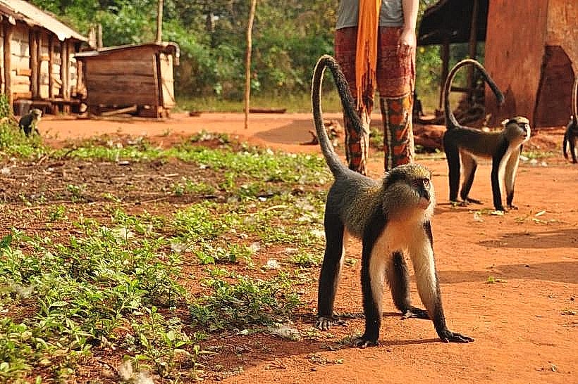
Boabeng-Fiema Monkey Sanctuary: 45.0km Southwest
Pumpum River Bridge: 0.2km North