Landmark: Kwajalein Lagoon Lookouts
City: Kwajalein
Country: Marshall Islands
Continent: Australia
Kwajalein Lagoon Lookouts, Kwajalein, Marshall Islands, Australia
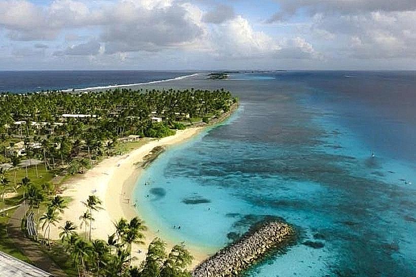
Kwajalein Lagoon Lookouts are observation points situated on Kwajalein Atoll in the Marshall Islands. These locations provide elevated perspectives of the surrounding lagoon and its features.
Visual Characteristics
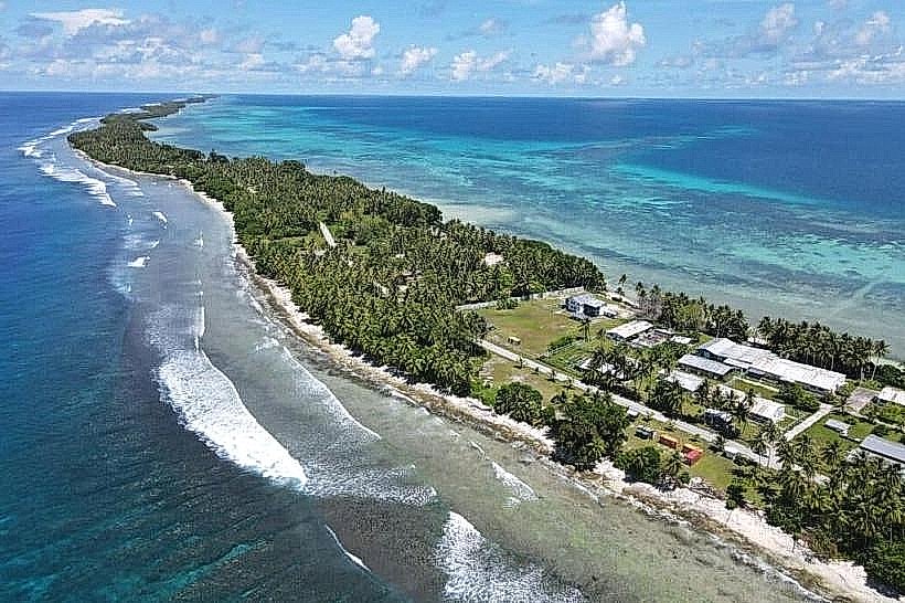
The lookouts are typically constructed from concrete and metal, featuring simple platforms or elevated structures. They are painted in utilitarian colors, often grey or white, to blend with the environment. The surrounding landscape consists of flat coral atoll terrain with sparse vegetation, primarily low-lying shrubs and grasses. The lagoon itself is characterized by clear turquoise water, with visible coral formations beneath the surface in shallower areas. Distant islands and the open ocean form the horizon.
Location & Access Logistics
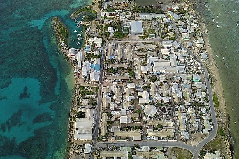
Access to the Kwajalein Lagoon Lookouts is primarily via internal roads on Kwajalein Island. The lookouts are situated at various points around the atoll, with specific access roads marked by signage. For instance, the lookout near the northern end of the island is accessible via a paved road branching off the main East-West Road, approximately 3 kilometers from the central settlement. Parking is available in designated gravel areas adjacent to the lookout structures. Public transport on Kwajalein Island is limited to shuttle services for authorized personnel; therefore, personal vehicles or authorized transport are required for access.
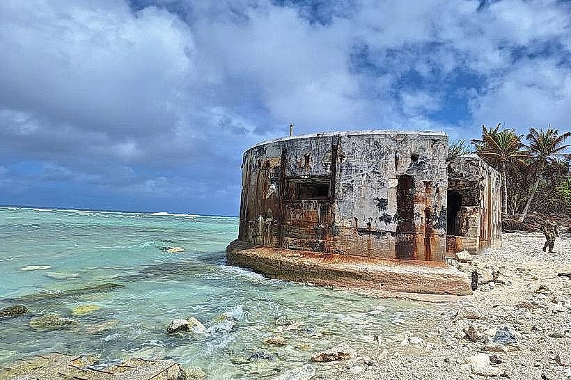
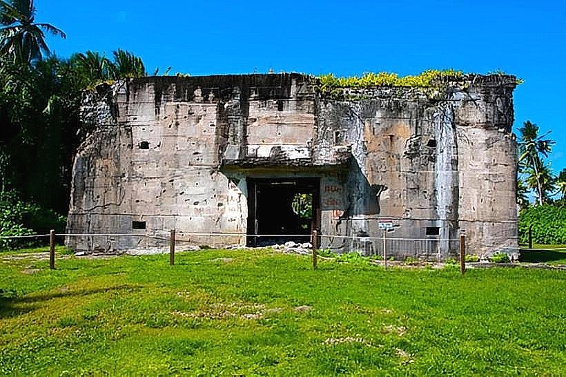
Historical & Ecological Origin
The lookouts were constructed by the United States military during the mid-20th century as part of the Kwajalein Missile Range. Their original purpose was for observation and monitoring of missile tests and space launches conducted from the atoll. Ecologically, Kwajalein Atoll is a coral atoll, formed by the accumulation of coral polyps over a submerged volcanic seamount. The lagoon is a shallow, protected body of water, supporting a diverse marine ecosystem.
Key Highlights & Activities
Observation of the lagoon's expanse and the distant horizon is the primary activity. Visitors can observe marine traffic within the lagoon and the flight paths of aircraft. Birdwatching is possible, with various seabird species frequenting the area. Photography of the lagoon and atoll landscape is a common activity. Some lookouts may offer unobstructed views of sunrise or sunset depending on their orientation.
Infrastructure & Amenities
Basic infrastructure at the lookouts typically includes concrete viewing platforms and sometimes simple railings. Shade is generally minimal, provided only by the structure itself. Restrooms are not typically available at the lookout sites; facilities are located in the main settlement area. Cell phone signal (4G/5G) is generally available on Kwajalein Island, including at most lookout locations. Food vendors are not present at the lookouts; provisions should be brought from the settlement.
Best Time to Visit
For photography, early morning (06:00-08:00) and late afternoon (16:00-18:00) offer optimal lighting conditions with softer shadows. The best months for weather are generally from February to April, characterized by lower humidity and consistent trade winds. High tide is not a critical factor for accessing the lookouts, as they are situated above the water level.
Facts & Legends
A specific historical oddity is that Kwajalein Atoll was the site of the first successful test of the Safeguard antiballistic missile system in 1974, observed from these types of vantage points. A local tip is to bring binoculars for better viewing of distant islands and marine life within the lagoon.
Nearby Landmarks
- Kwajalein Missile Range Museum (0.8km Southwest)
- Kwajalein Naval Base (1.2km West)
- Enewetak Atoll (approx. 200km Northwest - visible on clear days)
- Roi-Namur Island (approx. 50km North - visible on clear days)