Landmark: Lagos de Canelones
City: Canelones
Country: Uruguay
Continent: South America
Lagos de Canelones, Canelones, Uruguay, South America
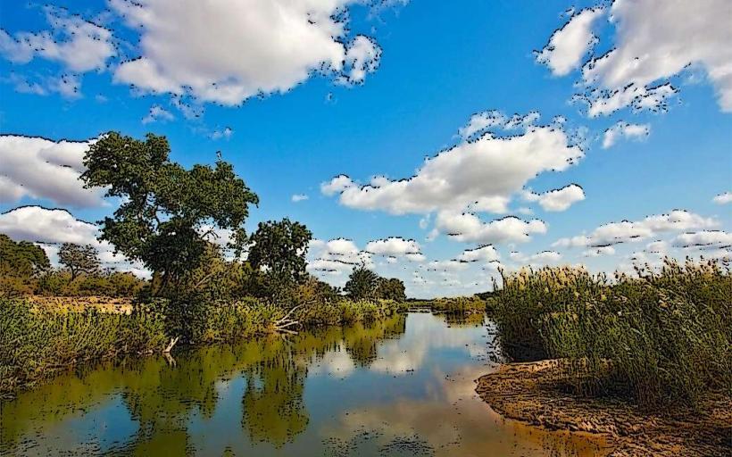
Lagos de Canelones is a system of artificial lakes located in the department of Canelones, Uruguay.
This area functions as a reservoir and recreational zone, primarily serving agricultural irrigation and flood control purposes.
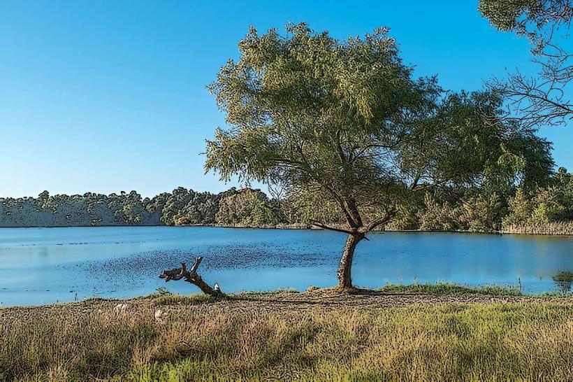
Visual Characteristics
The lakes are characterized by their irregular shorelines, formed by the inundation of former agricultural land. Water color varies from a muddy brown to a greenish hue depending on recent rainfall and algal bloom. The surrounding terrain is generally flat to gently rolling, with sparse vegetation consisting of native grasses and scattered trees along the banks. The lakebeds are composed of clay and silt.
Location & Access Logistics
Lagos de Canelones is situated approximately 15 kilometers northwest of the city of Canelones. Access is via Route 5, taking the exit for Route 107 (also known as Camino de los Molinos). Continue on Route 107 for approximately 8 kilometers, then turn right onto a gravel road marked with local signage for the lakes. Parking is available in unpaved areas adjacent to the main access points. Public transport options are limited; the nearest bus stop is in the town of Villa San Cono, requiring a further 3km walk or local taxi service.
Historical & Ecological Origin
The creation of Lagos de Canelones began in the late 1970s and continued through the 1980s as part of a national initiative to improve water management for agriculture. The lakes were formed by the construction of several earthen dams and dikes across small tributaries of the Santa Lucía River. Ecologically, the area is classified as a man-made wetland, supporting a variety of waterfowl and aquatic plant species adapted to altered hydrological conditions.
Key Highlights & Activities
Fishing is permitted in designated areas, with common species including pejerrey and tararira. Birdwatching is a primary activity, with opportunities to observe resident and migratory species. Kayaking and small boat use are allowed, but require self-launching. Hiking trails are present around some of the larger lakes, offering access to different vantage points.
Infrastructure & Amenities
Basic amenities are minimal. Uncovered picnic tables are available at some access points. There are no permanent restroom facilities; portable toilets may be present during peak seasons. Shade is limited to scattered trees. Cell phone signal (4G) is generally available but can be intermittent near the water's edge. No food vendors operate within the immediate vicinity of the lakes; visitors should bring supplies.
Best Time to Visit
For photography, early morning and late afternoon offer the best natural light. The months of September through April generally provide the most favorable weather conditions for outdoor activities. Water levels can fluctuate significantly with rainfall; checking local conditions is advisable before visiting, especially for boating activities.
Facts & Legends
A local anecdote suggests that during exceptionally dry periods, the exposed lakebed reveals remnants of old farmhouses, fueling stories of submerged villages. Scientifically, the area's soil composition is rich in clay, which aids in retaining water for the reservoir system.
Nearby Landmarks
- Parque de la_{- }Ciudad de Canelones (3km Southeast)
- Estadio Municipal de Canelones (4km Southeast)
- Museo de Artes Plásticas de Canelones (4.5km Southeast)
- Catedral de Nuestra Señora de Guadalupe (5km Southeast)