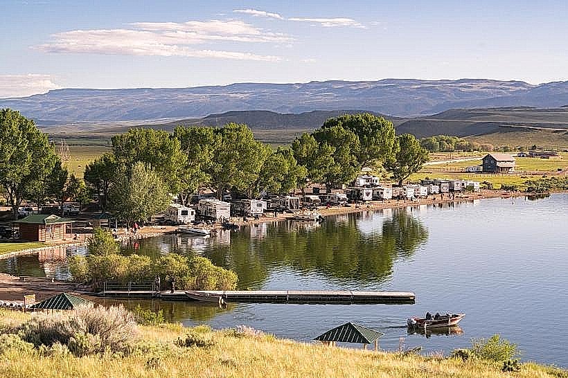
Landmark: Otter Creek State Park
City: Richfield
Country: USA Utah
Continent: North America
Otter Creek State Park, Richfield, USA Utah, North America
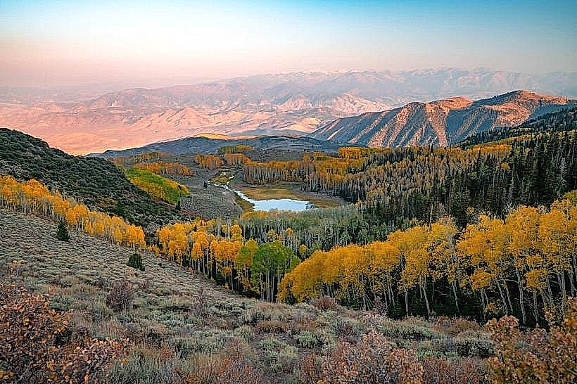
Otter Creek State Park is a state park located in south-central Utah, USA, centered around Otter Creek Reservoir.
Visual Characteristics
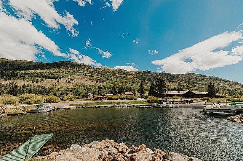
The reservoir exhibits water coloration ranging from deep blue to greenish-blue depending on depth and sediment load. The surrounding terrain consists of arid desert scrubland with sparse vegetation, primarily sagebrush and juniper. Rock formations are predominantly sandstone, exhibiting shades of tan and red. The reservoir shoreline is a mix of sandy beaches and exposed rock.
Location & Access Logistics
Otter Creek State Park is situated approximately 15 miles west of Antimony, Utah. Access is via State Route 22, which connects to State Route 62. The park entrance is clearly marked from SR 22. Ample parking is available at designated areas around the reservoir, including boat ramps and day-use sites. No public transport services operate directly to the park.
Historical & Ecological Origin
Otter Creek Reservoir was created by the construction of a dam on Otter Creek, completed in 1960. The primary purpose was to provide irrigation water for agricultural lands in the surrounding region. Ecologically, the area is classified as a high desert environment, supporting a variety of desert-adapted flora and fauna.
Key Highlights & Activities
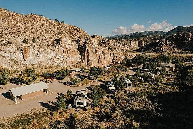
Activities include boating, fishing for rainbow trout and black crappie, and swimming. Designated areas are available for picnicking. Hiking trails are present around the reservoir, offering views of the water and surrounding landscape. Camping is permitted in designated campgrounds.
Infrastructure & Amenities
Restrooms with flush toilets are available at several locations within the park. Shaded picnic tables are provided. Cell phone signal (primarily 1-2 bars of 4G) is intermittent and unreliable throughout the park. No food vendors are located within the park boundaries; visitors should bring their own supplies.
Best Time to Visit
For optimal water activities, the months of June through September are recommended due to warmer temperatures. Early morning and late afternoon offer the best natural light for photography. Fishing is generally productive year-round, with specific success rates varying by season.
Facts & Legends
A local anecdote suggests that the reservoir's water levels are closely monitored by local farmers, as the water directly impacts crop yields for the season. The park is known for its clear night skies, making it suitable for stargazing.
Nearby Landmarks
- Bowery Creek State Park (12km Southwest)
- Piute State Park (25km Northwest)
- Capitol Reef National Park (approx. 60km Northeast)
- Fremont Indian State Park (approx. 40km West)