Landmark: Pincushion Mountain Trail
City: Grand Marais
Country: USA Minnesota
Continent: North America
Pincushion Mountain Trail, Grand Marais, USA Minnesota, North America
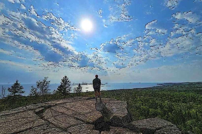
Pincushion Mountain Trail is a hiking destination located in Grand Marais, Minnesota. It offers elevated views of Lake Superior and the surrounding boreal forest.
Visual Characteristics
The trail ascends a prominent geological feature characterized by exposed volcanic rock formations. These rocks are primarily dark gray to black, with some areas exhibiting reddish-brown oxidation. The summit area features sparse vegetation, including hardy grasses and low-lying shrubs adapted to exposed conditions. The surrounding forest is composed of coniferous trees, predominantly pine and spruce, with a dense canopy.
Location & Access Logistics
The trailhead is situated approximately 3.2 kilometers (2 miles) east of Grand Marais city center, directly off State Highway 61. Parking is available at a designated lot adjacent to the highway. There are no public transport routes that directly serve the trailhead. Access is via private vehicle only.
Historical & Ecological Origin
Pincushion Mountain is an ancient volcanic remnant, part of the ancient Midcontinent Rift System. Its formation dates back approximately 1.1 billion years. The current trail system was established by the U.S. Forest Service in the mid-20th century to provide public access for recreation.
Key Highlights & Activities
Hiking the main loop trail (approximately 2.4 km or 1.5 miles) to the summit is the primary activity. Observation decks at the summit provide panoramic views. Birdwatching is possible, particularly during migration seasons. Photography of the geological formations and the lake vista is a common pursuit.
Infrastructure & Amenities
A small parking area is present. No restrooms or potable water are available at the trailhead or on the trail. Cell phone signal (4G/5G) is intermittent to non-existent on the trail and at the summit. No food vendors are located at or near the trailhead.
Best Time to Visit
For optimal lighting for photography, early morning or late afternoon is recommended. The best months for hiking are typically June through October, avoiding the snow and ice of winter. Trail conditions can be muddy after heavy rainfall.
Facts & Legends
The name "Pincushion Mountain" is derived from the appearance of the exposed rock formations, which resemble the surface of a pincushion when viewed from a distance. Local lore sometimes refers to the area as a place where ancient spirits of the land reside, though this is not historically documented.
Nearby Landmarks
- Grand Marais Lighthouse (1.5km West)
- Artist's Point (2.0km West)
- Grand Marais Municipal Campground (2.5km West)
- Oberg Mountain Trail (12.0km West)
- Judge C.R. Magney State Park (20.0km East)