Landmark: Plaza Principal
City: Quirigua
Country: Guatemala
Continent: North America
Plaza Principal, Quirigua, Guatemala, North America
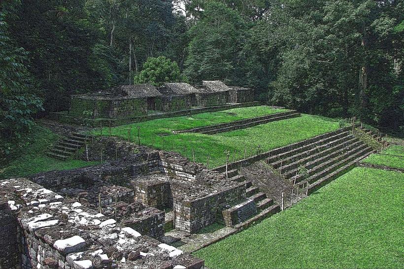
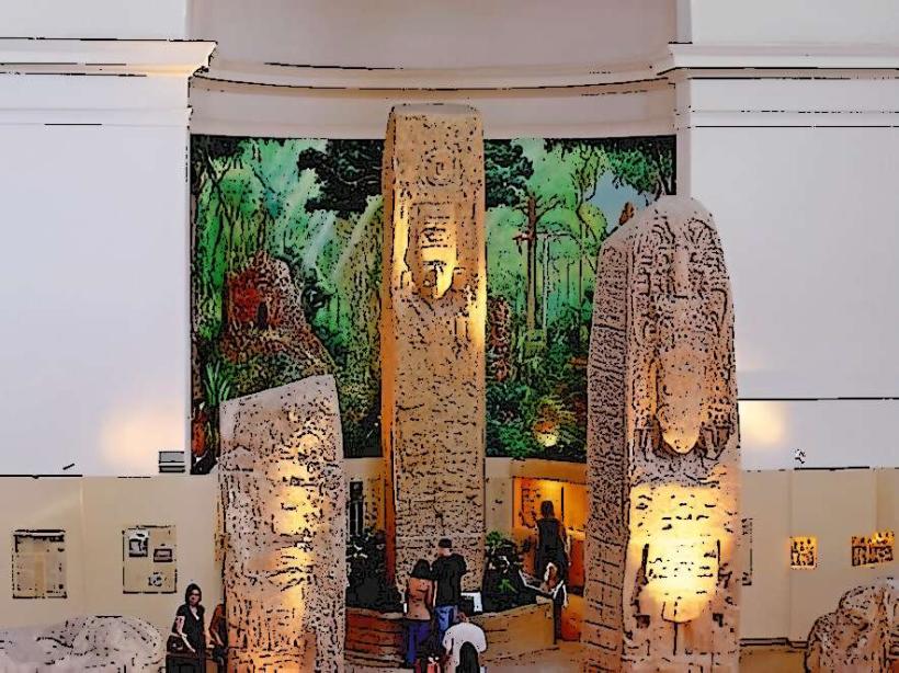
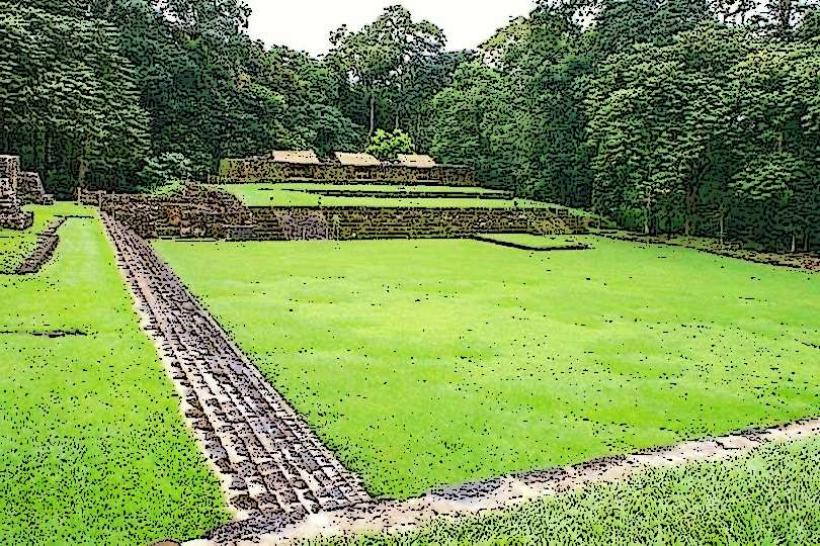
The Plaza Principal is the central public square located in the archaeological park of Quiriguá, Guatemala.
This site preserves significant pre-Columbian Maya monumental architecture and sculpture.
Visual Characteristics
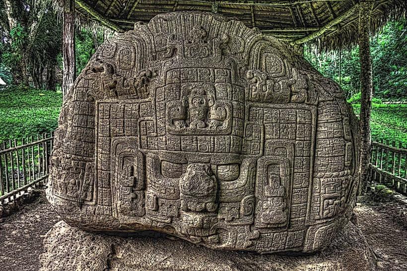
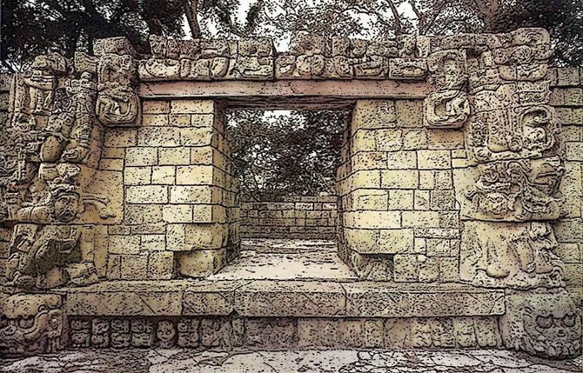
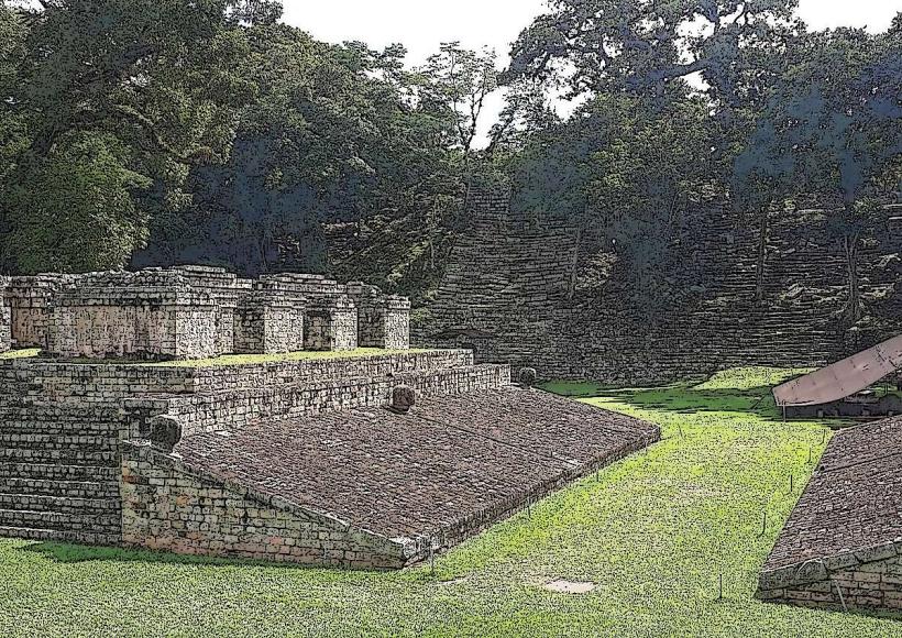
The plaza is an open, rectangular area defined by earth platforms and stone structures. The primary features are large, carved stelae, which are monolithic sandstone monuments. These stelae are characterized by intricate hieroglyphic inscriptions and zoomorphic designs. The sandstone is typically a light brown to reddish-brown color. The surrounding vegetation is dense tropical rainforest, with mature trees and undergrowth encroaching on the edges of the cleared plaza.
Location & Access Logistics
The Quirigua-archaeological-park_quirigua" class="underline">Quiriguá Archaeological Park is situated approximately 2 kilometers south of the town of Quiriguá, Izabal Department, Guatemala. Access is via the CA-9 highway (Carretera del Atlántico). The park entrance is clearly marked from the highway. From Guatemala City, it is approximately a 3-hour drive northeast. Ample parking is available at the park entrance. Public transport options include intercity buses that travel along the CA-9 highway; passengers would disembark in the town of Quiriguá and walk or take a short taxi ride to the park.
Historical & Ecological Origin
The Plaza Principal at Quiriguá was constructed and utilized by the Maya civilization, with its peak activity during the Late Classic period (approximately 600-900 AD). The stelae were erected by Maya rulers to commemorate significant events and record dynastic histories. The site is located within a tropical rainforest ecosystem, characterized by high humidity, significant rainfall, and a diverse array of flora and fauna.
Key Highlights & Activities
Observation of the Great Plaza and its monumental stelae, including Stela E, Stela F, and Stela J, which are among the tallest and most elaborately carved in the Maya world. Examination of the hieroglyphic inscriptions. Walking the designated pathways through the archaeological zone. Photography of the stelae and surrounding environment.
Infrastructure & Amenities
Restrooms are available at the park entrance. Limited shade is provided by the surrounding forest canopy and some covered areas near the stelae. Cell phone signal (4G) is generally available within the park. Food vendors are typically located near the park entrance or in the nearby town of Quiriguá.
Best Time to Visit
The best time of day for photography is generally in the morning (8:00 AM - 10:00 AM) or late afternoon (3:00 PM - 5:00 PM) to avoid harsh midday sun and capture softer lighting on the carvings. The dry season, from November to April, offers more comfortable weather conditions with less rainfall. The site is accessible year-round.
Facts & Legends
Stela J at Quiriguá is notable for its unique zoomorphic base, representing a complex mythological creature, and its inscription detailing a significant historical event: the capture and sacrifice of a ruler from the rival city of Copán. A specific tip for visitors is to look for the subtle variations in the sandstone's color and texture, which can indicate different quarry sources or weathering patterns over centuries.
Nearby Landmarks
- Copán Ruinas Archaeological Park: 65km Southwest (approximate distance, requires border crossing into Honduras)
- Río Dulce National Park: 50km East
- Livingston: 70km East (accessible via Río Dulce)
- Tikal National Park: 150km Northwest