Landmark: Rinjani National Park
City: Lombok
Country: Indonesia
Continent: Asia
Rinjani National Park, Lombok, Indonesia, Asia
Rinjani National Park is a protected area encompassing Mount Rinjani, an active volcano, located on the island of Lombok, Indonesia.
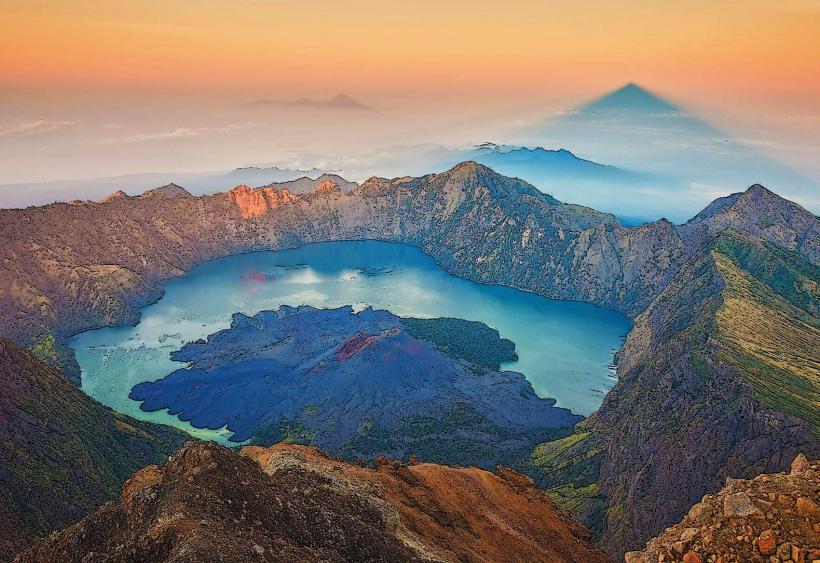
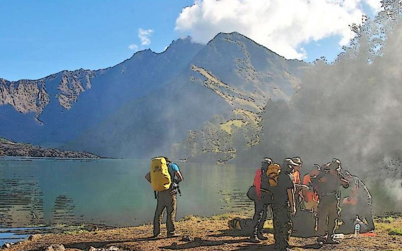
The park's primary feature is the caldera of Mount Rinjani, which contains Segara Anak lake and a smaller, active cone, Gunung Barujari.
Visual Characteristics
Mount Rinjani is a stratovolcano with a summit elevation of 3,726 meters (12,224 feet). The caldera rim is composed of andesite and basaltic rock. Segara Anak lake is a turquoise crater lake, approximately 6 km (3.7 miles) in diameter. The slopes of the volcano are covered in dense tropical rainforest and savanna vegetation, transitioning to alpine flora at higher elevations. Gunung Barujari is a cinder cone within the caldera, characterized by its dark volcanic rock and frequent steam emissions.
Location & Access Logistics
The park is situated in the center of Lombok island. Access points include the villages of Senaru (north) and Sembalun (east). From Mataram, the provincial capital, Senaru is approximately 70 km (43.5 miles) via the North Lombok Road (Jalan Raya Tanjung). Sembalun is approximately 90 km (56 miles) from Mataram via the East Lombok Road (Jalan Raya Aikmel). Parking is available at the official park entrances in Senaru and Sembalun. Public transport options are limited; shared taxis (bemos) or private car hire are the most common methods of reaching the park entrances from major towns.
Historical & Ecological Origin
Mount Rinjani is a stratovolcano formed by subduction of the Indo-Australian Plate beneath the Eurasian Plate. Its last major eruption was in 2016. The park was established to protect the volcano's unique ecosystem and watershed. The caldera lake, Segara Anak, is believed to have formed after a massive eruption approximately 800 years ago.
Key Highlights & Activities
Trekking to the summit of Mount Rinjani is the primary activity, typically requiring 2-3 days. Hiking to the crater rim offers views of Segara Anak lake. Visitors can swim in the hot springs located near the lake. Camping is permitted at designated sites within the caldera. Observation of diverse flora and fauna, including various bird species and macaques, is possible along the trails.
Infrastructure & Amenities
Basic facilities are available at the park entrances, including visitor centers and toilets. Rest areas and designated campsites are located along trekking routes. Cell phone signal is intermittent and generally unavailable at higher elevations. Food vendors are present in Senaru and Sembalun villages, but supplies are limited within the park itself.
Best Time to Visit
The dry season, from April to September, is the optimal period for visiting. The best time of day for photography of the summit and caldera is typically early morning, between 06:00 and 09:00, when lighting is favorable. Trekking is not recommended during the wet season (October to March) due to increased risk of landslides and difficult trail conditions.
Facts & Legends
Local Sasak mythology associates Segara Anak lake with spiritual significance. It is believed that the lake's water possesses healing properties. A common practice for visitors is to collect water from the lake's hot springs as a souvenir. The volcano's activity is closely monitored by Indonesian volcanologists.
Nearby Landmarks
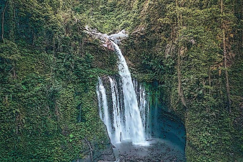
- Tiu Kelep Waterfall (1.5km North-West)
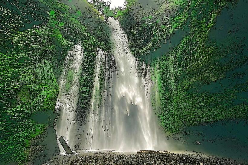
- Sendang Gile Waterfall (1.8km North-West)
- Mount Rinjani National Park Sembalun Entrance (10km East)
- Mount Rinjani National Park Senaru Entrance (1.2km North)
- Pusuk Pass (15km West)