Landmark: Siar Island
City: Madang
Country: Papua New Guinea
Continent: Australia
Siar Island, Madang, Papua New Guinea, Australia
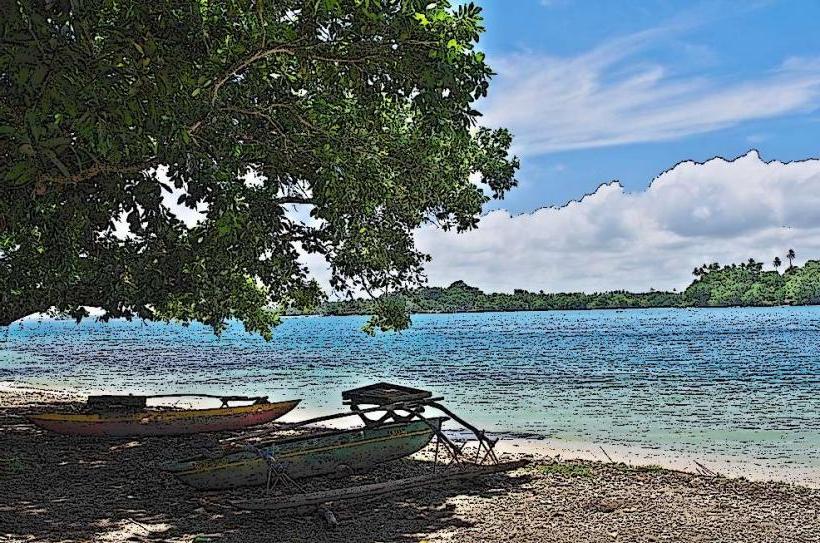
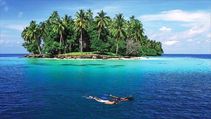
Siar Island is a small landmass situated off the coast of Madang, Papua New Guinea. It is accessible via a causeway from the mainland.
Visual Characteristics
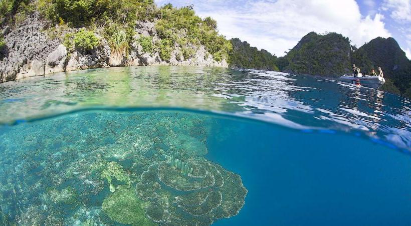
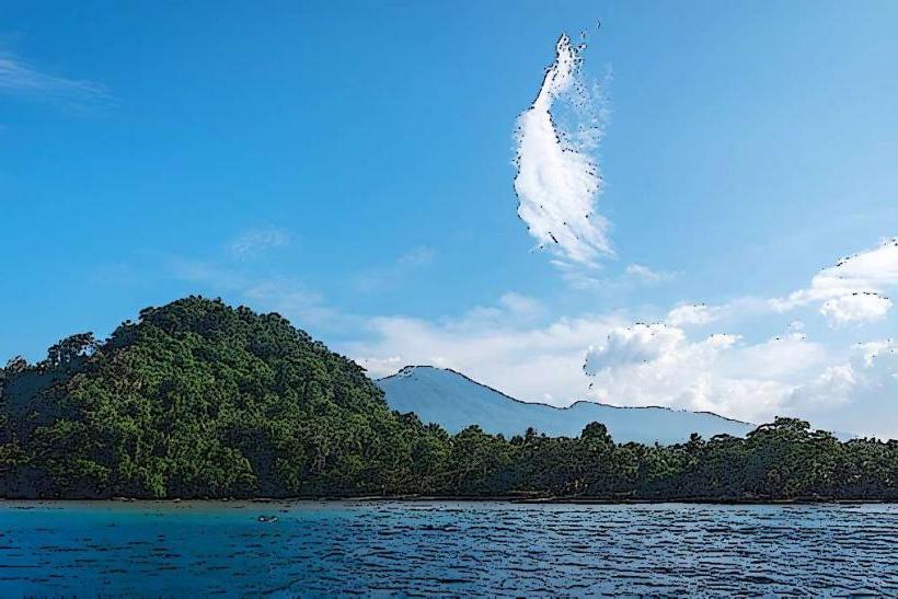
The island is characterized by low-lying terrain with dense tropical vegetation. Its coastline consists of sandy beaches and shallow coral reefs. The water surrounding the island is typically clear and exhibits shades of turquoise and blue.
Location & Access Logistics
Siar Island is located approximately 3 kilometers east of Madang's city center. Access is primarily via the Siar Causeway, a concrete structure connecting the island to the mainland. This causeway is passable by vehicle. Limited parking is available on the island's edge. Public transport options to the mainland side of the causeway include local bus services operating within Madang.
Historical & Ecological Origin
Siar Island is a coral island, formed over geological time from the accumulation of coral skeletons. Historically, it served as a location for a leper colony and later as a site for a World War II airfield. Evidence of these past uses, such as remnants of concrete structures, can still be observed.
Key Highlights & Activities
Snorkeling and diving are possible in the surrounding coral reefs, particularly during calm conditions. The island's beaches are suitable for relaxation. Exploration of the island's interior reveals remnants of its historical past.
Infrastructure & Amenities
Basic amenities are limited. There are no permanent food vendors on the island. Restrooms are not consistently available. Cell phone signal (4G/5G) is generally present but can be intermittent depending on location on the island. Shade is provided by natural vegetation.
Best Time to Visit
The best time for clear water visibility for snorkeling and diving is during the dry season, from May to October. Mid-morning offers good natural light for photography of the marine environment. Low tide can expose more of the reef structure.
Facts & Legends
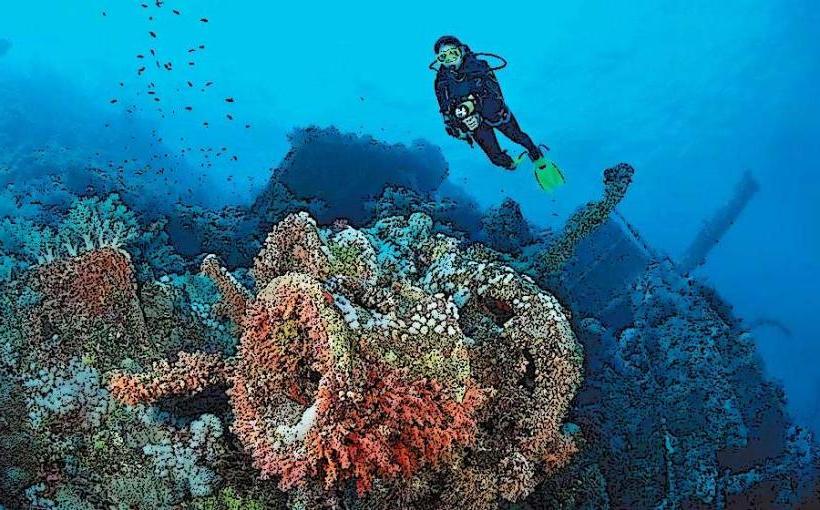
A notable historical fact is the presence of a Japanese Zero fighter plane wreck in the shallow waters off the island's western side, a remnant from World War II. Local lore sometimes speaks of spirits associated with the former leper colony.
Nearby Landmarks
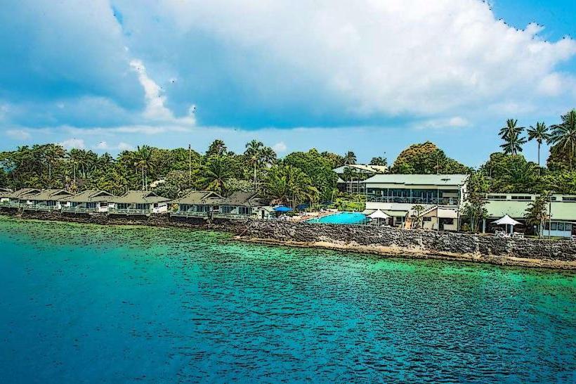
- Madang Resort Hotel (2.5km West)
- Bao Island (3.0km Southwest)
- Coastwatchers Memorial Lighthouse (3.5km West)
- Balek Wildlife Sanctuary (10.0km Northwest)