Landmark: Akko Port
City: Akko
Country: Israel
Continent: Asia
Akko Port, Akko, Israel, Asia
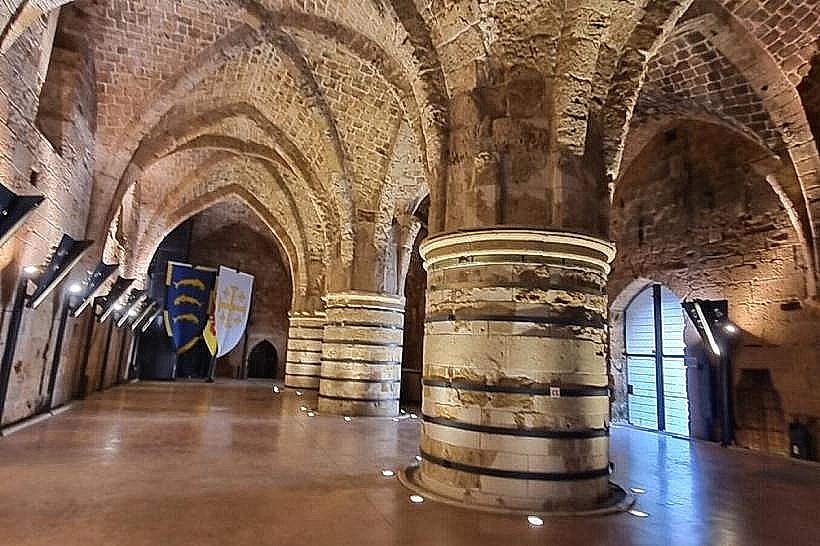
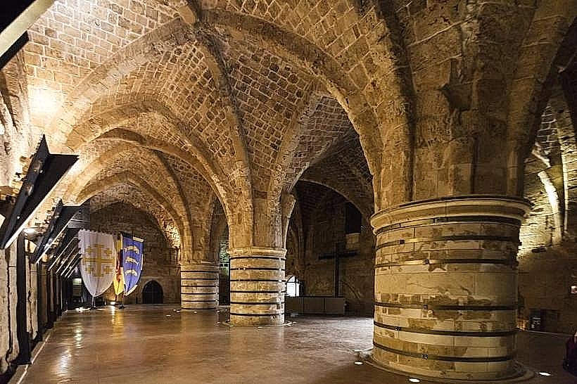
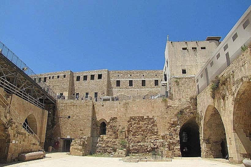
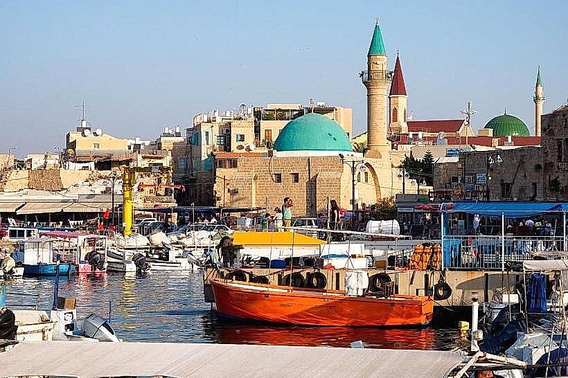
Akko Port is an active fishing harbor and marina located at the southeastern tip of the Old City. It is one of the oldest continuously operating ports in the world, having evolved from a strategic Phoenician and Crusader maritime gateway into a hub for tourism and local industry.
Visual Characteristics
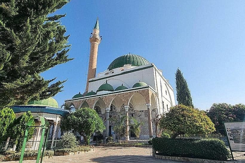
The port is defined by its massive stone sea walls and a dense cluster of colorful wooden fishing boats moored alongside modern yachts. The skyline is dominated by Ottoman-era masonry and the nearby minarets of the Old City. The area features wide stone piers, stacks of traditional fishing nets, and historic warehouses repurposed into seafood restaurants. The water is often bustling with small passenger ferries and tour boats departing for excursions around the bay.
Location & Access Logistics
The harbor is situated at the southern end of the Old City's pedestrian zone. Access by car is restricted within the walls; visitors typically park at the large public lot near the northern entrance of Old Acre and walk through the market to reach the water. The port is roughly 1.8 km from the Acre Railway Station. It marks the eastern terminus of the Templars' Tunnel, which connects the harbor to the western lighthouse district.
Historical & Ecological Origin
Archaeological evidence indicates the port has been in use since at least the Phoenician period. It reached its peak significance during the Crusader era when it served as the primary link between the Kingdom of Jerusalem and Europe. Geologically, the harbor is protected by a natural sandstone ridge and ancient man-made breakwaters. The seabed in the vicinity contains numerous shipwrecks and ruins from centuries of naval conflict, including the 1799 Napoleonic siege.
Key Highlights & Activities
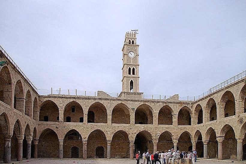
The primary tourist activity involves taking boat tours that offer views of the Acre sea walls from the Mediterranean. The harbor is also a major culinary destination, featuring restaurants built directly into the Crusader-era fortifications. In the early mornings, the active fishing fleet returns to unload catch for the adjacent fish market. The Khan al-Umdan (Caravanserai of the Pillars) is located immediately next to the piers.
Infrastructure & Amenities
The port area features public restrooms, wooden docking slips, and maritime administrative offices. The piers are largely level, though some historic sections have uneven stone paving. Full 5G cellular coverage is available. While the piers are exposed to the sun, the surrounding arcades and restaurant terraces provide significant shade. Public drinking fountains are located near the market entrance.
Best Time to Visit
The port is accessible 24 hours a day. The most authentic time to visit is early morning (06:00–08:00) to see the fishing boats arriving. Late afternoon is the optimal time for photography of the sunset over Haifa Bay. During weekends and holidays, the port becomes high-traffic with visitors taking pleasure cruises.
Facts & Legends
A historical oddity is the "Tower of Flies," a small ruin on an island at the harbor entrance that served as a lighthouse and defensive outpost during the Crusader period. Local legend claims the tower was named because it was once used for animal sacrifices that attracted swarms of flies, though historians categorize it as a strategic point for controlling maritime traffic into the bay.
Nearby Landmarks
Khan al-Umdan – 0.1km North
Templars' Tunnel – 0.2km West
Al-Jazzar Mosque – 0.4km North
Old Acre Market – 0.1km North
Acre Sea Walls – 0.1km South