Landmark: Ashdod Waterfront
City: Ashdod
Country: Israel
Continent: Asia
Ashdod Waterfront, Ashdod, Israel, Asia
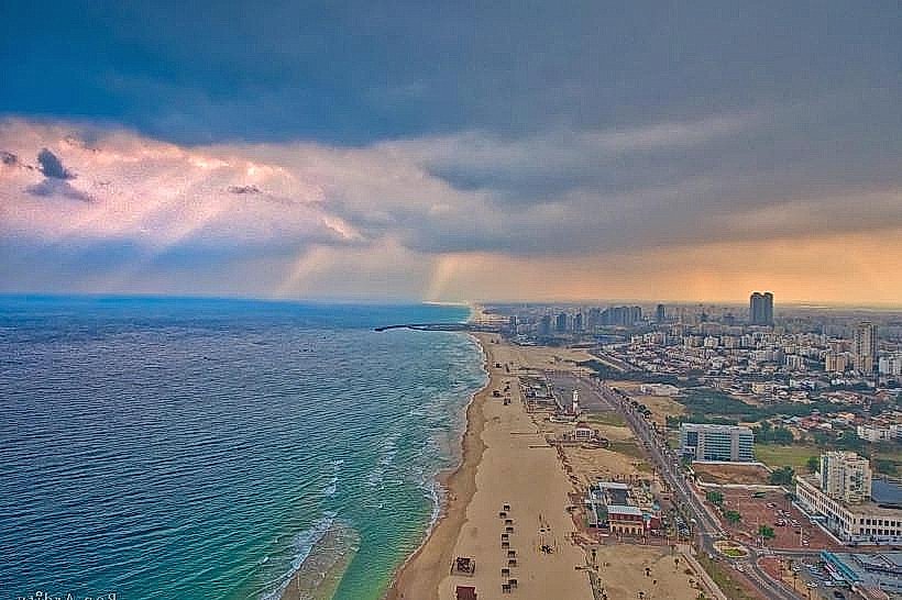
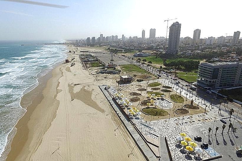
The Ashdod Waterfront is a continuous coastal corridor in Ashdod spanning approximately 8 kilometers along the Mediterranean Sea. It acts as the city's primary recreational edge, integrating a series of blue-flag certified beaches with modern urban promenades and historical archaeological sites.
Visual Characteristics
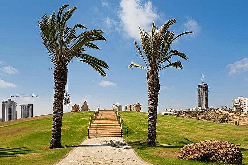
The waterfront is characterized by vast stretches of fine, pale sand dunes that transition into manicured green spaces. The northern sections are dominated by the industrial silhouette of the Ashdod Port and the greenery of Lakhish Park, while the southern stretches feature rugged kurkar (sandstone) outcrops. The "Rock Promenade" (Tayalet HaSla'im) features stone-paved walkways, shaded pergolas, and contemporary sculptures, all set against a backdrop of clear turquoise waters without artificial breakwaters.
Location & Access Logistics
The waterfront parallels Moshe Dayan Boulevard, extending from the Lakhish River mouth in the north to the Ashdod-Yam Fortress in the south. It is accessible from Tel Aviv via Highway 4, with a travel distance of approximately 37 kilometers. Public transport is serviced by local bus lines 2, 4, and 11 from the Ashdod Ad Halom railway station. Ample free parking is available in paved lots located at Lido Beach, Oranim Beach, and near the Ashdod Sea Park entrance.
Historical & Ecological Origin
Geologically, the area is part of the Holocene sand dune belt, which has been significantly influenced by the construction of the Ashdod Port (1961–1964) acting as a sediment trap. Historically, the waterfront was the site of ancient Ashdod-Yam, a harbor city mentioned in Neo-Assyrian records. The 7th-century Umayyad fortress, Castellum Beroar, stands at the southern end of the waterfront, originally built to defend the coast against Byzantine naval incursions.
Key Highlights & Activities
Specific actions include surfing and kiteboarding at Gil Beach, which hosts national competitions due to the lack of breakwaters. The Lakhish River Park offers pedal boating and a small zoo near the northern end of the promenade. Fitness enthusiasts utilize the continuous 8-kilometer paved path for long-distance running and cycling, while the Saturday "shuk" (market) on the promenade offers local crafts and vintage goods.
Infrastructure & Amenities
The waterfront is highly developed with public restrooms, outdoor showers, and specialized disability access ramps that lead directly to the waterline. The area features numerous beachside cafes, restaurants, and kiosks, primarily concentrated near the Blue Marina and Lido Beach. Full 5G cellular coverage is available throughout the coastal strip, and the main promenades are equipped with drinking fountains and shaded benches.
Best Time to Visit
Photography is optimal during the late afternoon "golden hour" when the sun sets directly over the Mediterranean, illuminating the kurkar ruins and the sand dunes. The months of April through June and September through November provide the most comfortable temperatures for walking the full length of the promenade. The Saturday morning market is the peak time for cultural and commercial activity.
Facts & Legends
A verified local oddity is that Ashdod's beaches are among the few in Israel that do not utilize stone breakwaters, resulting in "cleaner" sand flow but more powerful wave action. Local tradition holds that the nearby Givat Yonah (Jonah's Hill) is the site where the biblical prophet Jonah was spit out by the whale, providing a high-altitude vantage point over the entire waterfront.
Nearby Landmarks
Ashdod-Yam Fortress – 0.1km South
Ashdod Sea Park – 0.5km East
Ashdod Marina – 1.2km North
Lakhish River Park – 4.5km North
Givat Yonah (Jonah's Hill) – 5.0km North