Landmark: Bridger Wilderness
City: Pinedale
Country: USA Wyoming
Continent: North America
Bridger Wilderness, Pinedale, USA Wyoming, North America
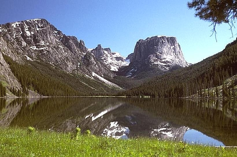
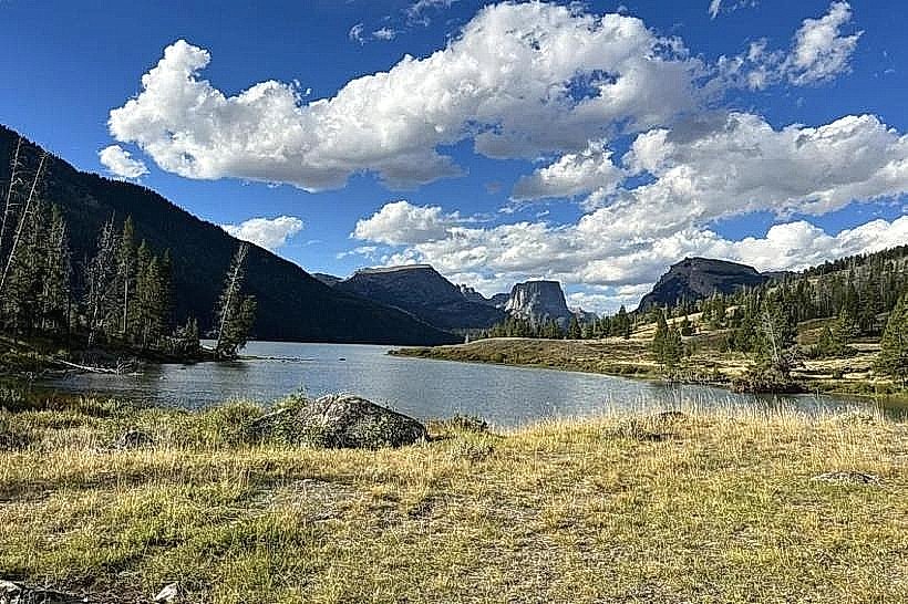
The Bridger Wilderness is a designated wilderness area located within the Shoshone National Forest in western Wyoming, USA.
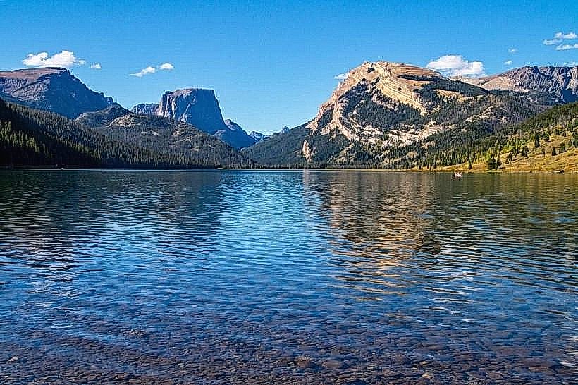
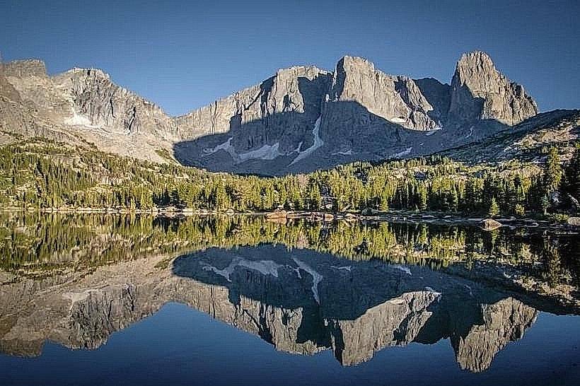
It encompasses a significant portion of the Wind River Range, characterized by high alpine terrain.
Visual Characteristics
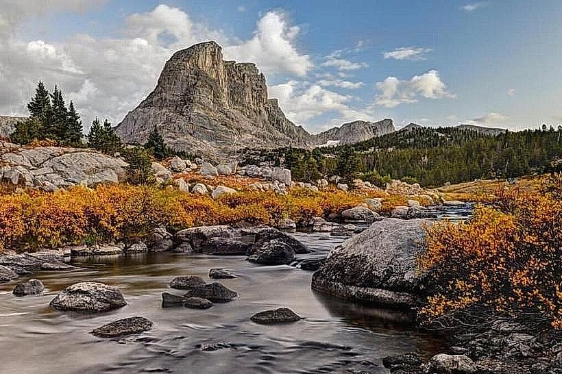
The landscape features granite peaks, cirque lakes, and extensive alpine meadows. Elevations range from approximately 9,000 feet to over 13,000 feet. Rock formations are primarily Precambrian granite. Vegetation includes subalpine fir, lodgepole pine, and various grasses and wildflowers at lower elevations, transitioning to alpine tundra at higher altitudes. Water bodies are typically clear, cold alpine lakes and streams.
Location & Access Logistics
The Bridger Wilderness is situated approximately 30 miles east of Pinedale, Wyoming. Access is primarily from the west via Wyoming Highway 352 (also known as the Fremont Lake Road) and the Elkhart Park Trailhead. This trailhead is located at the end of a paved road and offers a large gravel parking area. Public transport to Pinedale is available via bus services, but no direct public transport reaches the wilderness trailheads. The Elkhart Park Trailhead is the most common entry point for accessing the central and northern sections of the wilderness.
Historical & Ecological Origin
The Bridger Wilderness was established as part of the National Wilderness Preservation System in 1970. Its geological origin is rooted in the Laramide Orogeny, which uplifted the Wind River Range, followed by extensive glaciation that carved out the characteristic cirques, U-shaped valleys, and alpine lakes. Ecologically, it represents a high-altitude alpine and subalpine ecosystem.
Key Highlights & Activities
Hiking is the primary activity, with numerous trails providing access to alpine lakes and peaks. Popular trails include the Elkhart Park Trail to Island Lake and Titcomb Basin. Backpacking and camping are permitted in designated areas. Fishing is available in many of the lakes and streams. Rock climbing opportunities exist on granite formations.
Infrastructure & Amenities
Within the wilderness area itself, infrastructure is minimal, adhering to wilderness principles. There are no developed facilities such as restrooms, designated campsites, or visitor centers. Cell phone signal is generally absent. Basic amenities like food vendors and restrooms are available in Pinedale and at trailheads like Elkhart Park, but not within the wilderness core.
Best Time to Visit
The optimal visiting period is from July through September, when snow has largely receded from higher trails and meadows are accessible. Mid-day offers the most consistent daylight for hiking. For photography, early morning and late afternoon provide softer light. High tide is not a relevant factor for this inland wilderness.
Facts & Legends
The wilderness is named after Jim Bridger, a renowned mountain man and explorer. A notable geological feature is the Titcomb Basin, known for its concentration of high alpine lakes and dramatic granite spires. A specific tip for visitors is to be prepared for rapid weather changes, including afternoon thunderstorms, even in summer.
Nearby Landmarks
- Fremont Lake (0.8km West)
- Wind River Range (0.1km East)
- Pinedale (30km West)
- Shoshone National Forest (Adjacent)
- Bridger-Teton National Forest (Adjacent)