Information
Landmark: Lago MorenoCity: Bariloche
Country: Argentina
Continent: South America
Lago Moreno, Bariloche, Argentina, South America
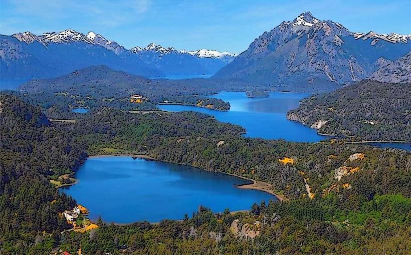
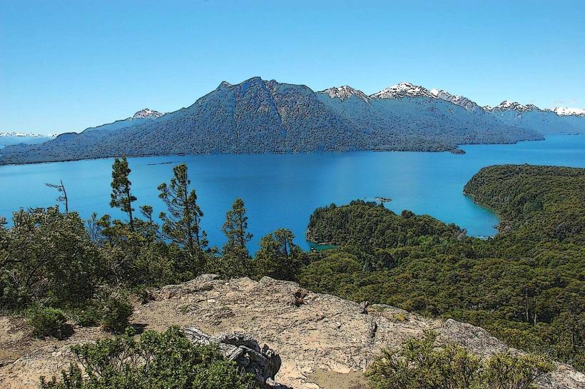
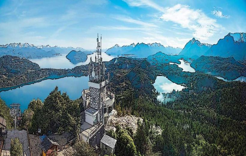
Lago Moreno is a glacial lake situated west of San Carlos de Bariloche, Argentina.
It is divided into two distinct basins, Lago Moreno Oeste and Lago Moreno Este, connected by a narrow channel.
Visual Characteristics
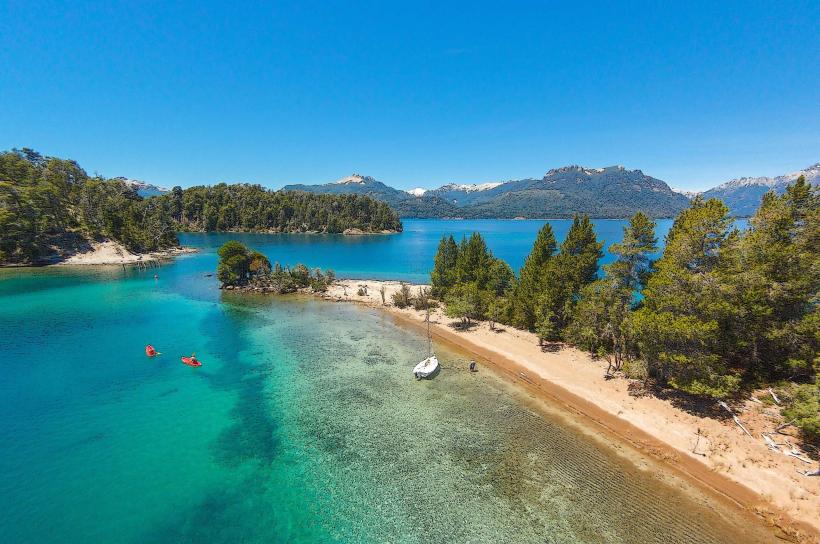
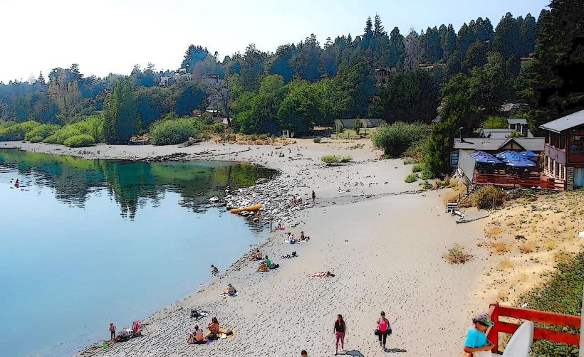
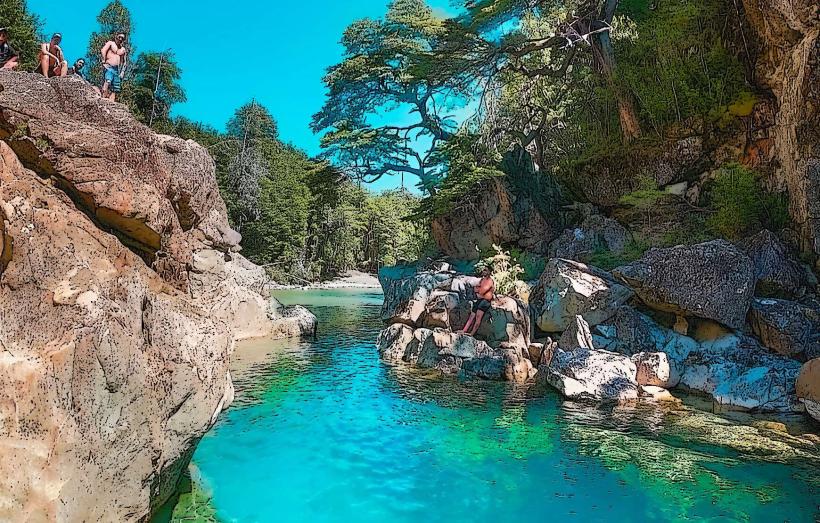
The lake exhibits clear, deep blue water, particularly in its western section. The eastern basin is shallower and can appear more greenish. Shorelines are characterized by mixed gravel and sand beaches, with surrounding slopes covered in dense native forest, primarily Lenga and Coihue trees. Rock outcrops are visible along some sections of the coastline.
Location & Access Logistics
Lago Moreno is located approximately 20 kilometers west of San Carlos de Bariloche. Access is primarily via National Route 258 (Avenida de los Pioneros). Several unpaved access roads branch off Route 258, leading to different points along the lake's perimeter. Parking is available at designated pull-offs and small informal lots near popular access points. Public transport options are limited; Line 10 of the local bus service runs along Route 258, with stops at intervals, requiring a walk to reach specific lake access points.
Historical & Ecological Origin
Lago Moreno is a product of glacial erosion from the last ice age, formed by the movement of large ice sheets that carved out the valley. Its ecological classification is a sub-Antarctic Andean lake, supporting a specific range of flora and fauna adapted to cold, clear water environments.
Key Highlights & Activities
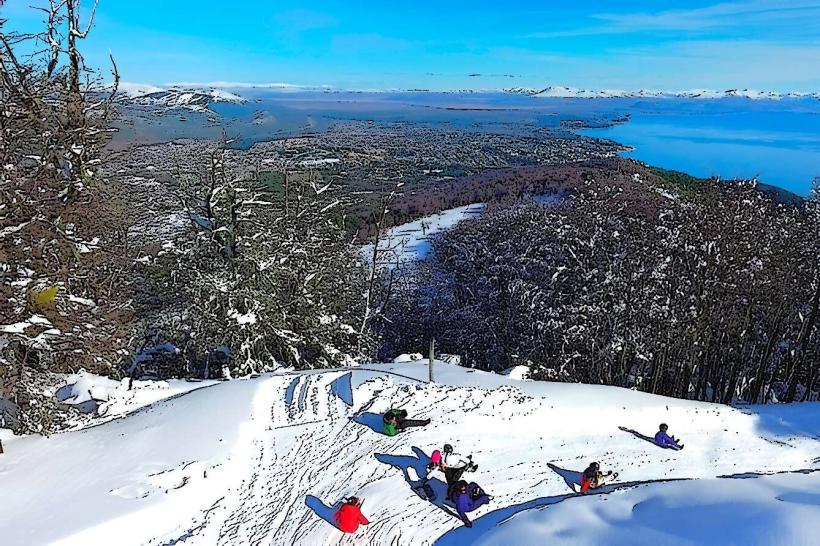
Kayaking and paddleboarding are possible on both basins. Fishing for rainbow and brown trout is permitted in designated areas. Hiking trails exist along parts of the eastern shore, offering views of the lake and surrounding mountains. Swimming is feasible during warmer months, with water temperatures typically ranging from 10-18°C.
Infrastructure & Amenities
Basic amenities are scarce directly at the lake. Some informal picnic areas with rudimentary tables may be found. Restrooms are not consistently available. Cell phone signal (4G/5G) is intermittent and often unavailable in more remote sections. Food vendors are not present at the lake itself; provisions should be carried from Bariloche.
Best Time to Visit
For photography, early morning and late afternoon provide optimal lighting conditions, with the sun illuminating the western shores. The best months for visiting are from December to March, when air and water temperatures are at their highest. High tide is not a relevant factor for access or activities.
Facts & Legends
A local legend suggests that the lake's depth is immeasurable, with some tales attributing its origins to a giant's tears. Geologically, the lake's two basins were once separate, with the channel connecting them formed by more recent geological activity.
Nearby Landmarks
- Cerro Campanario (1.5km Northwest)
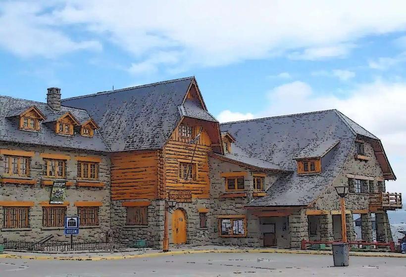
- Llao Llao Hotel & Resort (3km West)
- Parque Nacional Nahuel Huapi Visitor Center (4km Southwest)
- Bosque de Arrayanes (5km West, accessible by boat)