Landmark: Lago Nahuel Huapi
City: Bariloche
Country: Argentina
Continent: South America
Lago Nahuel Huapi, Bariloche, Argentina, South America
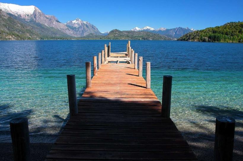
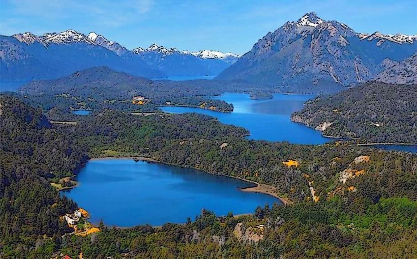
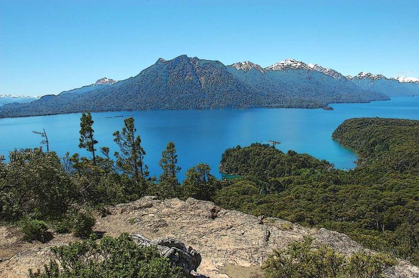
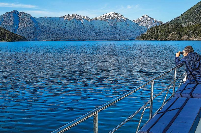
Lago Nahuel Huapi is a large glacial lake situated in the Patagonia region of Argentina, primarily associated with the city of San Carlos de Bariloche.
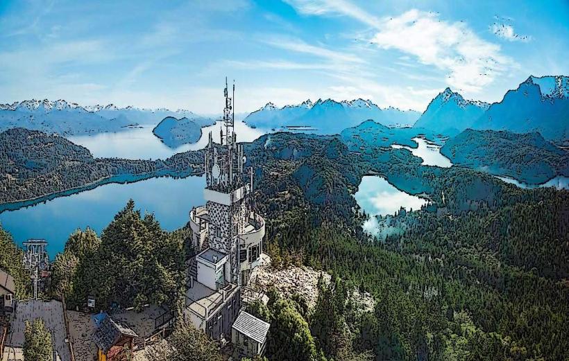
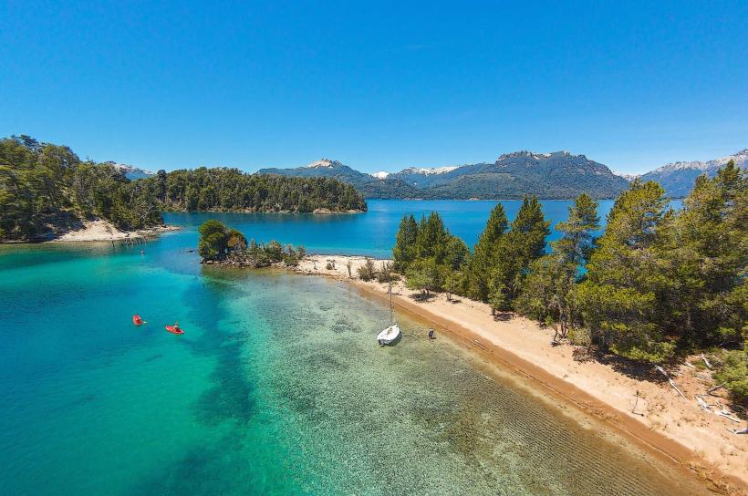
The lake's shoreline is characterized by numerous peninsulas and islands, with its waters exhibiting a deep blue to turquoise hue depending on depth and light conditions. The surrounding landscape is dominated by the Andes Mountains, featuring granite peaks and dense evergreen forests, primarily Lenga and Coihue trees.
Location & Access Logistics
Lago Nahuel Huapi is located approximately 1,600 kilometers (994 miles) southwest of Buenos Aires. Access to the lake is primarily via San Carlos de Bariloche. The main access road is National Route 40 (Ruta Nacional 40), which skirts the northern and western shores. Within Bariloche, numerous access points and marinas are available. Parking is available at designated areas in Bariloche and at various viewpoints and trailheads along the lake's perimeter. Public transport includes local bus lines within Bariloche that service areas near the lake. Boat tours depart regularly from the Puerto San Carlos.
Historical & Ecological Origin
Lago Nahuel Huapi is a glacial lake, formed by the erosive action of glaciers during the Pleistocene epoch. Its irregular shape and deep basins are characteristic of glacial carving. The surrounding mountains are part of the Andes mountain range, formed by tectonic uplift and volcanic activity over millions of years. The lake's name originates from the Mapuche language, referring to a mythical island shaped like a jaguar (nahuel).
Key Highlights & Activities
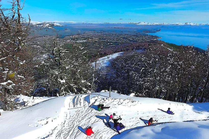
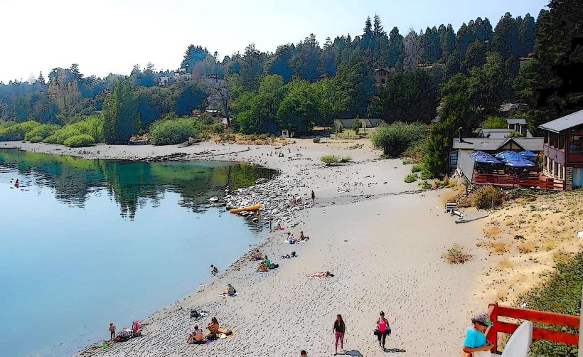
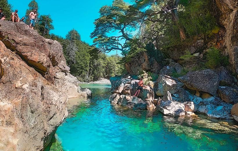
Boat excursions to Isla Victoria and the Arrayanes Forest are available. Kayaking and paddleboarding can be done on calmer sections of the lake. Fishing for trout and salmon is permitted in designated areas. Hiking trails are present along the shoreline and in the surrounding national park, such as the Circuito Chico. Swimming is possible during warmer months, though water temperatures remain cool.
Infrastructure & Amenities
Restrooms are available at major access points, marinas, and tourist centers in Bariloche. Shade is provided by the surrounding forest canopy in many areas. Cell phone signal (4G/5G) is generally available in and around Bariloche and along the main access routes, but can be intermittent in more remote sections of the lake. Food vendors and restaurants are concentrated in Bariloche and at some tourist hubs like Puerto Pañuelo.
Best Time to Visit
The best months for visiting are from December to March (summer in the Southern Hemisphere) for warmer weather suitable for water activities. For photography, early morning and late afternoon light offers optimal conditions for illuminating the mountain peaks and lake surface. High tide is not a significant factor for lake access, but wind conditions can affect boat travel and water sports.
Facts & Legends
A local legend speaks of the "Nahuelito," a creature said to inhabit the lake's depths, similar to the Loch Ness Monster. While unverified, the legend contributes to the lake's mystique. The lake's deepest point reaches approximately 464 meters (1,522 feet).
Nearby Landmarks
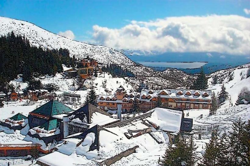
- Cerro Catedral (15km Southwest)
- Parque Nacional Nahuel Huapi (Adjacent)
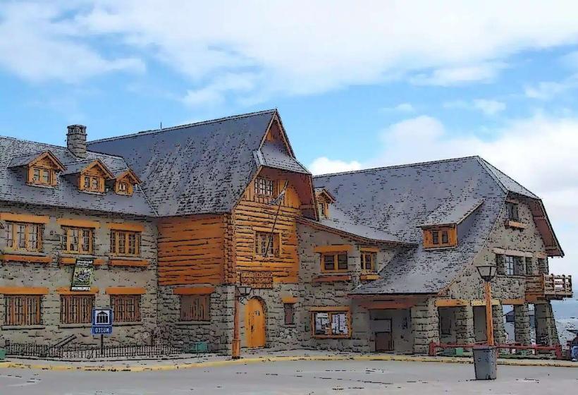
- Llao Llao Hotel & Resort (10km West)
- Bosque de Arrayanes (Isla Victoria, accessible by boat)
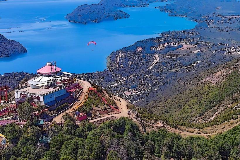
- Cerro Campanario (8km West)