Landmark: Madre de Dios River
City: Madre de Dios
Country: Peru
Continent: South America
Madre de Dios River, Madre de Dios, Peru, South America
The Madre de Dios River is a major waterway in the Madre de Dios region of Peru. It is a significant tributary of the Amazon River.
Visual Characteristics
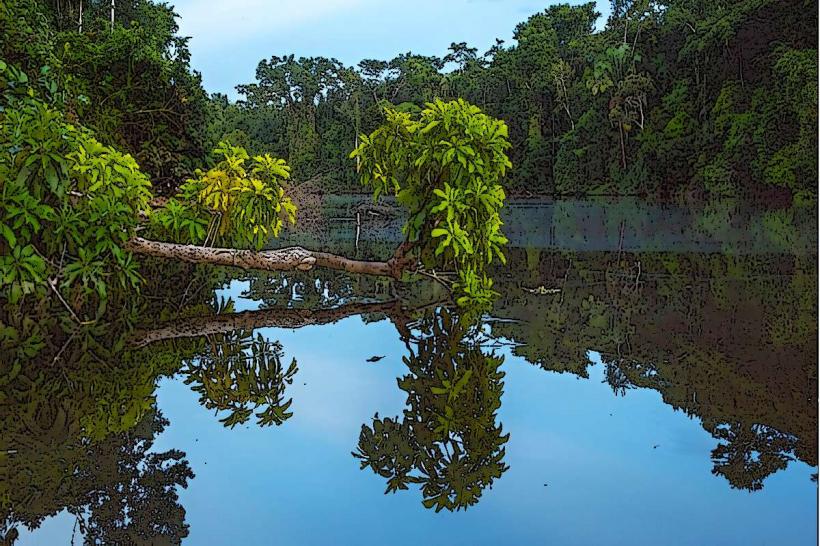
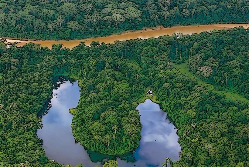
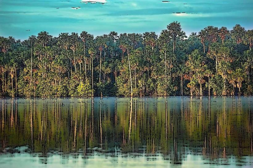
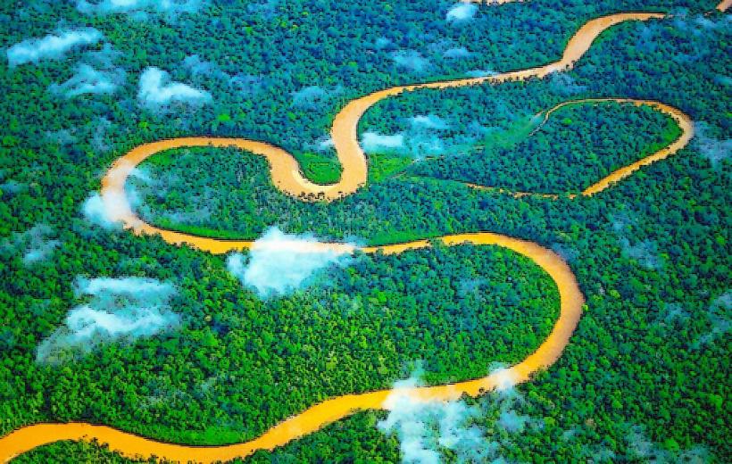
The river's water color varies from brown to reddish-brown due to sediment load, particularly during the rainy season. The riverbanks are characterized by dense tropical rainforest vegetation, with emergent trees reaching significant heights. The river width fluctuates seasonally, ranging from approximately 500 meters to over 2 kilometers in certain sections.
Location & Access Logistics
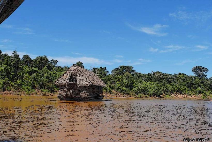
The Madre de Dios River flows through the Madre de Dios region, with major settlements like Puerto Maldonado situated along its banks. Access is primarily via riverboat from Puerto Maldonado. The main port is located approximately 1 kilometer south of the city center. Regular boat services operate daily to various lodges and communities along the river. Road access to the river itself is limited outside of established port areas.
Historical & Ecological Origin
The Madre de Dios River is a geologically young river system, formed by tectonic uplift and erosion processes within the Amazon Basin. Ecologically, it is classified as a whitewater river, characterized by its high sediment content derived from the Andes Mountains. This sediment supports a rich aquatic ecosystem.
Key Highlights & Activities
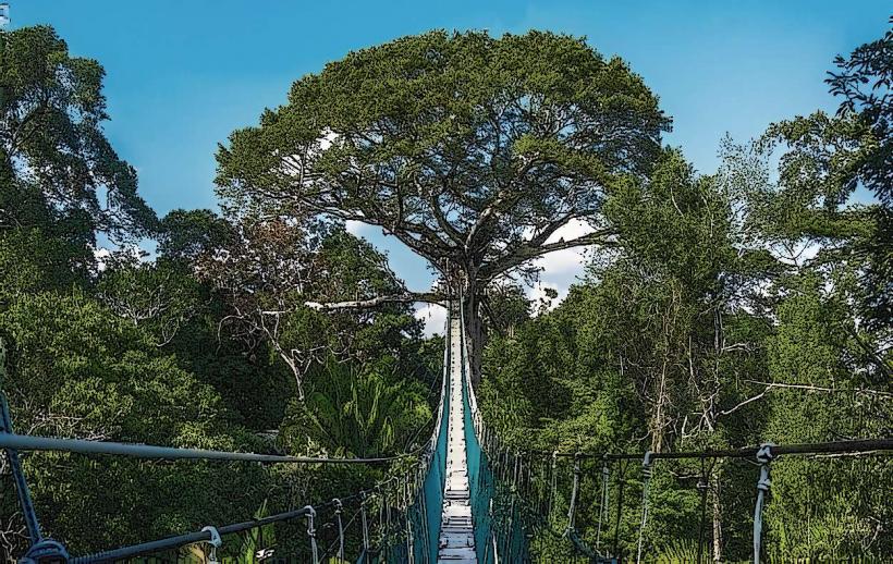
Boat excursions for wildlife observation are a primary activity. Piranha fishing is possible in designated areas. Guided jungle treks along the riverbanks are offered by local operators. Birdwatching tours focus on species found in the riparian zone.
Infrastructure & Amenities
Basic infrastructure is present at river ports and lodges, including restrooms and covered waiting areas. Food vendors are typically found at larger ports like Puerto Maldonado. Cell phone signal (2G/3G) is intermittent along the river, with better reception closer to populated areas. Shade is available from natural tree cover and constructed shelters.
Best Time to Visit
The dry season, from May to October, offers lower water levels, exposing more riverbanks and potentially increasing wildlife visibility. The wet season, from November to April, results in higher water levels, allowing for easier navigation into flooded forest areas. Morning hours (6:00 AM - 9:00 AM) provide optimal lighting for photography and wildlife viewing.
Facts & Legends
Local indigenous communities hold beliefs that the river is inhabited by spirits, including the "Yacumama," a giant water serpent. Historically, the river was a crucial route for rubber tappers in the late 19th and early 20th centuries.
Nearby Landmarks
- Tambopata National Reserve (15km Southwest)
- Bahauja Sonene National Park (40km Southeast)
- Puerto Maldonado (1km North)
- Inkaterra Reserva Amazónica (8km Southwest)
- Sandoval Lake (10km Southwest)