Information
Landmark: Tambopata National ReserveCity: Madre de Dios
Country: Peru
Continent: South America
Tambopata National Reserve, Madre de Dios, Peru, South America
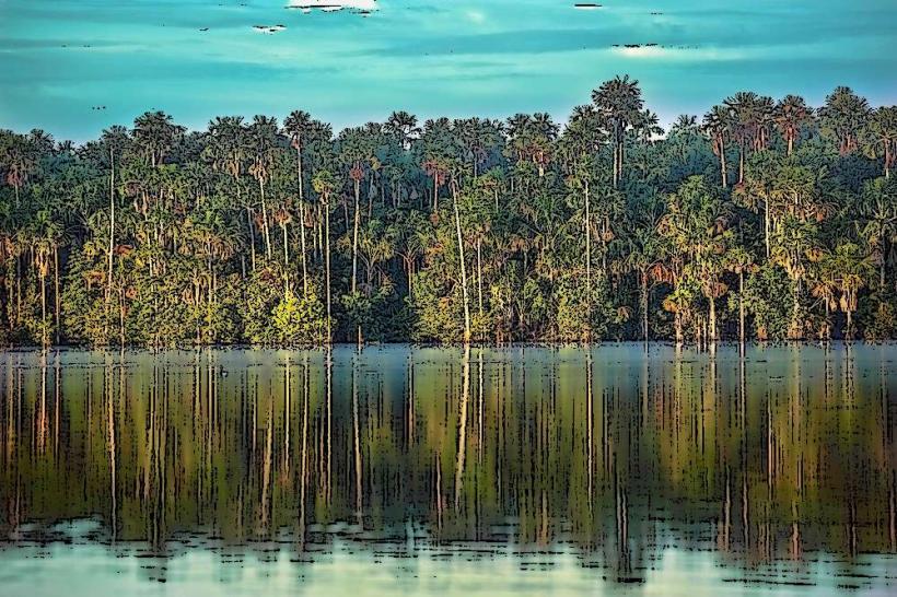
Tambopata National Reserve is a protected area located in the Madre de Dios region of southeastern Peru. It encompasses a significant portion of the Amazon rainforest.
Visual Characteristics
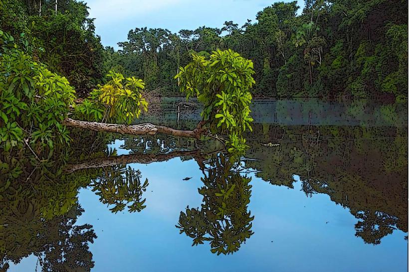
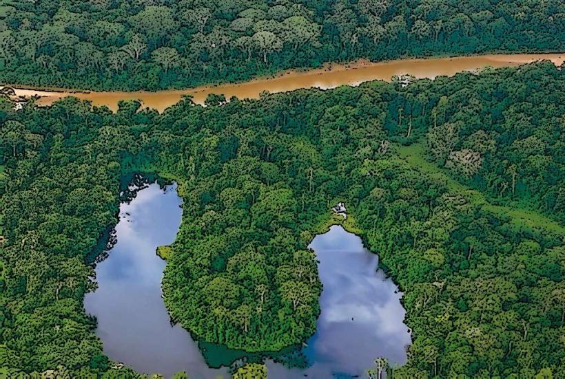
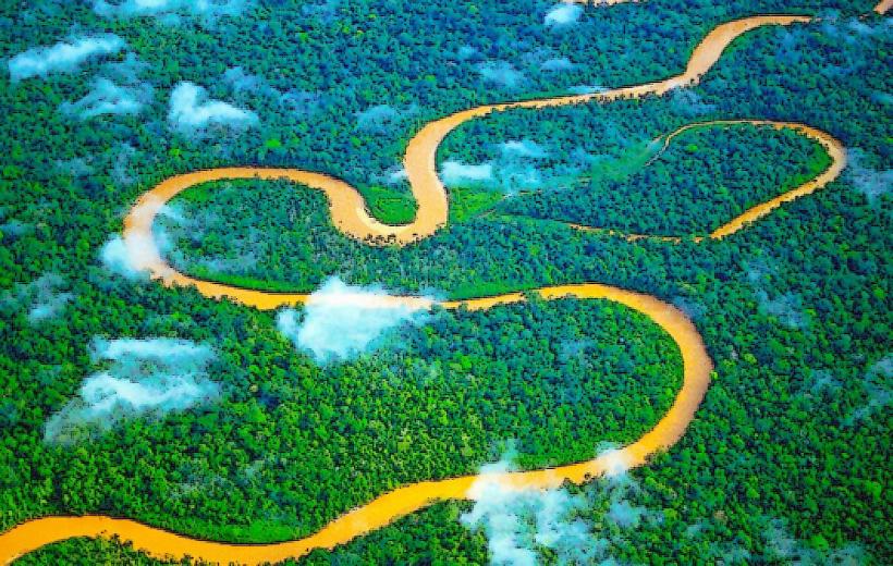
The reserve is characterized by dense tropical rainforest, with a canopy reaching heights of 30-40 meters. Dominant tree species include mahogany, cedar, and kapok. The Tambopata River, a major waterway, flows through the reserve, exhibiting a muddy brown color due to sediment load. Oxbow lakes, formed by meandering river channels, are also present, supporting aquatic vegetation. Wildlife sightings are common, including various primate species, macaws, and caimans.
Location & Access Logistics
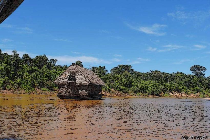
The reserve is situated approximately 40 kilometers south of Puerto Maldonado, the capital of Madre de Dios. Access is primarily via the Interoceanic Highway (Route 30C) for a portion, followed by boat transfer on the Tambopata River. Boat journeys from Puerto Maldonado can range from 2 to 5 hours, depending on the specific lodge or entry point within the reserve. There is no direct road access to most interior areas. Limited parking is available at the Puerto Maldonado port facilities.
Historical & Ecological Origin
Tambopata National Reserve was established in 1990 to protect its rich biodiversity and ecological processes. Ecologically, it is classified as a lowland tropical rainforest, part of the Amazon basin. The area is geologically characterized by alluvial plains and river terraces, shaped by the dynamic course of the Tambopata River over millennia. The region is known for its high species endemism and ecological complexity.
Key Highlights & Activities
Activities include guided jungle treks on designated trails, boat excursions on the Tambopata River and oxbow lakes for wildlife observation, and visits to macaw clay licks. Night walks are available for nocturnal wildlife viewing. Birdwatching is a primary activity, with over 600 species recorded. Photography of flora and fauna is also a significant draw.
Infrastructure & Amenities
Within the reserve, infrastructure is limited to eco-lodges and research stations, which typically provide basic amenities. Restrooms are available at lodges and designated visitor areas. Shade is abundant due to the dense forest canopy. Cell phone signal is generally absent or very weak within the reserve. Food vendors are not present within the reserve; meals are provided by lodges.
Best Time to Visit
The dry season, from May to October, is generally considered the best time to visit due to lower rainfall and more accessible trails. The wet season, from November to April, sees higher river levels, which can facilitate boat access but also increase insect activity. For photography, early morning and late afternoon offer optimal lighting conditions, particularly for wildlife viewing at clay licks.
Facts & Legends
A notable fact is the presence of the Chuncho Clay Lick, one of the largest macaw clay licks in the Amazon, where hundreds of macaws and parrots congregate. Local indigenous communities hold beliefs about forest spirits and the interconnectedness of all living things within the rainforest.
Nearby Landmarks
- Bahia Las Torres: 10km Northwest (River access)
- Collpa Chuncho: 15km Northwest (River access)
- Tambopata Research Center: 25km Southwest (River access)
- Lake Sandoval: 10km West (Requires boat transfer from Puerto Maldonado)
- Puerto Maldonado: 40km North (City center)