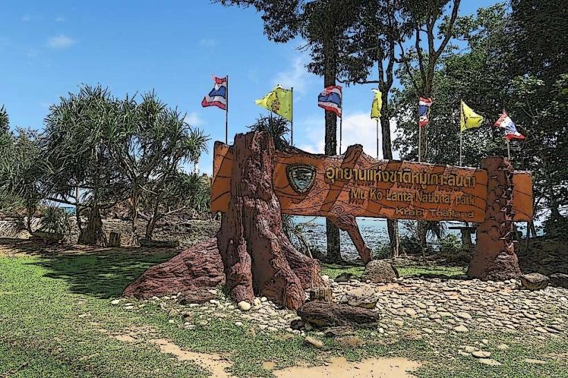
Landmark: Mu Ko Lanta National Park
City: Krabi
Country: Thailand
Continent: Asia
Mu Ko Lanta National Park, Krabi, Thailand, Asia
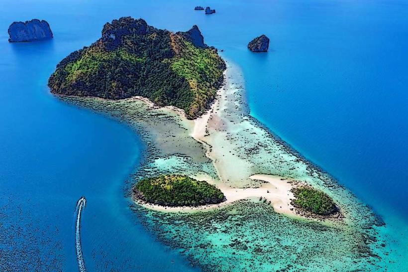
Mu Ko Lanta National Park is an archipelago located in the Andaman Sea, off the coast of Krabi Province, Thailand.
This park encompasses a cluster of islands, with Ko Lanta Yai being the largest and most developed.
Visual Characteristics
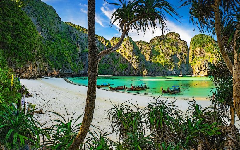
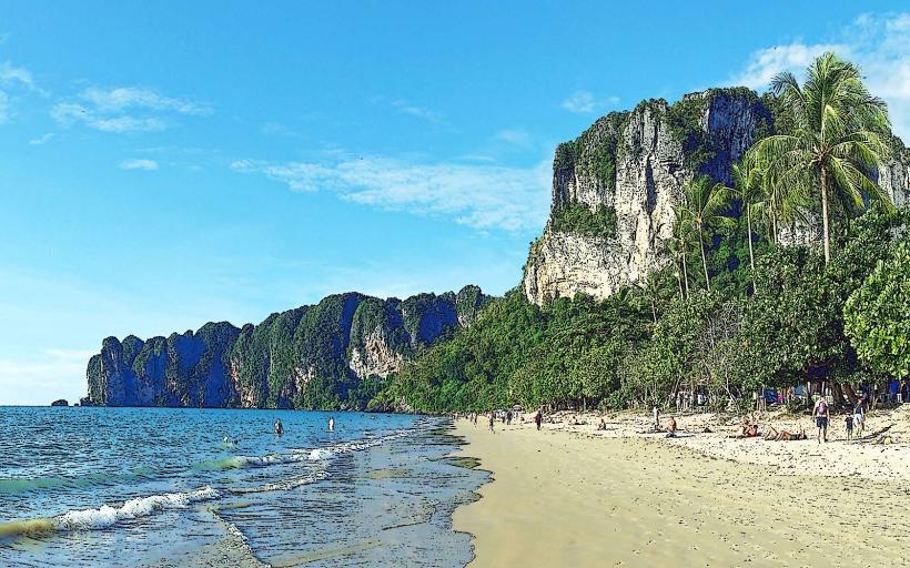
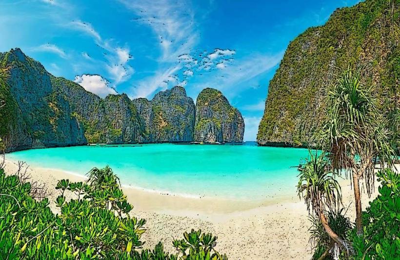
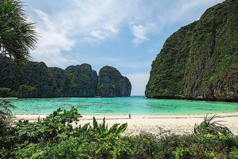
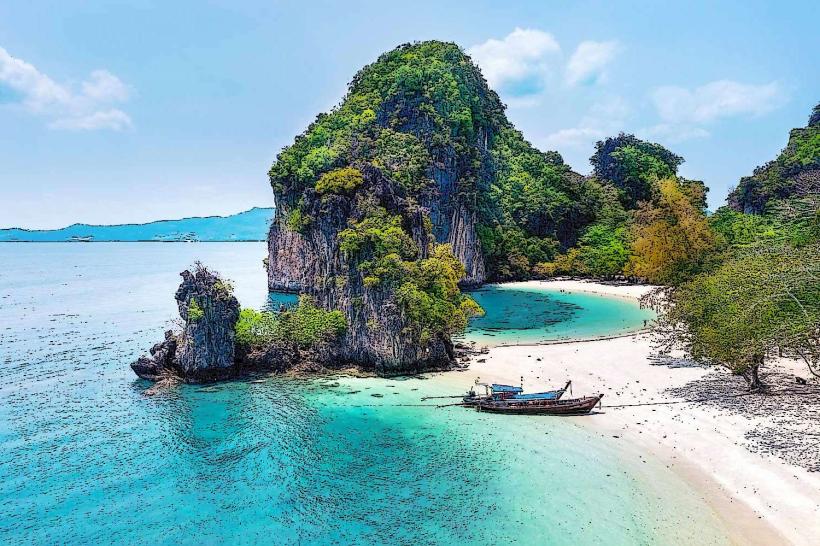
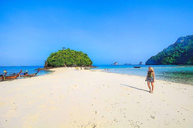
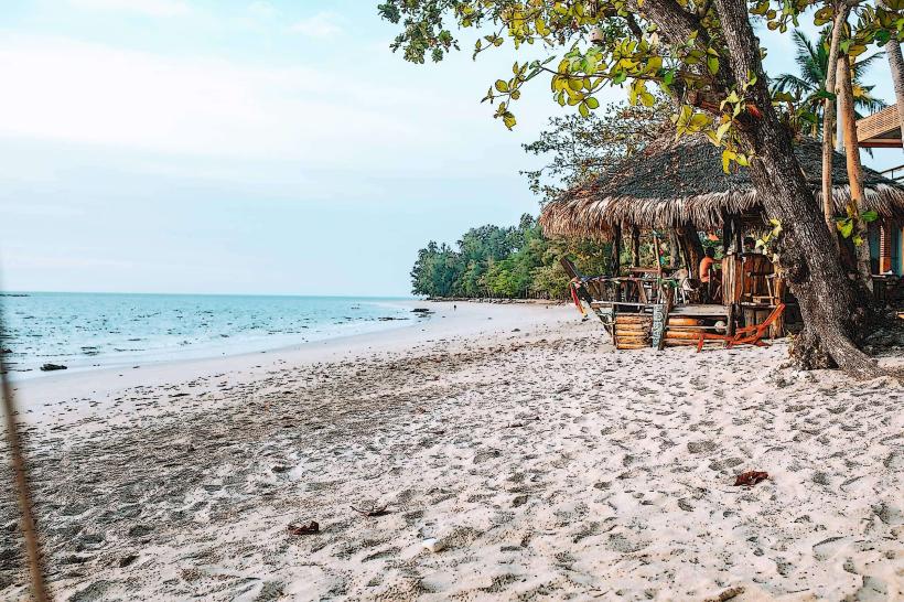
The islands are characterized by limestone karst formations, dense tropical rainforests, and a coastline featuring sandy beaches and coral reefs. Ko Lanta Yai exhibits a varied topography, including hills covered in vegetation and coastal plains. The waters surrounding the islands are typically clear, with varying shades of blue and green depending on depth and seabed composition. Beaches range from fine white sand to coarser grains.
Location & Access Logistics
Mu Ko Lanta National Park is situated approximately 70 kilometers southwest of Krabi Town. Access is primarily via ferry or speedboat from Krabi Town's Klong Jilad Pier or from the nearby island of Ko Phi Phi. Road access to Ko Lanta Yai is possible via a bridge connecting it to the mainland. Within the park, local transport includes songthaews (shared taxis) and motorbike rentals. Parking is available at designated areas on Ko Lanta Yai, particularly near the park headquarters.
Historical & Ecological Origin
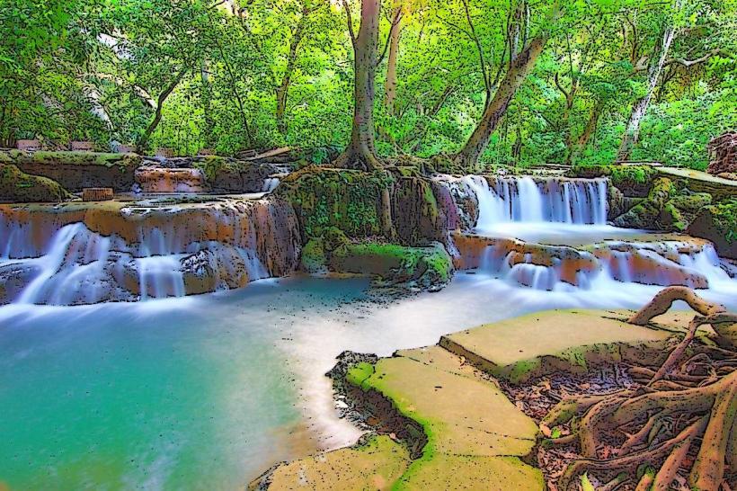
The islands of Mu Ko Lanta are primarily of geological origin, formed from ancient limestone deposits that have been shaped by erosion over millennia. Ecologically, the area is classified as a marine national park, established in 1996 to protect its diverse marine life, coral reefs, and terrestrial ecosystems. The rainforests support a variety of flora and fauna, while the surrounding waters are home to numerous fish species and marine invertebrates.
Key Highlights & Activities
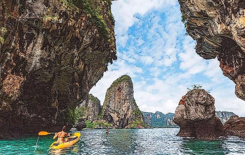
Activities include snorkeling and diving at sites such as Ko Haa and Ko Rok, which are accessible via day trips. Hiking trails are present on Ko Lanta Yai, leading to viewpoints and waterfalls. Kayaking through mangrove forests is also an option. The park headquarters offers an interpretive center detailing the local ecology.
Infrastructure & Amenities
Basic facilities are available at the park headquarters on Ko Lanta Yai, including restrooms and a small information center. Limited food vendors operate near popular beach areas on Ko Lanta Yai. Cell phone signal (4G) is generally available on Ko Lanta Yai, but may be intermittent on smaller, more remote islands. Shade is provided by natural tree cover and some man-made structures on developed beaches.
Best Time to Visit
The dry season, from November to April, offers the most favorable weather conditions with lower rainfall and calmer seas, ideal for water activities. The best time of day for photography, particularly for capturing the coastline and karst formations, is during the early morning or late afternoon when the sun's angle is lower, providing softer light and longer shadows. High tide is generally preferred for accessing certain shallow reef areas for snorkeling.
Facts & Legends
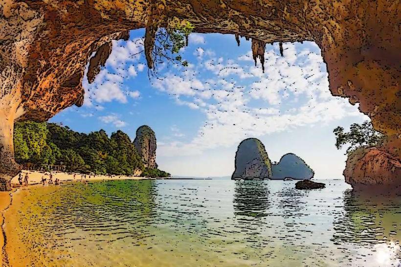
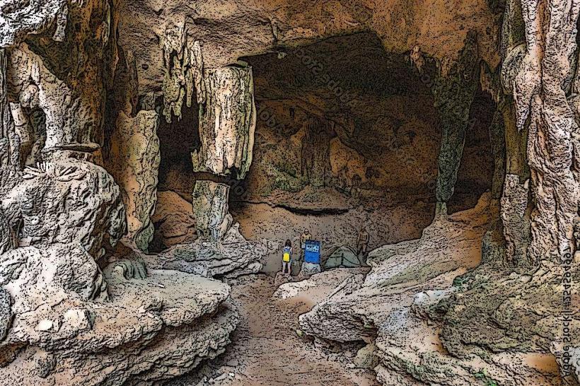
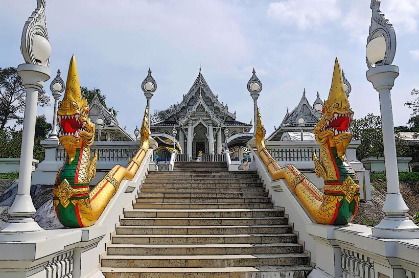
A notable geological feature within the park is the presence of sea caves, some of which are accessible by boat. Local folklore often associates the limestone formations with ancient spirits or mythical creatures. A specific tip for visitors is to check the tide tables before planning boat trips to outer islands, as sea conditions can significantly impact accessibility and visibility.
Nearby Landmarks
- Ko Phi Phi Islands (15km Northeast)
- Emerald Cave (Ko Mook) (25km Southeast)
- Railay Beach (40km Northeast)
- Ao Nang Beach (50km Northeast)
- Phang Nga Bay (70km North)