Landmark: Mua Hills
City: Machakos
Country: Kenya
Continent: Africa
Mua Hills, Machakos, Kenya, Africa
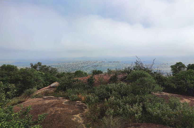
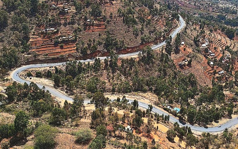
The Mua Hills are a geological formation located in Machakos County, Kenya. This area is characterized by its elevated terrain and natural landscape.
Visual Characteristics
The hills are composed primarily of weathered Precambrian basement rocks, exhibiting a range of earthy tones from ochre to brown. Vegetation cover varies, with denser acacia woodlands on lower slopes and sparser grassland at higher elevations. Rock outcrops are common, forming irregular formations.
Location & Access Logistics
The Mua Hills are situated approximately 40 kilometers southeast of Machakos town. Access is via the A2 road towards Konza, then turning onto local unpaved roads. The final approach requires a 4WD vehicle due to the uneven terrain. No public transport directly serves the hills; private vehicle hire is the primary access method. Parking is informal and available at designated trailheads.
Historical & Ecological Origin
Geologically, the Mua Hills are part of the East African Rift System's basement complex, formed by ancient metamorphic and igneous rocks. Their current topography is a result of long-term erosion and uplift. Ecologically, they represent a transition zone between the semi-arid plains and higher altitude regions, supporting a diverse range of flora and fauna adapted to these conditions.
Key Highlights & Activities
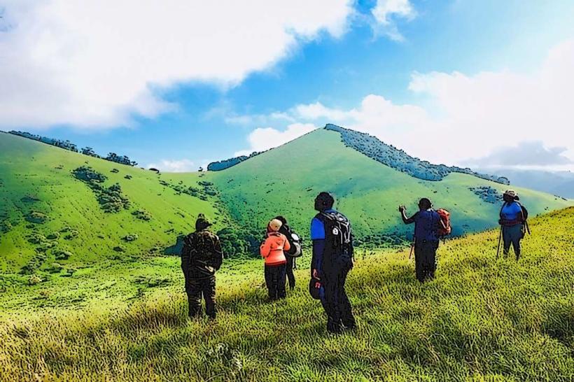
Hiking is the primary activity, with several informal trails leading to higher vantage points. Observation of local birdlife is possible. Photography of the landscape is a common pursuit, particularly during sunrise and sunset.
Infrastructure & Amenities
There are no formal infrastructure or amenities within the Mua Hills. Restrooms, shade, and food vendors are not present. Cell phone signal is intermittent and generally weak.
Best Time to Visit
The best time for visiting is during the dry season, from June to October, to ensure trail accessibility. Early morning or late afternoon provides optimal lighting conditions for photography due to lower sun angles.
Facts & Legends
Local folklore suggests that the hills were once inhabited by ancient spirits, and certain rock formations are believed to be their dwelling places. A specific rock outcrop known as "The Chief's Seat" is said to have been used by elders for important council meetings.
Nearby Landmarks
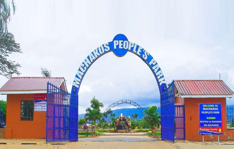
- Machakos People's Park (15km Northwest)
- Ol Donyo Sabuk National Park (35km Northeast)
- Koma Rock (25km West)
- Kituluni Hill (20km North)