Landmark: Needles Highway
City: Custer
Country: USA South Dakota
Continent: North America
Needles Highway, Custer, USA South Dakota, North America
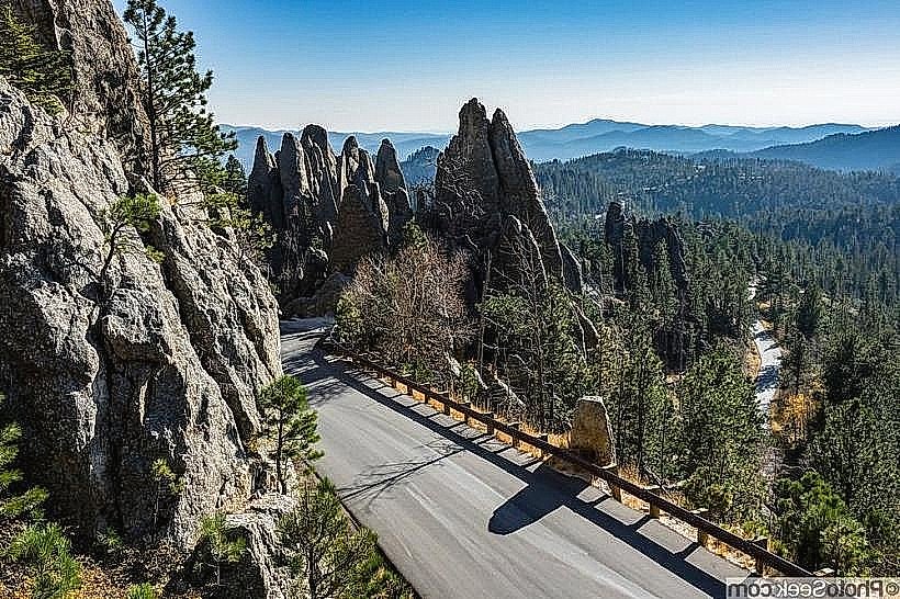
The Needles Highway is a 14-mile scenic drive located in Custer-state-park_custer" class="underline">Custer State Park, South Dakota. It is characterized by its narrow, winding route through granite formations.
Visual Characteristics
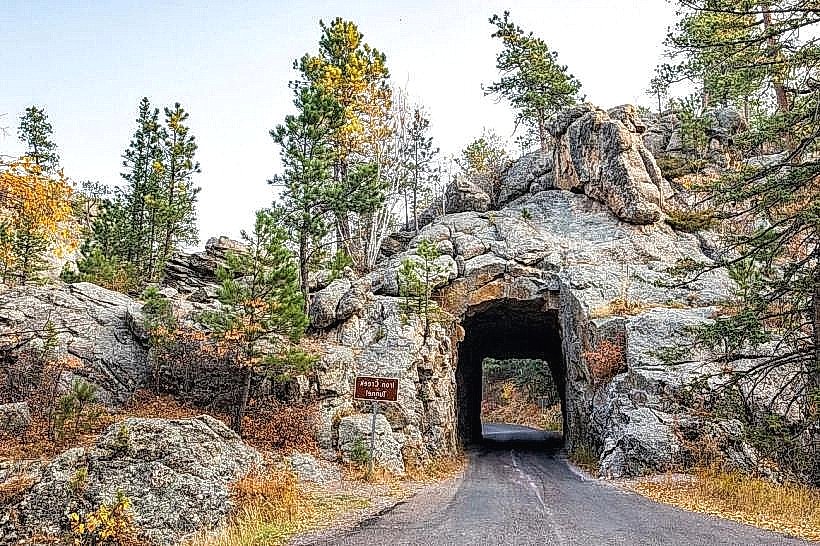
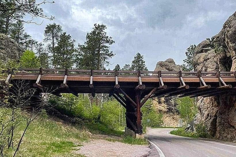
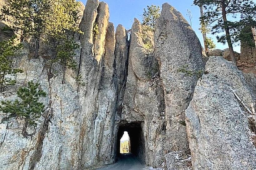
The highway traverses a landscape dominated by large, weathered granite spires and rock outcroppings. The road itself is paved, with sections featuring single-lane tunnels blasted through solid rock. Vegetation consists of Ponderosa pine, aspen, and various underbrush, with seasonal wildflowers present. The elevation changes significantly along the route.
Location & Access Logistics
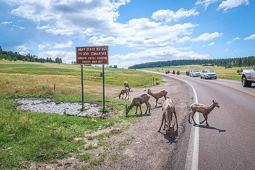
The Needles Highway is accessible from State Highway 16A (also known as Iron Mountain Road) and State Highway 87. The southern terminus connects to State Highway 87, and the northern terminus connects to State Highway 16A. Custer State Park entrance fees apply. Parking is available at designated pull-offs and trailheads; these areas can become full during peak season. No direct public transport services operate on the Needles Highway itself. The nearest major city is Rapid City, approximately 45 miles northeast.
Historical & Ecological Origin
Construction of the Needles Highway was completed in 1922. It was designed and built by the Custer State Park engineers, with Peter Norbeck playing a significant role in its conception. The purpose was to provide access to the park's unique geological features and enhance tourism. The granite formations are Precambrian in age, part of the Black Hills uplift.
Key Highlights & Activities
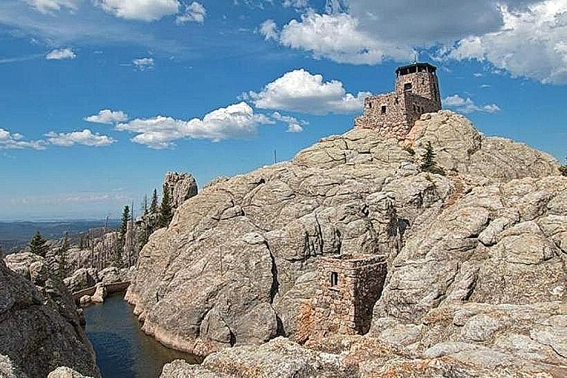
Driving the highway offers views of the granite spires. Specific points of interest include the Needles Eye, a narrow rock formation resembling a needle's eye, and the Cathedral Spires. Hiking trails are accessible from various points along the route, such as the Cathedral Spires Trail. Photography is a common activity due to the unique rock formations and vistas.
Infrastructure & Amenities
Restrooms are available at designated picnic areas and trailheads. Shade is provided by the surrounding pine forests. Cell phone signal is intermittent and generally unreliable along most of the route. Food vendors are not present directly on the highway; services are available at the park's visitor centers and lodges outside the immediate highway corridor.
Best Time to Visit
The highway is typically open from mid-May through mid-October, depending on snow conditions. For photography, early morning and late afternoon offer the best natural light on the granite formations. The months of June, July, and August are the busiest. There are no tide-dependent features on this route.
Facts & Legends
One of the tunnels, the Needles Eye Tunnel, is only 8 feet 4 inches wide and 9 feet 6 inches high, requiring careful navigation for larger vehicles. The construction involved significant manual labor and explosives to carve through the solid granite.
Nearby Landmarks
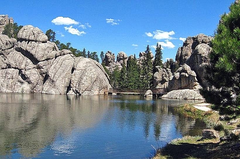
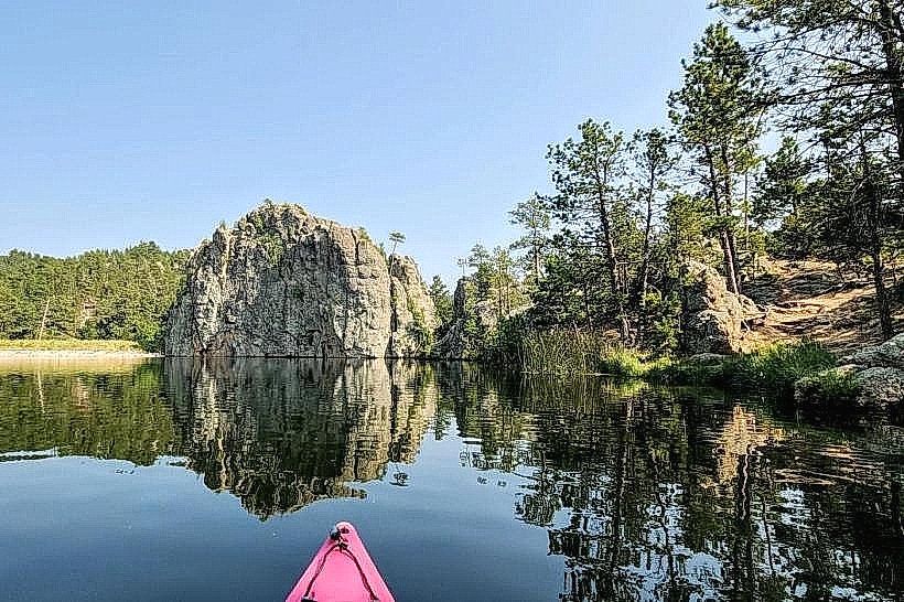
- Sylvan Lake (0.8km Northwest)
- Black Elk Peak Trailhead (1.2km West)
- Iron Mountain Road (2.5km North)
- Mount Rushmore National Memorial (15km Northeast)
- Crazy Horse Memorial (18km Southwest)