Landmark: Peter Norbeck Scenic Byway
City: Custer
Country: USA South Dakota
Continent: North America
Peter Norbeck Scenic Byway, Custer, USA South Dakota, North America
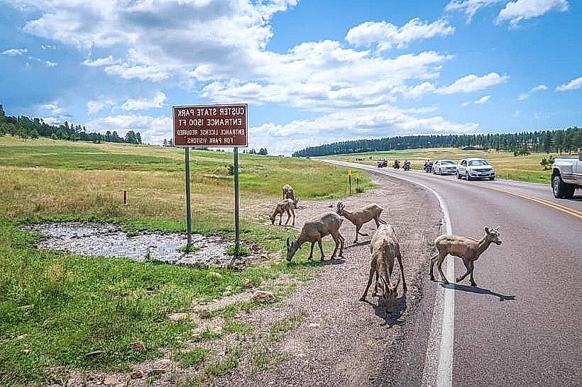
The Peter Norbeck Scenic Byway is a 47-mile loop road located in Custer-state-park_custer" class="underline">Custer State Park, South Dakota. It provides access to several key geological formations and overlooks within the park.
Visual Characteristics
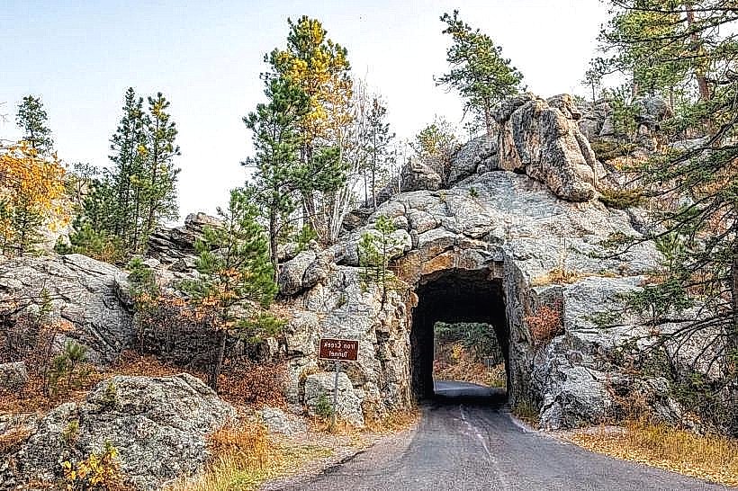
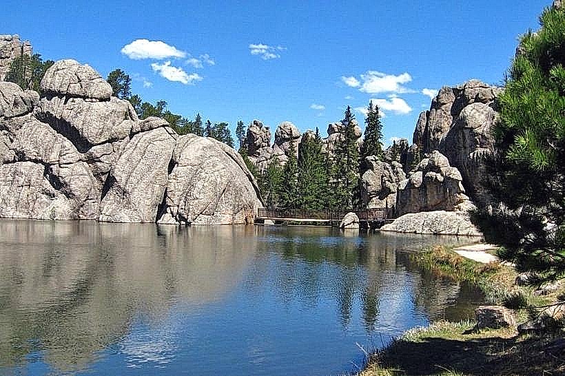
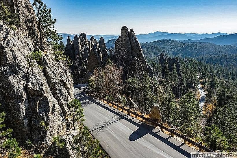
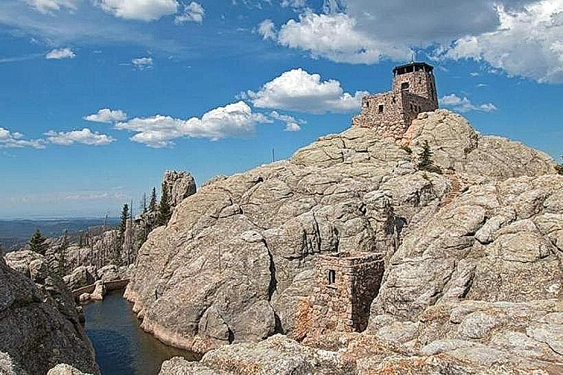
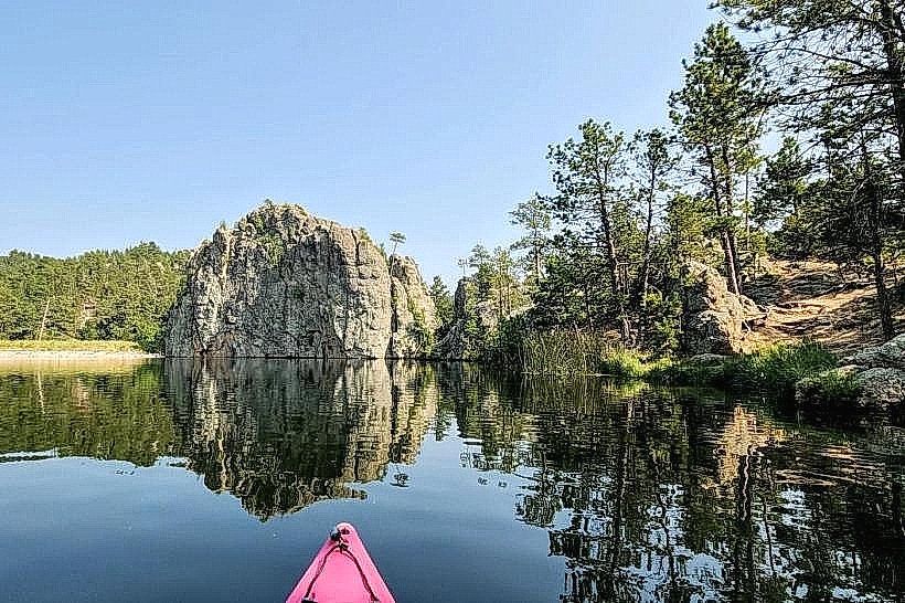
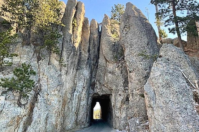
The byway traverses granite formations, including the Needles Highway section which features narrow tunnels and sharp turns through rock spires. The road itself is paved asphalt. Vegetation consists primarily of Ponderosa pine forests and mixed prairie grasses. Elevations range from approximately 5,000 to 6,000 feet.
Location & Access Logistics
The byway is accessible from multiple points within Custer State Park. The main access points are from US Highway 16A near the towns of Custer and Keystone. The loop can be driven in either direction. Parking is available at designated pull-offs and overlooks. No specific public transport services operate directly on the byway; personal vehicles are required.
Historical & Ecological Origin
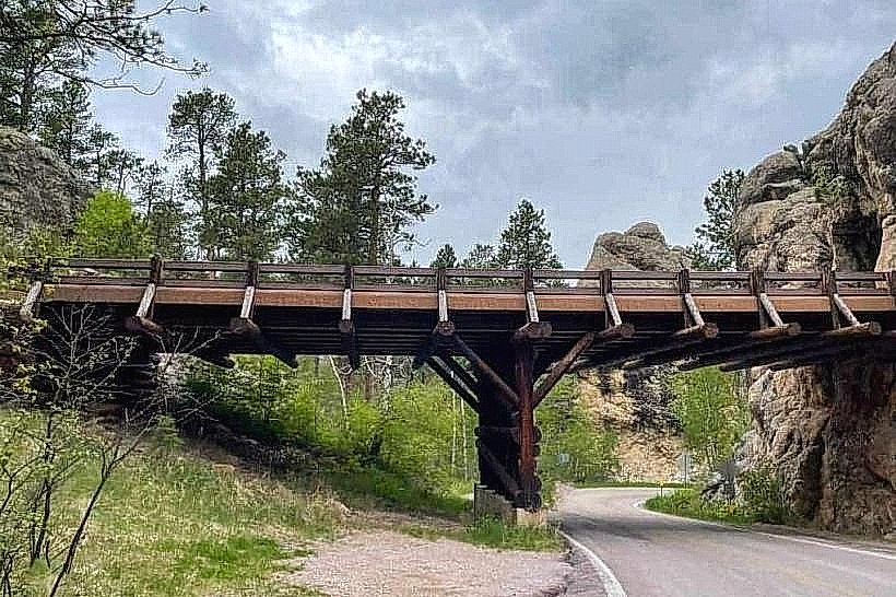
Construction of the byway began in the 1920s, with significant portions completed by the Civilian Conservation Corps in the 1930s. Peter Norbeck, a former South Dakota governor and senator, was instrumental in its planning and development, aiming to showcase the park's natural features. The geological formations are primarily Precambrian granite, shaped by millions of years of erosion.
Key Highlights & Activities
Driving the byway allows access to the Needles Highway, Iron Mountain Road, and Wildlife Loop Road. Specific points of interest include the Needles Eye, the Cathedral Spires, and various overlooks offering views of the Black Hills. Wildlife viewing is common along the Wildlife Loop Road section. Hiking trails are accessible from designated trailheads along the route.
Infrastructure & Amenities
Restrooms are available at several designated rest areas and visitor centers within Custer State Park. Shade is provided by the surrounding forest canopy in many sections. Cell phone signal is intermittent and generally unreliable along most of the byway. Food vendors and restaurants are located in the nearby towns of Custer and Keystone, and at the State Game Lodge within the park.
Best Time to Visit
The byway is typically open from late April or early May through mid-October, depending on snow conditions. The best time of day for photography is generally during the morning or late afternoon for softer light. Summer months (June-August) offer the most stable weather, though afternoon thunderstorms are possible. Fall (September-October) provides autumn foliage.
Facts & Legends
The tunnels along the Needles Highway section were intentionally cut to frame specific views of the surrounding granite formations. One tunnel, the Norbeck Tunnel, is 17 feet wide and 13 feet high, requiring careful navigation for larger vehicles.
Nearby Landmarks
- Mount Rushmore National Memorial (3.5km Northwest)
- Crazy Horse Memorial (8.2km Southwest)
- Wind Cave National Park (20.1km South)
- Custer State Park Visitor Center (1.2km West)
- Black Elk Peak Trailhead (6.8km Northeast)