Landmark: Nusa Island
City: New Ireland
Country: Papua New Guinea
Continent: Australia
Nusa Island, New Ireland, Papua New Guinea, Australia
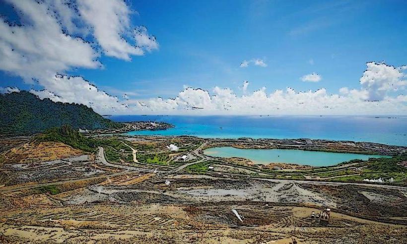
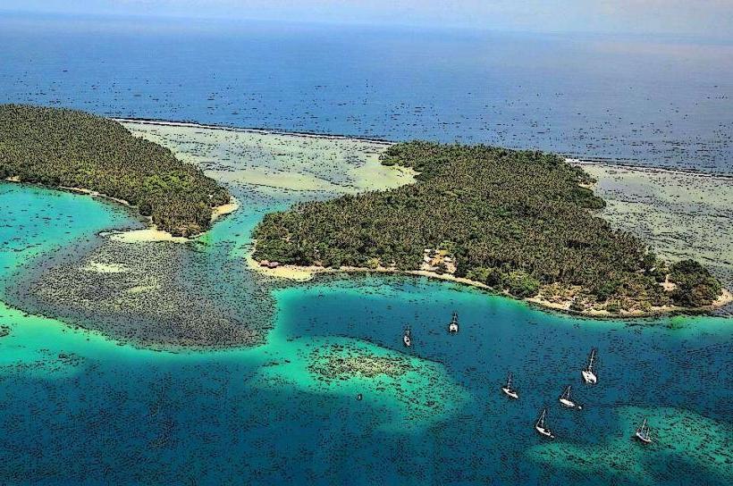
Nusa Island is a small island located off the coast of New Ireland Province, Papua New Guinea. It is situated approximately 10 kilometers east of Kavieng.
Visual Characteristics
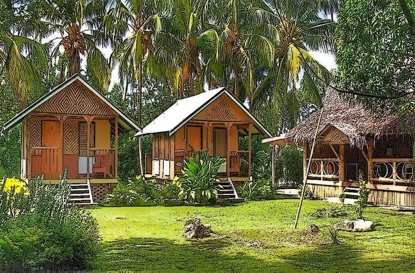
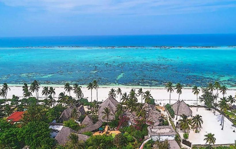
The island features a coastline composed of fine, light-colored sand. Inland, the terrain is characterized by dense tropical vegetation, primarily palm trees and various shrubs. The surrounding waters are clear and exhibit a turquoise hue, transitioning to deeper blue further offshore.
Location & Access Logistics
Access to Nusa Island is primarily via boat transfer from Kavieng. The journey takes approximately 20-30 minutes. Local boat operators can be arranged at the Kavieng market or through accommodations in Kavieng. There is no public transport directly to the island. Parking is available in Kavieng at the departure point for boat transfers.
Historical & Ecological Origin
Nusa Island is a natural land formation, likely a coral island built upon a submerged volcanic base, typical of the region's geology. Its ecological classification is a tropical island ecosystem, supporting a variety of plant and animal life adapted to this environment.
Key Highlights & Activities
Activities include snorkeling and diving in the surrounding coral reefs, which are accessible from the shore. Swimming is possible in the calm lagoon areas. Birdwatching is also a potential activity due to the island's vegetation.
Infrastructure & Amenities
Basic amenities may be available depending on the operator providing boat transfers, often including simple shelters. Permanent restroom facilities are not guaranteed. Cell phone signal is generally weak or non-existent on the island. Food vendors are not present on Nusa Island; visitors should arrange for provisions beforehand.
Best Time to Visit
The best time for clear water visibility for snorkeling and diving is during the dry season, typically from June to September. Mid-morning offers good lighting conditions for underwater photography. High tide is generally preferred for accessing certain reef areas.
Facts & Legends
Local lore suggests that the island was once inhabited by spirits who protected the surrounding waters. A specific tip for visitors is to check the tide charts before departure, as extremely low tides can expose extensive reef areas, making boat access more challenging.
Nearby Landmarks
- Kavieng Town (10km West)
- Malendok Island (8km Southwest)
- New Hanover Island (30km North)
- Lavongai Island (40km Northwest)