Landmark: Santo Antão Island
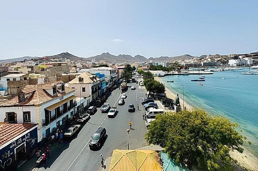
City: Porto Novo City
Country: Cabo Verde
Continent: Africa
Santo Antão Island, Porto Novo City, Cabo Verde, Africa
Santo Antão Island is the second most populous island in the Cape Verde archipelago, located northwest of São Vicente Island.
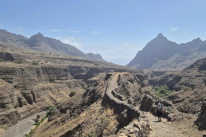
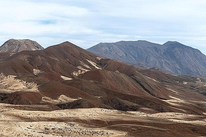
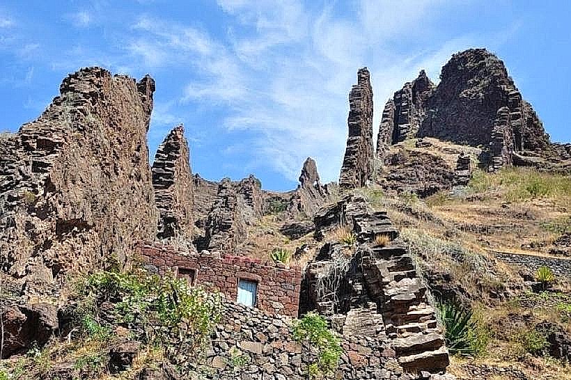
The island is characterized by its rugged volcanic terrain, deep ravines, and terraced agricultural fields.
Visual Characteristics
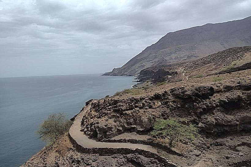
The island's topography is dominated by steep, eroded volcanic mountains reaching over 1,900 meters. Valleys are deep and narrow, with sheer cliffs. Vegetation density varies significantly, with lush green slopes in the higher, wetter regions and arid, rocky expanses at lower elevations and along the coast. Coastal areas feature dark volcanic sand and rock formations.
Location & Access Logistics
Santo Antão is accessible via ferry from Porto Novo City on São Vicente Island. The ferry terminal in Porto Novo City is the primary entry point. From Porto Novo City, local transport includes shared taxis (aluguers) and private taxis that service the island's road network. The main road, EN1-SA01, connects Porto Novo to Ribeira Grande and Ponta do Sol. Public transport is limited to aluguers, which operate on fixed routes but can be chartered. Parking is available at designated areas in towns and at trailheads, though it can be limited.
Historical & Ecological Origin
Santo Antão is of volcanic origin, formed by a shield volcano. Its geological history is marked by significant erosion, creating the dramatic ravines and peaks seen today. The island was settled by Portuguese colonists in the 17th century, primarily for agriculture. The terraced farming system, known as "socalcos," was developed over centuries to maximize arable land on the steep slopes.
Key Highlights & Activities
Hiking is a primary activity, with established trails such as the path from Cova Crater to Ribeira Grande and the trail through the Paúl Valley. Exploring the terraced fields and agricultural villages is recommended. Photography of the dramatic landscapes is possible. Boat tours along the coast offer views of the cliffs and coves.
Infrastructure & Amenities
Restrooms are available in towns and at some larger tourist sites. Shade is present in forested areas and villages, but limited on exposed trails. Cell phone signal (4G) is generally available in towns and along main roads, but can be intermittent in remote valleys and higher elevations. Food vendors and small restaurants are located in Porto Novo, Ribeira Grande, and Ponta do Sol.
Best Time to Visit
The best months for visiting are generally from November to June, avoiding the peak of the rainy season (August-October). For photography, early morning and late afternoon light provides optimal illumination of the mountain contours. There are no specific tide requirements for most activities.
Facts & Legends
The island's terraced fields are a UNESCO World Heritage tentative site, representing a centuries-old adaptation to steep terrain. A local legend speaks of a hidden spring in the mountains that never runs dry, said to be guarded by spirits.
Nearby Landmarks
- Porto Novo City (0.1km West)
- Monte Verde (15km East)
- Ribeira Grande (25km East)
- Ponta do Sol (30km East)