Landmark: Telegraph Island
City: Khasab
Country: Oman
Continent: Asia
Telegraph Island, Khasab, Oman, Asia
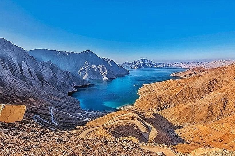
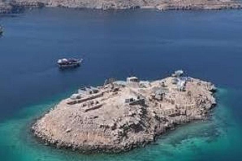
Telegraph Island (Jazirat al Maqlab) is a small rocky landmass located in the Elphinstone Inlet (Khor Ash Sham) of the Musandam Peninsula, Oman. It is situated approximately 1.1 hectares in size and lies roughly 10 kilometers from the regional capital of Khasab.
Visual Characteristics
The island is approximately 160 meters long and 90 meters wide, characterized by its jagged limestone composition and steep rocky perimeter. The terrain is largely barren with minimal desert scrub and is dominated by the stone and mud-brick ruins of a 19th-century repeater station. The surrounding marine environment features rock strata that dip sharply into the turquoise waters of the fjord, reflecting the intense geological pressure from the subducting Arabian tectonic plate.
Location & Access Logistics
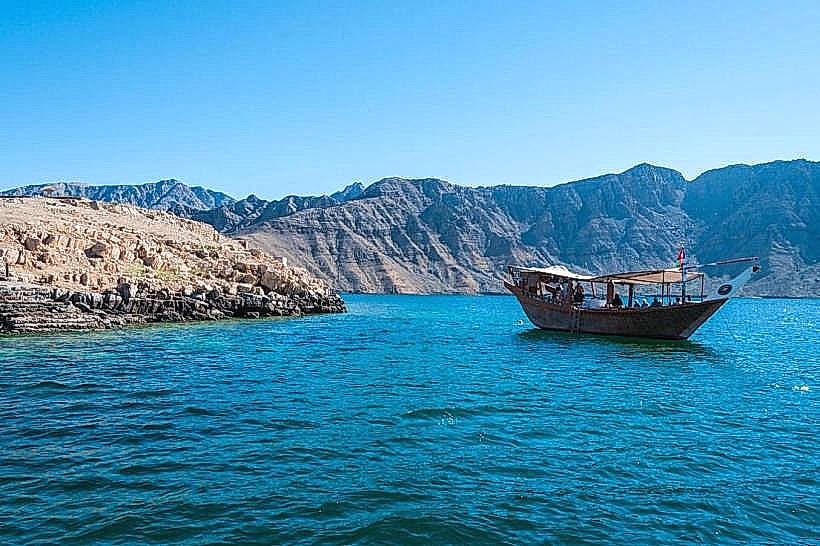
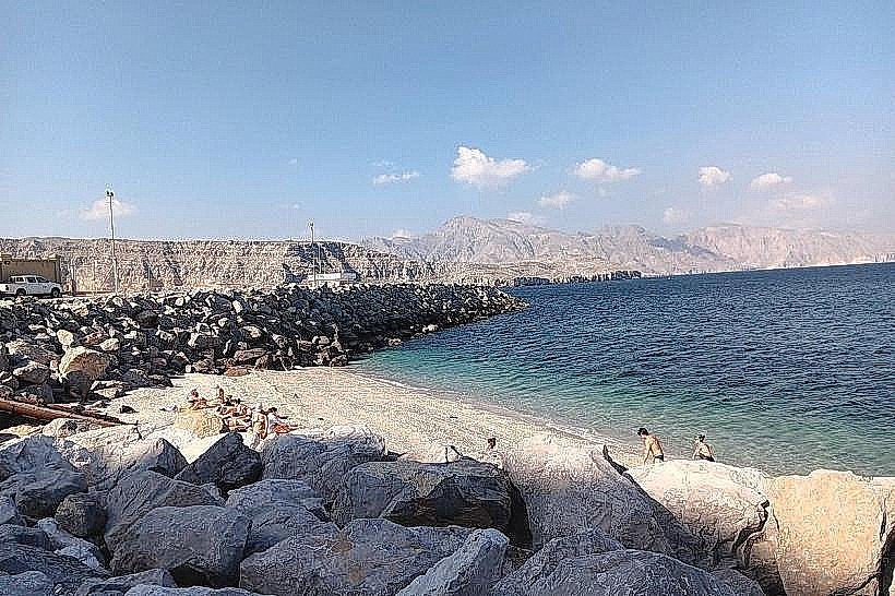
Access is exclusively by sea, primarily via traditional Omani dhows departing from the Khasab Port. The boat journey through the fjord takes approximately 45 to 60 minutes depending on sea conditions. While private kayaks and speedboats can reach the island, most visitors utilize organized tours that depart from the marina near Khasab Fort. There is no road access or public ferry service directly to the island; landing requires navigating a two-to-three-foot tidal range that can make the small stone steps difficult to access at low tide.
Historical & Ecological Origin
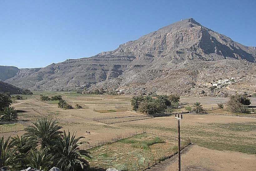
The island became a British repeater station in 1864 as part of the Persian Gulf submarine telegraph cable linking London to Karachi. It served as a critical node where weak telegraph signals were boosted before continuing along the underwater line. Geologically, the island is a limestone outcrop part of the Musandam Mountains, formed during the Permian to Middle Cretaceous periods and currently undergoing a gradual subsidence of approximately 6mm per year.
Key Highlights & Activities
Snorkeling is the primary activity, with visibility often exceeding 20 meters, allowing for views of reef sharks, rays, and hawksbill turtles. Visitors can climb the stone steps to the island's summit to explore the crumbled remains of the telegraph operators' quarters and the station office. Dhow cruises frequently anchor in the shallow lagoon for swimming and dolphin watching in the surrounding inlet.
Infrastructure & Amenities
The island is uninhabited and has no permanent modern infrastructure. There are no restrooms, shaded buildings, or food vendors on the landmass. Cell phone signal (4G) is generally available but can be intermittent due to the surrounding high cliffs of the fjord. Shade is limited to the shadows cast by the stone ruins; visitors must rely on their transport vessel for water, food, and facilities.
Best Time to Visit
The most favorable months are October through April, when air temperatures are moderate. The optimal time of day for snorkeling and photography is between 08:00 and 11:00, when the sun's angle provides maximum light penetration into the water and the sea surface is typically calm. During the summer months, temperatures frequently exceed 45°C, making the island's rocky surface extremely hot.
Facts & Legends
The island is famously associated with the English phrase "going round the bend." It is widely believed to refer to the British telegraph operators who supposedly went mad from the isolation and extreme heat while waiting for a ship to take them "around the bend" of the Musandam Peninsula back to India. While the station was only active for roughly five years (1864–1869), its legacy persists as a symbol of the immense difficulty of 19th-century global communication.
Nearby Landmarks
Sham Island (0.5km North)
Khor Ash Sham (0.1km Perimeter)
Seebi Island (4.8km East)
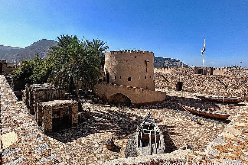
Khasab Fort (10.2km Southwest)