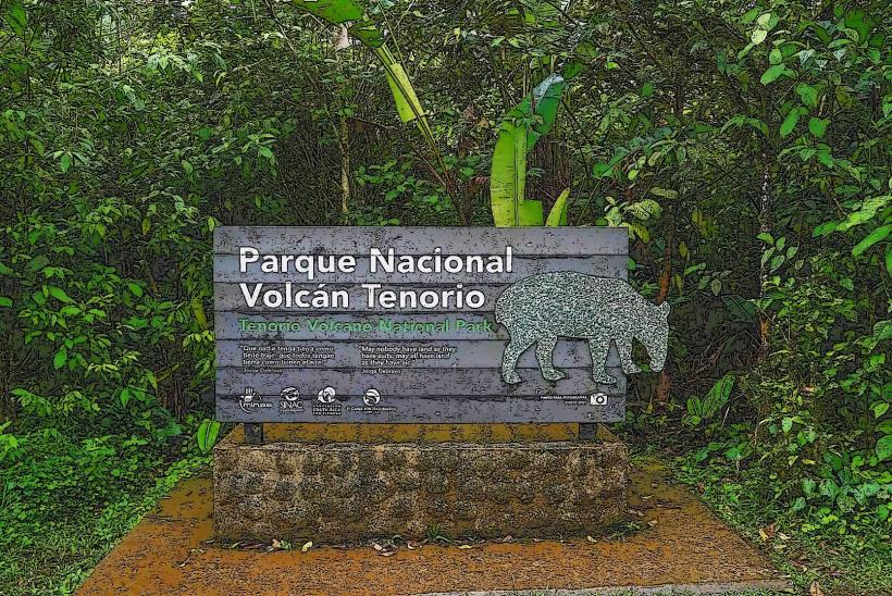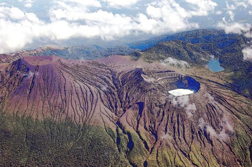
Landmark: Tenorio Volcano
City: Guanacaste
Country: Costa Rica
Continent: North America
Tenorio Volcano, Guanacaste, Costa Rica, North America
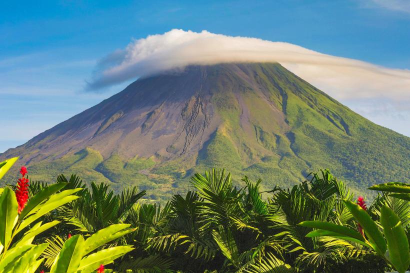
Tenorio Volcano is a stratovolcano located in the Guanacaste Province of Costa Rica. It is part of the Guanacaste Mountain Range.
Visual Characteristics
The volcano is characterized by its conical shape, with slopes covered in dense tropical rainforest. The summit reaches an elevation of 1,916 meters (6,286 feet). The surrounding landscape features a variety of flora, including primary and secondary forests, with a high density of trees and undergrowth.
Location & Access Logistics
Tenorio Volcano is situated approximately 25 kilometers (15.5 miles) northeast of the town of Bijagua. Access is primarily via unpaved roads from Bijagua. The main entrance to the Tenorio Volcano National Park is accessible by car, with limited parking available at the ranger station. Public transport options are scarce; a taxi or private transfer from Bijagua is the most reliable method. The drive from Bijagua to the park entrance takes approximately 45 minutes to 1 hour.
Historical & Ecological Origin
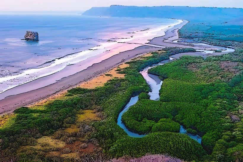
Tenorio Volcano is a dormant stratovolcano, part of the geological formation of the Guanacaste Cordillera, which is of volcanic origin. Its last known eruption occurred approximately 20,000 years ago. The park encompasses a diverse ecosystem, classified as tropical wet forest and pre-montane wet forest, supporting a rich biodiversity.
Key Highlights & Activities
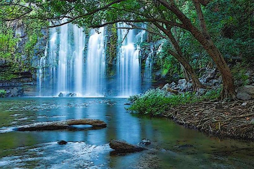
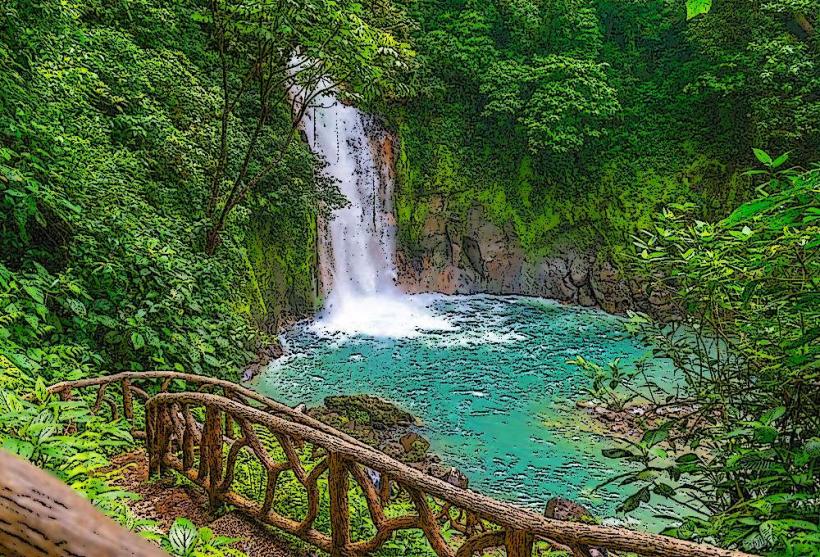
The primary activity within Tenorio Volcano National Park is hiking. The park features several trails, including the 2.8-kilometer (1.7-mile) Las Ollas trail, which leads to the Rio Celeste Waterfall and the blue river. The longer 7.2-kilometer (4.5-mile) main trail offers views of volcanic fumaroles and hot springs. Swimming is not permitted in the Rio Celeste due to its natural state and potential hazards.
Infrastructure & Amenities
Within Tenorio Volcano National Park, there are basic restroom facilities located near the park entrance. Shade is provided by the dense forest canopy along the trails. Cell phone signal is generally unreliable within the park boundaries. Food vendors are not present inside the park; visitors should bring their own provisions. Small sodas and snacks may be available for purchase in Bijagua before entering the park.
Best Time to Visit
The best time of day for photography of Rio Celeste is between 10:00 AM and 2:00 PM, when sunlight is most direct, enhancing the blue color. The dry season, from December to April, generally offers clearer skies and more stable weather. The wet season (May to November) can bring heavy rainfall, impacting trail conditions and visibility. High tide is not a relevant factor for visiting this inland volcano park.
Facts & Legends
The striking blue color of the Rio Celeste is attributed to a chemical reaction between volcanic minerals (specifically sulfur and silica) and sunlight. Local indigenous legends suggest the river's color is the result of God painting the sky and then dipping his brush into the river.
Nearby Landmarks
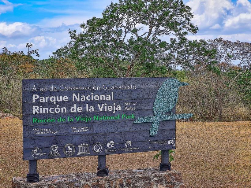
- Rincón de la Vieja National Park (25km Southwest)
- Arenal Volcano National Park (50km Southeast)
- Lake Arenal (55km Southeast)
- La Fortuna Waterfall (58km Southeast)
- Palo Verde National Park (60km West)