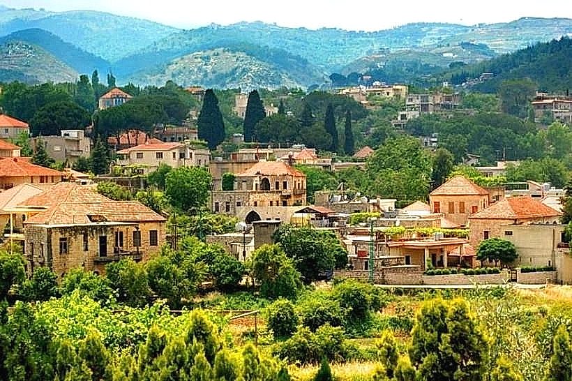
City: Akkar
Country: Lebanon
Continent: Asia
Akkar, Lebanon, Asia
Akkar serves as Lebanon's northern gateway, functioning as a vital agricultural heartland and a strategic transit corridor to Syria. Geographically, it is defined by the expansive Akkar Plain along the Mediterranean coast, which ascends eastward into the rugged heights of the Lebanon Mountains and the Syrian border.
Historical Timeline
Akkar has been a strategic outpost since the Phoenician and Roman eras, notably serving as the birthplace of the Roman Emperor Alexander Severus (born in Arqa, circa 208 CE). The region was dominated by feudal families, such as the Al-Merehbi clan, throughout the Ottoman period. Its modern urban and social form was significantly shaped by the 1970s peasant revolts against land-owning "Beys" and the subsequent impact of the Lebanese Civil War (1975–1990). The 2011 Syrian conflict and the resulting influx of refugees represent the most recent transformative event, straining infrastructure but reinforcing the region's role as a primary humanitarian and logistical hub.
Demographics & Population
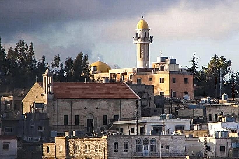
The Akkar Governorate has an estimated population of 425,000 for 2026. It is one of the most confessionally diverse regions in Lebanon, composed of Sunni Muslims (the majority), Alawites (the largest concentration in Lebanon), Maronite and Greek Orthodox Christians, and Lebanese Turks. The median age is approximately 29 years, reflecting a high birth rate and a youthful demographic profile.
Urban Layout & Key Districts
The governorate is organized into distinct topographical zones that dictate its layout.
Halba: The administrative capital and central commercial hub, located at the junction of the coastal plain and the foothills.
The Plain (Sahel): The western agricultural belt, characterized by greenhouse farming and dense rural settlements.
Al-Qoubaiyat: Located to the east, it is the region’s primary summer resort and cultural center, nestled in the forested highlands.
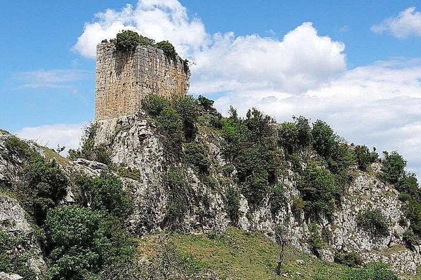
Akkar al-Atika: A historical mountainous district known for its rugged terrain and ancient fortress ruins.
Top City Landmarks
Tell Arqa: An archaeological mound featuring layers from the Neolithic to the Roman periods; birthplace of Emperor Alexander Severus.
Akkar al-Atika Fortress (Gibelet): Ruins of a strategic medieval castle overlooking the northern mountains.
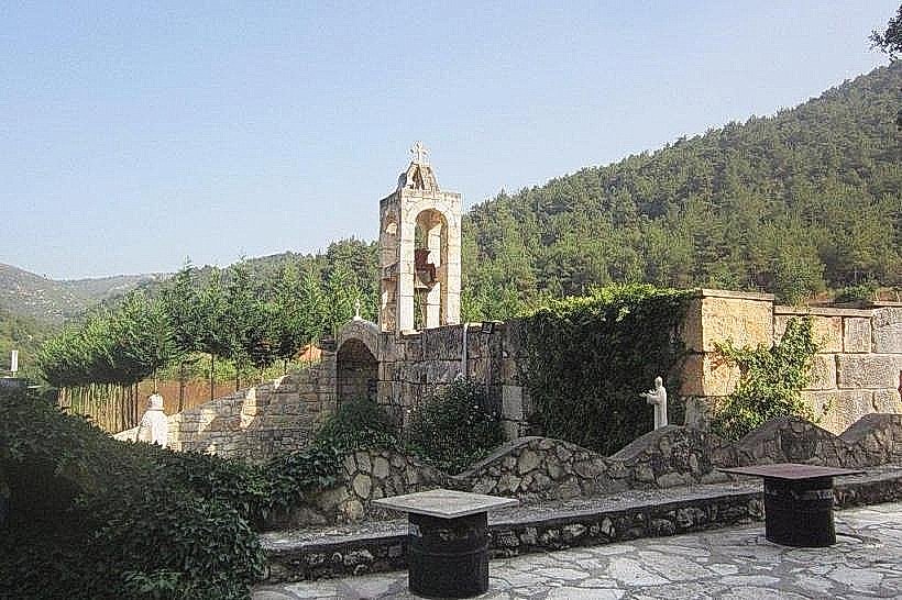
Saint Doumit Monastery: A significant religious and historical site located in the heights of Qoubaiyat.
The Great Plain Olive Groves: Some of the oldest and most expansive olive plantations in the Levant.
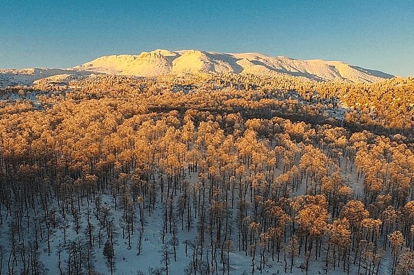
Qammouah Forest: A high-altitude nature reserve featuring rare cedars, junipers, and fir trees.
Transportation Network
Transit in Akkar is exclusively road-based and centered around the coastal highway and the internal "Arqa" road. Movement is facilitated by "Service" shared taxis and private minivans. There is no rail or metro service. Official taxis have red license plates. Traffic density is high around the Halba-Abdeh intersection, a major bottleneck for northern transit. Ride-sharing apps like Bolt have low to moderate availability, primarily concentrated in Halba.
Safety & "Red Zones"
Akkar is generally stable but remains a sensitive border region. Visitors should avoid the immediate border crossings (Wadi Khaled) and northern smuggling routes at night due to localized security risks. The Lebanese Armed Forces maintain a heavy presence with checkpoints along main arteries. Common scams are rare, but it is standard to confirm the price of shared transit before boarding.
Digital & Financial Infrastructure
Internet speeds average 20–40 Mbps via 4G/LTE, with mobile carriers Alfa and Touch providing the most reliable coverage. The economy is heavily cash-reliant; USD and Lebanese Pounds (LBP) are used interchangeably. Card acceptance is extremely low, restricted to large-scale pharmacies or modern gas stations in Halba and Qoubaiyat. ATMs are available in Halba but are often subject to withdrawal limits.
Climate & Air Quality
Akkar features a Mediterranean climate with sharp altitudinal variations. The plain (Sahel) experiences hot, humid summers (25°C–33°C) and mild winters, while the highlands (Qoubaiyat) are significantly cooler (18°C–28°C in summer) and prone to heavy snow in winter. Air quality is generally high due to its rural nature, though seasonal agricultural burning can cause localized smog in the autumn.
Culture & Social Norms
The region maintains a deeply traditional and hospitable social structure.
Tipping: 10% is standard in seated restaurants.
Greeting: Handshakes are formal; placing a hand over the heart is a sign of respect among conservative communities.
Dress Code: Conservative; men and women should keep shoulders and knees covered in public areas and rural villages.
Alcohol: Generally restricted to Christian-majority towns like Qoubaiyat or private resorts; it is not served in public spaces in Sunni or Alawite majority areas.
Accommodation Zones
Al-Qoubaiyat: Recommended for its cooler climate, forested surroundings, and range of mountain resorts and guesthouses.
Halba Perimeter: Recommended for logistical access to government offices and the coastal highway.
Local Cost Index
1 Espresso: 165,000 LBP ($1.75 USD)
1 Standard Lunch: 845,000 LBP ($9.00 USD)
1 Bus Ticket to Tripoli: 95,000 LBP ($1.00 USD)
Nearby Day Trips
Tripoli: Mamluk city and historic souks (25 km).
Ehden: High-altitude mountain village and nature reserve (45 km).
Tartus, Syria: Accessible via the Arida border crossing (30 km – requires visa).
Mseilha Fort: Historic fortification near Batroun (55 km).
Facts & Legends
Local folklore speaks of "The Mother of Thunder," a mythical figure used to explain the violent winter storms that roll off the Mediterranean into the Akkar mountains. A verified historical oddity is that the "Arqa" archaeological site was so famous in antiquity for its fertility that it was mentioned in the Bible (as the land of the Arkites) and Egyptian records long before it became a Roman imperial birthplace.