Landmark: Karm el-Moher Forest
City: Akkar
Country: Lebanon
Continent: Asia
Karm el-Moher Forest, Akkar, Lebanon, Asia
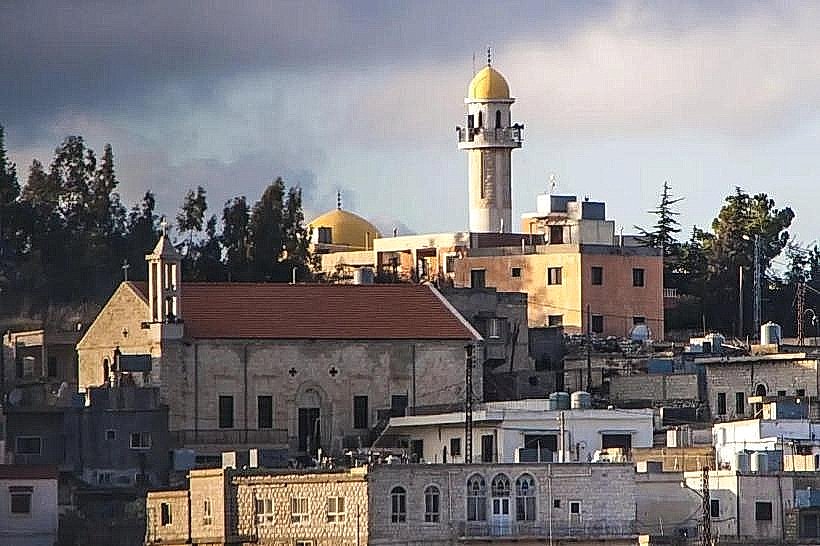
The Karm el-Moher Forest, also referred to as the Karm el-Mohr Cedar Forest, is an alpine woodland located above the mountain village of Karm el-Mohr within the Miniyeh-Danniyeh District of the North Governorate, Lebanon. Positioned on the steep upper slopes of the western Mount Lebanon range (the Makmel massif), this forest is a high-altitude sanctuary for endemic botanical species.
Visual Characteristics
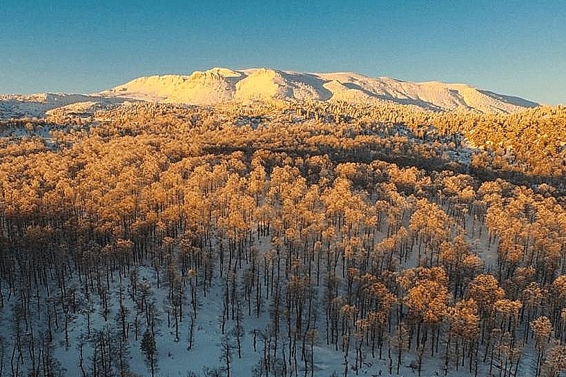
The forest is characterized by stands of mature and regenerating Lebanese Cedars (Cedrus libani) growing alongside ancient oak tree populations. The topography is rugged and steep, with trees anchoring into near-vertical grey limestone cliffs, karst crags, and scree fields at elevations ranging between 1,350 and 1,750 meters above sea level. In the spring, the forest floor displays wild orchids and tulips. The northern edge of the woods opens into high-altitude alpine zones with panoramic views toward the Akkar highlands and the Ehden mountains.
Location & Access Logistics
The forest is situated approximately 110 kilometers northeast of Beirut and about 20 kilometers east of Zgharta. Access from Beirut follows the Northern Coastal Highway to Tripoli, exiting inland toward Beddawi and ascending the regional mountain roads through Sfireh or Miziara toward the village of Karm el-Mohr. Trailheads typically begin near the adjoining villages of Dairaiya or Swekeh. The terrain requires 4WD vehicles for high-altitude dirt tracks, and no public transit directly serves the forest perimeter. Visitors use regional minibuses to the town of Syr el-Danniyeh and coordinate private mountain transport to reach the hiking tracks.
Historical & Ecological Origin
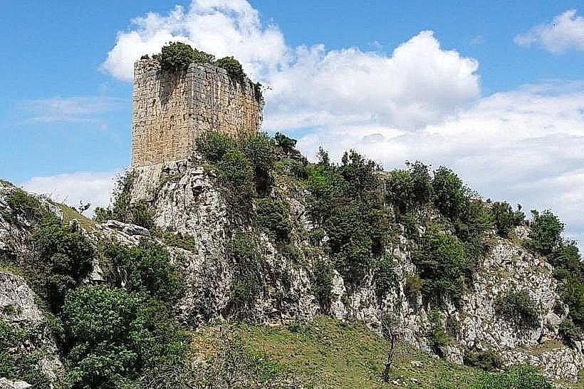
Geologically, the area rests on highly fractured, porous Jurassic and Cretaceous limestone formations. The extensive winter snowpack infiltrates these strata to supply major local freshwater springs, including the prominent Al-Fawwar spring (Nabeh el-Fawwar). Historically, the peaks above the forest hosted ancient mountain paths linking the coastal northern districts to the interior Beqaa Valley via the high passes of Kornet el-Sawda. Near the tree line sit the stone ruins of the 13th-century Aisha Fortress (Qalaat Aycha), which served as a fortified outpost and strategic mountain checkpoint controlling regional trade corridors.
Key Highlights & Activities
Hiking the intermediate and advanced loop trails that cross from Dairaiya village through the dense cedar stands of Ghabet Ain Hkailet.
Exploring the rugged limestone cliff formation known as Sheer El Arous (The Bride's Cliff) overlooking the valley.
Ascending the steep mountain paths directly beneath the rocky spine of the Aisha Fortress ruins.
Field observation and documentation of specialized high-altitude flora, including seasonal wild mountain tulips.
Infrastructure & Amenities
The Karm el-Moher Forest is maintained as an undeveloped, open-access natural site with no formal park gates, visitor centers, or admission fees. Navigational infrastructure is limited to rustic hiking paths and localized stone trail indicators. Public restroom facilities and structured shade pavilions are entirely absent inside the woodland perimeter. Cellular connectivity is variable; stable 4G network tracking is accessible on open, west-facing ridgelines, but significant signal dropouts occur within deep ravines and dense interior tree covers. Basic supplies and dining options are located in Karm el-Mohr village or Syr el-Danniyeh.
Best Time to Visit
The optimal months for hiking and traversing the upper forest loops are from May to October. Heavy snow accumulation makes the high-altitude trails impassable for standard trekking from December through April. Photographic lighting conditions are most balanced during the early morning hours between 07:30 and 09:30, before rising convective mountain mist obscures the high vertical ridges and reduces long-range visibility toward the coast.
Facts & Legends
According to regional linguistic studies, the name Karm el-Mohr combines the Arabic words for vineyard (Karm) and dowry (Mohr). Local oral history relates that the high terraced agricultural plots below the forest were historically gifted as a wedding endowment to a regional princess. Local lore also connects the high rock features of Sheer El Arous to traditional pre-wedding purification rituals practiced by mountain communities during the feudal era.
Nearby Landmarks
Aisha Fortress Ruins: 2.5km Southeast
Al-Fawwar Mountain Spring: 2.0km South
Jabal Al-Arbaeen Viewpoint: 4.5km East
Miziara Mountain Village: 5.5km West