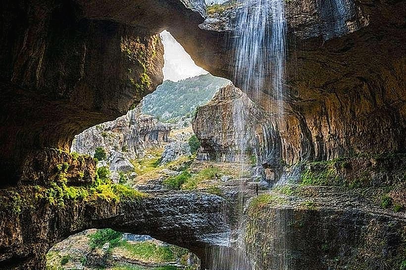
Landmark: Baatara Gorge Waterfall
City: Aley
Country: Lebanon
Continent: Asia
Baatara Gorge Waterfall, Aley, Lebanon, Asia
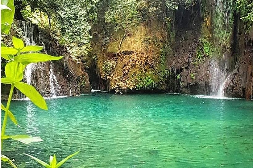
The Baatara Gorge Waterfall, also known as the Balaa Pothole or Cave of the Three Bridges, is a seasonal waterfall located in the village of Balaa, situated near the town of Tannourine within the Batroun District of Northern Lebanon. The natural formation features a stream that drops down into a vertical limestone chasm behind three stacked, naturally occurring stone spans.
Visual Characteristics
The Baatara Gorge Waterfall plunges a total of 255 meters into a subterranean sinkhole, with the primary free-fall segment dropping roughly 90 to 100 meters. The surrounding pothole is composed of highly eroded, 160-million-year-old grey Jurassic limestone. Three distinct geological arches are vertically arranged one above the other over the abyss, forming natural walkways that cross the cavern entrance. The rock surfaces are uneven, sharply fractured, and prone to moisture accumulation, with green moss expanding across lower shelves where sunlight is restricted.
Location & Access Logistics
The site is positioned 68 kilometers northeast of Beirut and approximately 10 kilometers south of Tannourine. Access from coastal Batroun is via the regional highway heading east through Amioun and Kousba toward Tannourine, or alternatively via the mountain route from Laklouk to Tannourine through the village of Balaa. A paved municipal parking area is situated along the main road near the trailhead entrance. No direct public bus lines serve the exact site, meaning visitors must use private 4WD vehicles or hire local regional taxis from the transport nodes in Batroun or Jbeil.
Historical & Ecological Origin
The limestone structure began forming through vertical and circular water erosion combined with historical structural roof collapses during the Jurassic period. The hydrological system functions as a major karst drainage point where surface snowmelt enters the mountain aquifers, traveling six kilometers underground before emerging at the Dalleh spring in Mgharet al-Ghaouaghir. The gorge was first mapped and brought to international attention in 1952 by French bio-speleologist Henri Coiffait, with full internal mapping completed by the Spéléo Club du Liban in the 1980s.
Key Highlights & Activities
Traversing the graded dirt access trail from the main entrance down to the upper observation decks.
Inspecting the geological composition of the top natural stone arch from the designated safety perimeters.
Observing the full trajectory of the waterfall plunge into the lower 240-meter cavern depths.
Hiking segments of the intersection between the local trails and the main Lebanon Mountain Trail network.
Infrastructure & Amenities
The Baatara Gorge Waterfall features minimal baseline tourism infrastructure to keep the natural landscape intact. A basic stone ticket office stands at the trailhead, accompanied by informational orientation signs and directional markers. Safety railings are present along sections of the upper canyon rim, though access to the middle natural bridge is strictly restricted due to structural collapse risks. Public restrooms are located only at the main entrance facility. Cell phone connectivity fluctuates, with stable 4G on the higher entrance ridges and total signal dropouts inside the lower gorge basin. No permanent food vendors or commercial facilities operate within the immediate crater area.
Best Time to Visit
The site must be visited during March and April when the spring snowmelt from the upper Mount Lebanon heights feeds the waterfall stream. By late summer, the cascade dries up completely, leaving only the dry limestone chasm. Photographic lighting is most effective between 09:00 and 11:00, when the morning sun penetrates the lip of the vertical sinkhole, directly illuminating the three interior bridges and the descending spray without creating severe shadows.
Facts & Legends
A fluorescent dye test conducted by hydrologists in 1988 verified the complex internal plumbing of the mountain by tracking the water from the bottom of the pothole to a lower village valley spring. Local mountain communities historically avoided the immediate edge of the chasm, circulating warnings regarding the slippery limestone lips and generating tales of an endless abyss that swallowed winter torrents without ever filling up.
Nearby Landmarks
Tannourine Cedar Nature Reserve: 4.5km Northeast
Mar Yaacoub Rock Monastery: 3.8km Northwest
Laklouk Ski Resort Slopes: 4.9km South
Chatine Village Overlook: 1.5km North