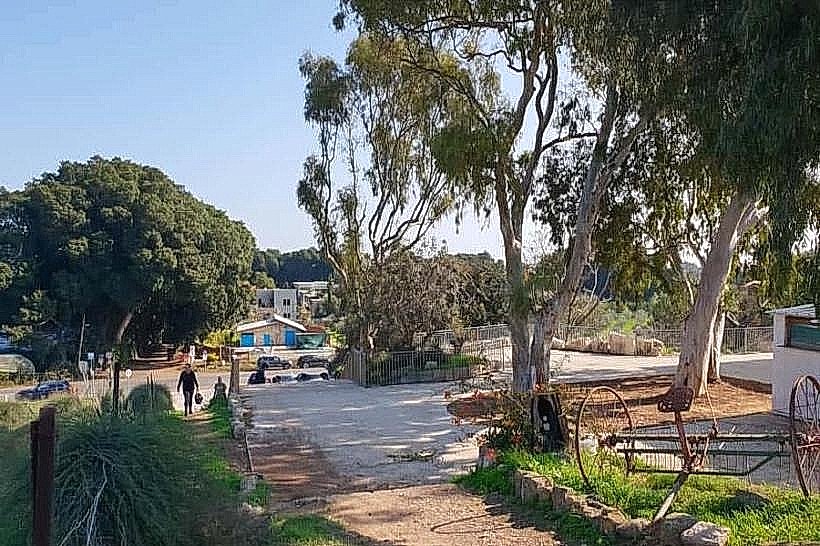
Landmark: Beit Aharon
City: Netanya
Country: Israel
Continent: Asia
Beit Aharon, Netanya, Israel, Asia
Beit Aharon is a communal settlement and historic site located in the Hefer Valley, situated just north of Netanya. It sits on a strategic sandstone ridge overlooking the coastal plain and the Alexander River basin.
Visual Characteristics
The area is defined by a central kurkar (sandstone) ridge featuring a mix of Mediterranean scrub, eucalyptus groves, and citrus orchards. The architecture within the settlement consists of low-rise residential structures, while the historic House of Aharon stands as a prominent rectangular stone building with a red-tiled roof. The surrounding landscape transitions from sandy ridges to fertile alluvial soil in the valley below.
Location & Access Logistics
The site is located off Highway 2 (the Coastal Highway), accessible via the Havatzelet Interchange or the Yanai Interchange. It is approximately 6 kilometers north of Netanya city center. Visitors arriving via public transport can use bus lines 825 or 826, stopping at the Beit Aharon junction on Road 4. Limited street parking is available near the historic landmarks, with primary access via local interior roads.
Historical & Ecological Origin
Established in 1948, the settlement was named after Aharon (Arnold) Alexander, a prominent Zionist activist. The "House of Aharon" (Beit Aharon) was originally a grand farmhouse built in the late 19th century by a Christian Arab landowner before being purchased by the Jewish National Fund. Ecologically, the site is part of the Sharon plain's sandstone ridge system, which serves as a vital corridor for local flora and fauna.
Key Highlights & Activities
Visitors can explore the historic stone manor, which serves as a gallery and event space. Hiking and cycling are common along the ridge trails that offer views of the Mediterranean coastline to the west and the Samarian hills to the east. The nearby "Turtle Bridge" area provides access to the Alexander River for wildlife viewing.
Infrastructure & Amenities
The settlement includes a local grocery store, a public library, and small playgrounds. There are no large-scale public restrooms or commercial food courts within the residential area; however, multiple gas stations and restaurants are located 2 kilometers away at the adjacent shopping centers. Cellular coverage is 5G capable throughout the ridge.
Best Time to Visit
The best time for a visit is during the spring (March to May) when the surrounding orchards are in bloom and the weather is mild for hiking. For photography, the late afternoon provides clear views of the coast with the sun illuminating the red-tiled roofs and the sandstone textures. The site is accessible year-round.
Facts & Legends
A local historical oddity involves the House of Aharon's role as a clandestine lookout point and signaling station during the pre-state era, utilizing its elevated position on the ridge to communicate with nearby settlements and ships at sea.
Nearby Landmarks
Alexander River (Turtle Bridge) – 1.8km North
Havatzelet HaSharon Beach – 2.5km West
Mishmar HaSharon – 3.2km East
Blue Bay Beach – 4.2km Southwest