Landmark: Bourke's Luck Potholes
City: Nelspruit
Country: South Africa
Continent: Africa
Bourke's Luck Potholes, Nelspruit, South Africa, Africa
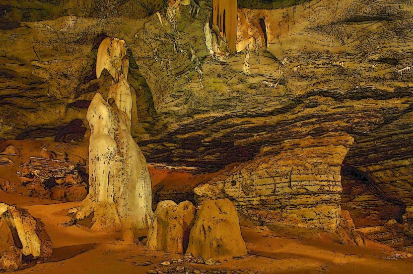
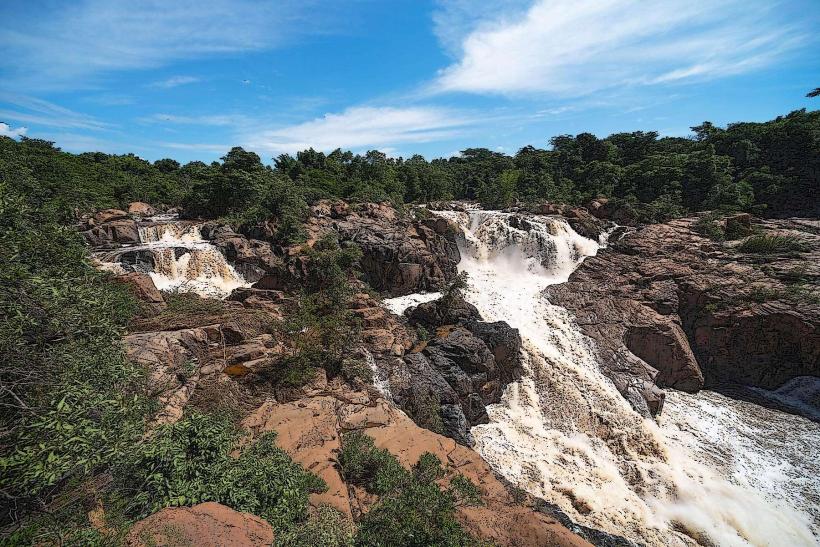
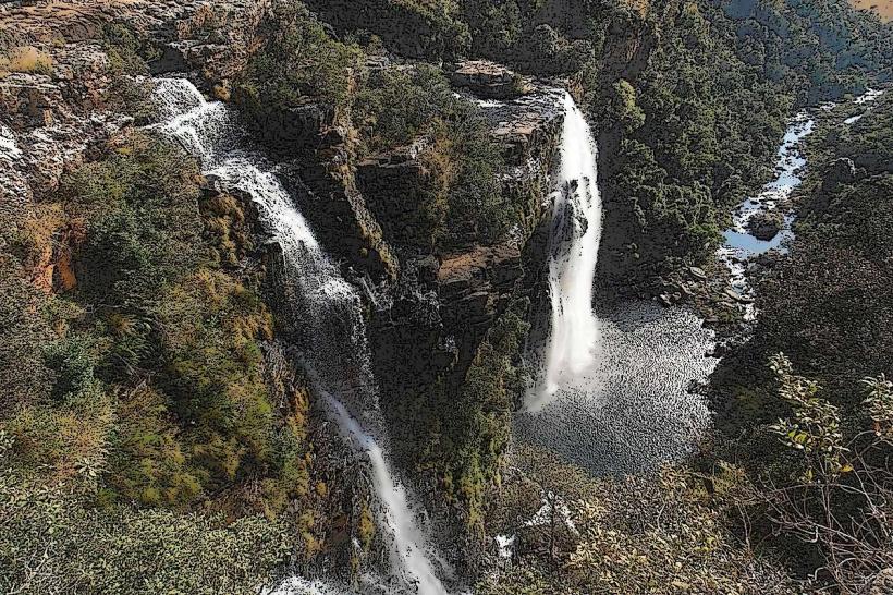
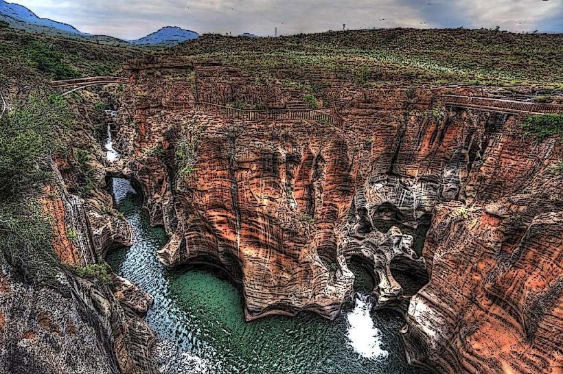
Bourke's Luck Potholes is a geological formation located at the confluence of the Blyde River and the Treur River in the Mpumalanga province of South Africa.
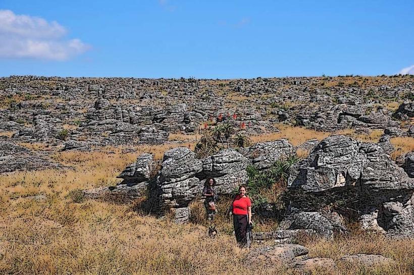
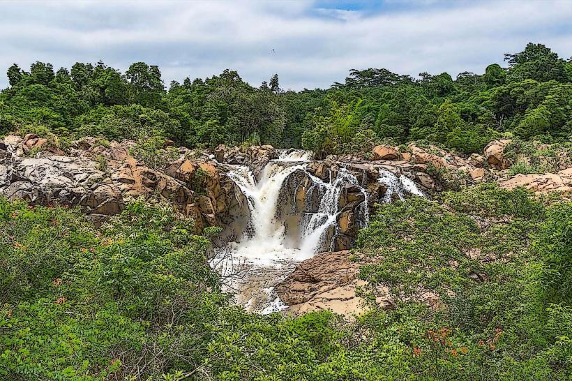
This site features a series of cylindrical potholes and waterfalls carved into the sandstone by water erosion over millions of years.
Visual Characteristics
The potholes are characterized by smooth, rounded rock formations, primarily composed of red and yellow sandstone. Water flows through these formations, creating cascades and pools. The surrounding vegetation is dense, consisting of indigenous trees and shrubs.
Location & Access Logistics
Bourke's Luck Potholes is situated approximately 35 kilometers north of Nelspruit, accessible via the R532 road. The site has a dedicated parking area. Public transport options are limited; private vehicles are the primary mode of access. The nearest major city is Nelspruit.
Historical & Ecological Origin
These potholes are a result of natural water erosion, specifically the swirling action of water carrying sand and pebbles, which has carved into the bedrock over an estimated 265 million years. They are part of the Drakensberg Escarpment's geological history.
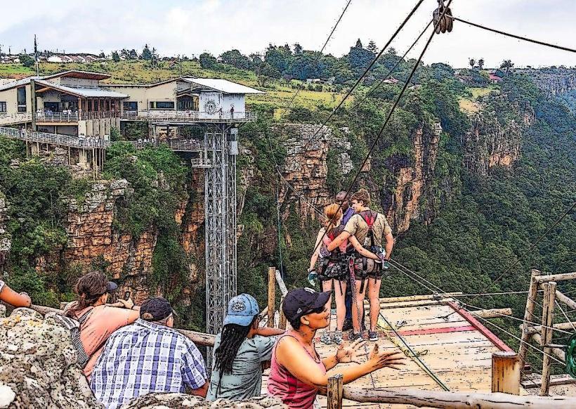
Key Highlights & Activities
Visitors can walk across a series of bridges and walkways that provide views of the potholes. Observation decks are positioned at key points. Photography is a common activity. No swimming or climbing on the rocks is permitted.
Infrastructure & Amenities
Restrooms are available on-site. Limited shade is provided by natural vegetation and some constructed shelters. Cell phone signal (4G) is generally available. Food vendors are typically present at the entrance area.
Best Time to Visit
The best time of day for photography is mid-morning or late afternoon when the sunlight creates distinct shadows and highlights on the rock formations. The dry season (May to September) offers more predictable weather conditions. Water levels can vary, but the potholes are generally visible year-round.
Facts & Legends
The name "Bourke's Luck Potholes" is attributed to a prospector named Tom Bourke, who is said to have staked a claim nearby during the gold rush era, though he never found significant gold. A local legend suggests the potholes were formed by ancient river spirits.
Nearby Landmarks
- God's Window (2.5km West)
- Wonder View (3.0km West)
- The Pinnacle Rock (4.0km West)
- Lisbon Falls (6.0km North)
- Berlin Falls (7.5km North)