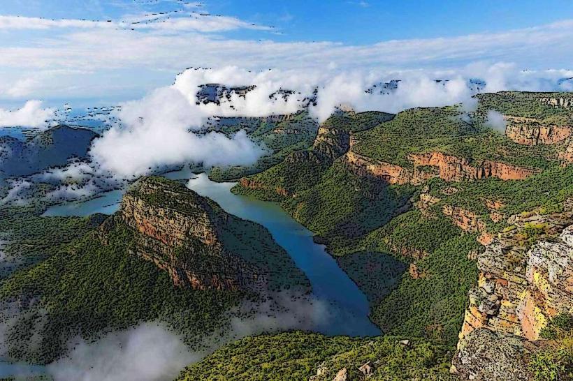
Landmark: Panorama Route
City: Nelspruit
Country: South Africa
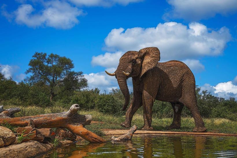
Continent: Africa
Panorama Route, Nelspruit, South Africa, Africa
The Panorama Route is a scenic drive located in the Mpumalanga province of South Africa, beginning near the city of Nelspruit.
This route traverses a significant portion of the Drakensberg escarpment, offering views of geological formations and natural features.
Visual Characteristics
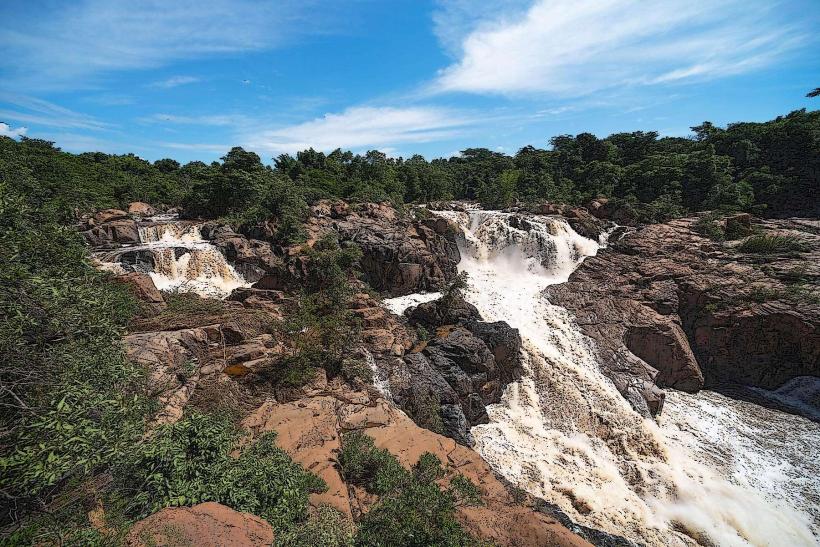
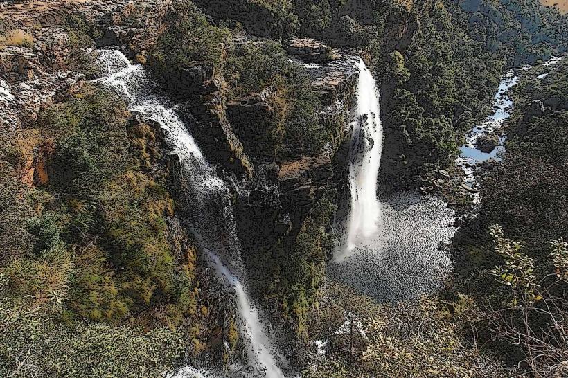
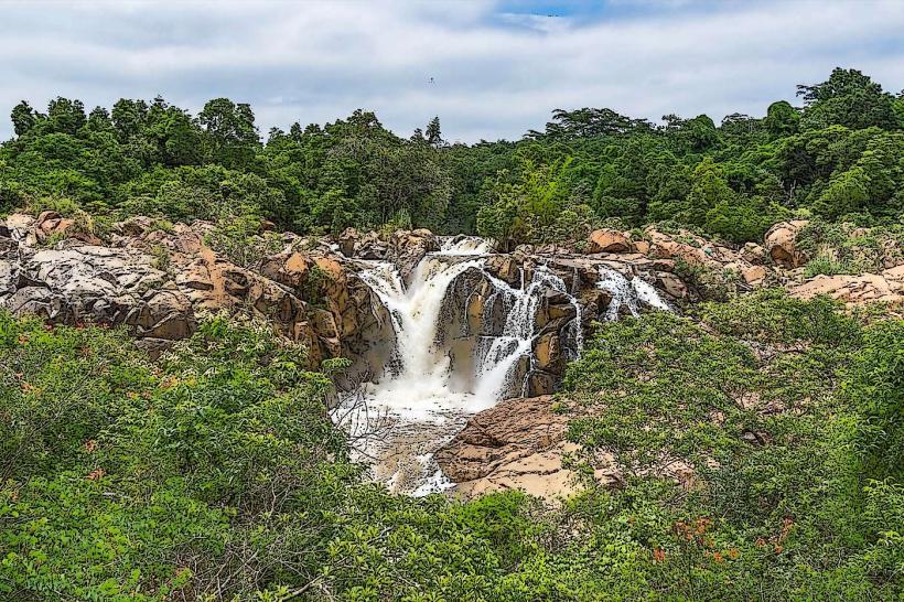
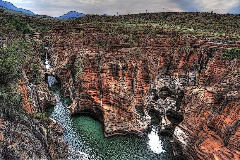
The route features dramatic escarpment edges with sheer drops, revealing layered geological strata. Vegetation varies from dense indigenous forest in kloofs to open grassland on the plateau. Water features include waterfalls, such as the Lisbon Falls and Berlin Falls, and the Blyde River Canyon, characterized by its red sandstone walls and the Three Rondavels rock formations. The canyon floor is at an elevation of approximately 600 meters, while the plateau rim reaches over 2,000 meters.
Location & Access Logistics
The Panorama Route is accessible from Nelspruit via the R40 highway, heading north towards White River. From White River, the R537 connects to the route. Key access points and viewpoints are signposted off the R532 and R36 roads. The total length of the primary scenic drive is approximately 100 kilometers. Parking is available at designated viewpoints and rest stops; capacity varies. Public transport is limited; private vehicle rental or guided tours are the primary means of access.
Historical & Ecological Origin
The geological formations are primarily sedimentary rocks, dating back to the Proterozoic Eon, shaped by millions of years of erosion. The Blyde River Canyon is one of the largest canyons on Earth, formed by fluvial erosion. The area is part of the Drakensberg escarpment, a significant geological feature of Southern Africa. Historically, the region was inhabited by indigenous peoples, and later became a site for gold prospecting in the late 19th century.
Key Highlights & Activities
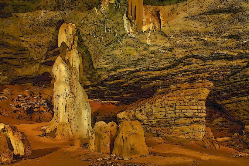
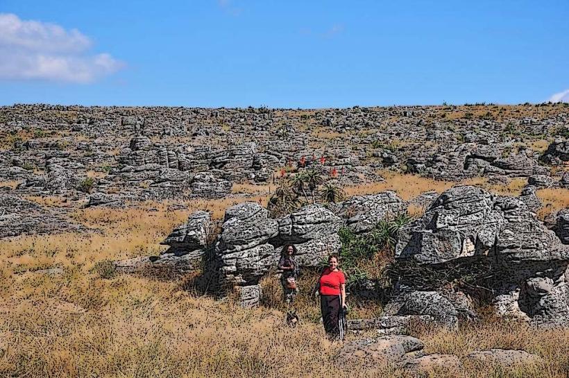
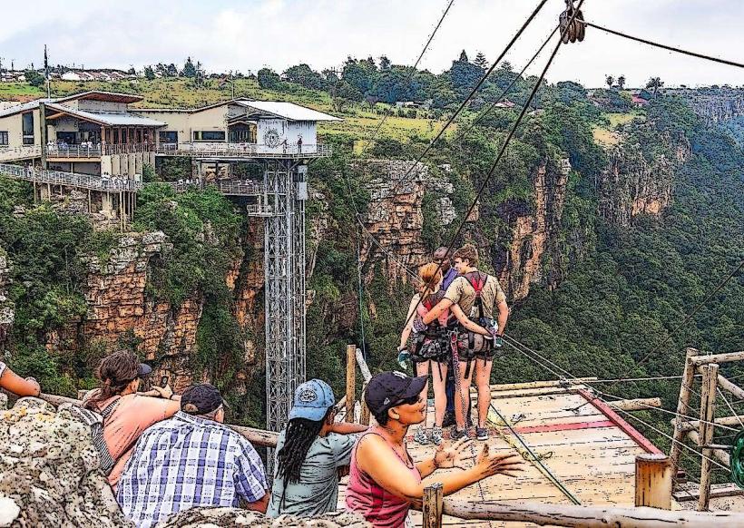
Observation of the Blyde River Canyon from viewpoints such as God's Window, Wonder View, and the Three Rondavels. Exploration of waterfalls including Lisbon Falls and Berlin Falls. Hiking trails are available at various locations, such as the Bourke's Luck Potholes, which feature unique cylindrical rock formations carved by water. Boat trips operate on the Blyde Dam within the canyon.
Infrastructure & Amenities
Restrooms are available at major viewpoints and rest stops. Shade is provided by natural vegetation and some man-made structures at key locations. Cell phone signal (4G/5G) is intermittent along the route, with better reception at towns and larger rest areas. Food vendors and restaurants are located in towns like Graskop and Hazyview, and at some larger tourist attractions.
Best Time to Visit
The best time for clear views is during the dry season, from May to September, when atmospheric haze is typically reduced. Mornings offer optimal lighting for photography due to the angle of the sun. High tide is not a relevant factor for this land-based attraction. Temperatures are generally cooler during these months.
Facts & Legends
The Bourke's Luck Potholes are named after a prospector, Tom Bourke, who allegedly pegged a claim nearby. Local folklore suggests that the distinctive rock formations of the Three Rondavels represent three Zulu chiefs.
Nearby Landmarks
- Bourke's Luck Potholes (0.8km West)
- Lisbon Falls (3.2km North)
- Berlin Falls (4.1km North)
- God's Window (1.5km South)
- Graskop town (2.5km South-West)