Landmark: Cataratas de Tacuarembó
City: Tacuarembo
Country: Uruguay
Continent: South America
Cataratas de Tacuarembó, Tacuarembo, Uruguay, South America
Cataratas de Tacuarembó is a waterfall system located within the Tacuarembó Department of Uruguay.
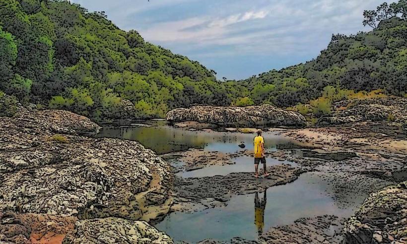
This natural site features a series of cascades and pools formed by the Tacuarembó River.
Visual Characteristics
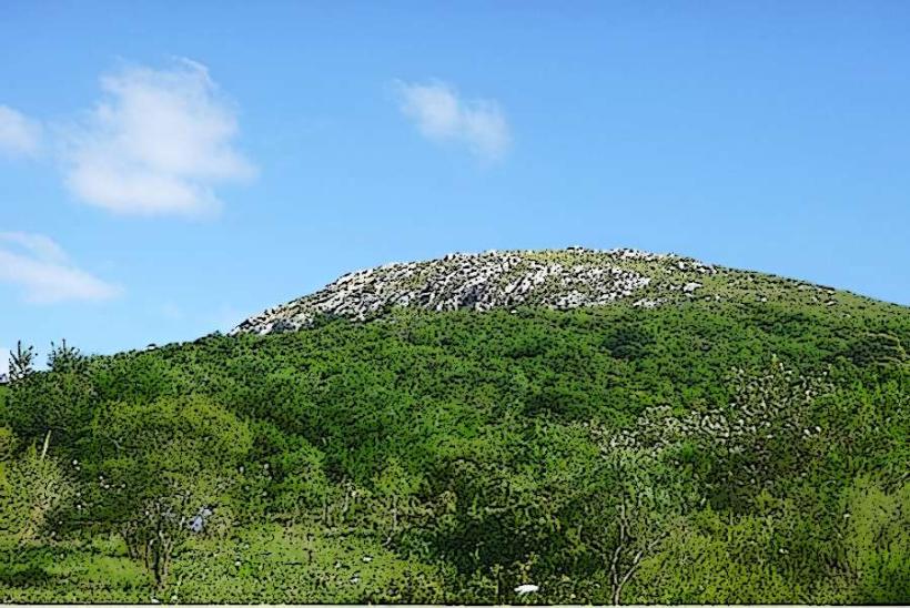
The waterfalls consist of multiple tiers of water flow over dark, weathered rock formations. The water color is typically clear to light brown, depending on recent rainfall. Surrounding vegetation is dense, primarily composed of native trees and shrubs, creating a shaded environment along the riverbanks. The rock faces exhibit signs of erosion, with distinct layering visible.
Location & Access Logistics
Cataratas de Tacuarembó is situated approximately 15 kilometers west of the city of Tacuarembó. Access is via Route 5, turning onto National Route 26 towards the west. A well-maintained gravel road branches off Route 26, leading directly to the site's parking area. Parking is available on-site and is free of charge. Public transport options to the immediate vicinity of the falls are limited; bus services operate between Tacuarembó and nearby towns, requiring a subsequent taxi or private vehicle for the final segment.
Historical & Ecological Origin
The formation of Cataratas de Tacuarembó is a result of fluvial erosion acting upon sedimentary rock layers over geological time. The Tacuarembó River, a tributary of the Uruguay River, has carved its course through the landscape, creating these stepped cascades. Ecologically, the area represents a riparian zone characteristic of the Uruguayan savanna biome, supporting diverse flora and fauna adapted to riverine environments.
Key Highlights & Activities
Visitors can observe the different levels of the waterfalls. Hiking trails are present along the river, providing access to various viewpoints. Swimming is permitted in designated pools during warmer months, provided water levels are safe. Photography opportunities are available throughout the site, particularly during morning and late afternoon hours.
Infrastructure & Amenities
Basic amenities are available at the site, including a limited number of picnic tables and trash receptacles. Restroom facilities are present but may be basic. Shade is provided by the natural tree canopy. Cell phone signal (4G) is intermittent and unreliable within the immediate vicinity of the falls. No food vendors operate directly at the site; visitors should bring their own provisions.
Best Time to Visit
The most favorable months for visiting are from September to April, offering milder temperatures and lower humidity. For photography, early morning (7:00 AM - 9:00 AM) and late afternoon (4:00 PM - 6:00 PM) provide optimal lighting conditions with softer shadows. Water flow is generally higher following periods of significant rainfall, typically occurring in autumn and spring.
Facts & Legends
Local folklore suggests that the sound of the falling water carries messages from ancient spirits of the land. A specific historical detail is that the area was a frequent stopping point for cattle drovers in the late 19th and early 20th centuries due to the reliable water source.
Nearby Landmarks
- Parque Nacional de Arequita (12km Southeast)
- Museo del Indígena (15km East)
- Plaza de Tacuarembó (15km East)
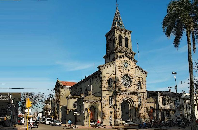
- Catedral de San Fructuoso (15km East)