Landmark: Cerro Tres Cruces
City: Tacuarembo
Country: Uruguay
Continent: South America
Cerro Tres Cruces, Tacuarembo, Uruguay, South America
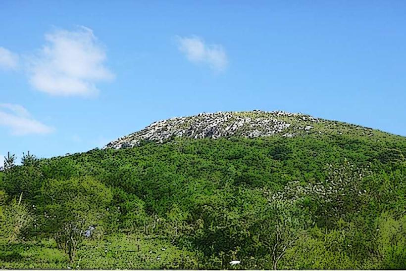
Cerro Tres Cruces is a prominent geological formation located in the department of Tacuarembó, Uruguay.
This hill serves as a significant natural landmark within the region.
Visual Characteristics
Cerro Tres Cruces presents as a rounded hill with exposed rock faces, primarily composed of sedimentary rock. The summit is marked by three distinct crosses, constructed from metal. Vegetation is sparse, consisting mainly of grasses and low-lying shrubs adapted to the arid conditions. The elevation provides a panoramic view of the surrounding rolling plains.
Location & Access Logistics
The landmark is situated approximately 15 kilometers west of the city of Tacuarembó. Access is via National Route 5, turning onto Provincial Route 204 (Ruta Departamental 204) for approximately 8 kilometers. A gravel road branches off Ruta 204, leading directly to the base of the hill. Parking is available on a cleared area at the foot of the ascent. Public transport does not directly service the site; private vehicle or taxi is required.
Historical & Ecological Origin
Geologically, Cerro Tres Cruces is a remnant of ancient sedimentary deposits, shaped by erosion over millennia. The crosses at the summit were erected in the mid-20th century, serving as a religious and navigational marker. The specific date of their installation is not precisely documented, but they are a recognized feature of the landscape.
Key Highlights & Activities
Ascent to the summit via the marked trail is the primary activity. The trail is approximately 1.5 kilometers in length and moderately steep. Observation of the surrounding landscape from the summit is a key highlight. Photography of the crosses and the panoramic views is recommended.
Infrastructure & Amenities
No permanent infrastructure or amenities are present at Cerro Tres Cruces. There are no restrooms, designated shade structures, or food vendors. Cell phone signal (4G/5G) is intermittent and generally weak at the base and summit.
Best Time to Visit
The optimal time for visiting is during the cooler months of autumn and spring (March to May and September to November) to avoid extreme summer heat. Early morning or late afternoon provides the best natural light for photography due to the angle of the sun. Midday sun can be intense with minimal shade.
Facts & Legends
A local anecdote suggests that the placement of the three crosses was intended to represent the Holy Trinity, though official documentation for this specific intent is absent. The hill is a popular spot for local residents during religious holidays.
Nearby Landmarks
- Tacuarembó City Center (15km East)
- Parque de la Hispanidad (12km East)
- Museo del Indígena (14km East)
- Laguna de las Lavanderas (10km Southeast)